
Connected Construction

Gyro X provides benefits
June 15, 2012
Sokkia has combined its SRX robotic total station with a gyroscope which, the company says, makes it even better for tunnelling, pipeline work, mining and shipbuilding. The Gyro X Gyro Station now has auto-pointing capabilities and a newly equipped image sensor. It finds true north and determines the azimuth with 15" precision regardless of work site environment.
Made to Measure laser mapping
June 15, 2012
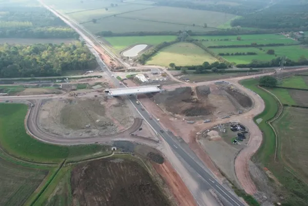
Dutch surveying company Geomaat says it is taking millimetre accurate measurements in record time to aid a range of highway design, construction and maintenance projects. Using the mobile laser mapping system StreetMapper, and specially developed point cloud software, Geomaat says it can calculate highly accurate cutting, milling and asphalt figures, create as built models and undertake change detection.
GPS technology developments
June 13, 2012
The use of GPS-inclusive technology is proving invaluable to contractors responsible for major transport-related construction projects across the globe. Guy Woodford looked at some of the latest and imminent site solutions featuring GPS Staff at Trimble Heavy Construction based in Sunnyvale, California recently finished developing three new solutions for connecting the construction site. The Trimble Connected Office, the Trimble Connected Controller and the Trimble Connected Machine, are all now available t
12D for Christchurch
June 12, 2012
Australia's increasingly popular 12D Model software package for road design, terrain modelling, surveying and drainage has been selected as the main design and survey tool for the coordinated earthquake rebuild of Christchurch in New Zealand The 12D Model software will be the common platform for a group of consultants and contractors making up the recently formed SCIRT, standing for "Stronger Christchurch Infrastructure Rebuild Team". They will use it for survey, repair and rebuild of both the road netwo
Ontario opts for Power InRoads design tools
June 12, 2012
One of Canada's largest provinces, Ontario, has decided to go with the latest Power InRoads suite of design tools now being offered by Bentley Systems as a complete stand-alone version As well as the Inroads tools, that means Ontario's Ministry of Transportation will use drafting and document production by the MicroStation CAD tool, and mapping and GIS functionality from Bentley Map. It previously used InRoads for highways work but on an AutoCAD platform. The whole new package is also designed to work co
Software alliance improves productivity
June 12, 2012
In the fast moving world of construction software, major innovations are happening on a continuous basis. All the leading players are making notable contributions to the sector. A new strategic alliance just announced between the management and data handling software giant Pitney Bowes, and design and construction software producer Autodesk, will help create an end to end range of products and tools for rapidly evolving BIM strategies in the industry. In particular in should help develop an integrated suite
TomTom maps cover over 35 million kilometres
May 4, 2012
TomTom has announced the availability of its latest map and enhancement product portfolio, delivering new coverage and features. With the addition of 400,000 kilometres across the globe, the company claims its navigable map database is the first to reach 35.2 million kilometres of roads, covering 104 countries and a record 3.4 billion people worldwide.
Smart constructioon with GIS, GPS design technology
May 2, 2012
A UK highway project has benefited from the latest software, GIS and GPS technology, Mike Woof reports. Sophisticated software, GIS and GPS technology has played an important role in a large highway upgrade project in the UK and helping to increase efficiency and drive down construction costs.
Mersey Bridge advance study
May 1, 2012
Research is underway on the Mersey Estuary in the UK, mapping tidal flows. The data will be used by the designers of the new Mersey Gateway Bridge, currently being designed. This profiling work is being carried out close to Runcorn and Widnes and is mapping the strength and direction of currents in the Mersey Estuary. Part of the development of the Mersey Gateway Project, the surveying work has been carried out by specialist contractor ABPmer using Acoustic Doppler Profiling equipment. The work measured the