
Connected Construction

Infinite uses for transport simulation program
March 2, 2012
The mezzo level transport simulation program from Canadian firm Inro has been finding larger and wider uses recently the firm reports, and it says Dynameq licences for up to 20,000 links have been taken. It is expected that larger dynamic traffic assignment models will be used.
Hydro secures UK experts for new global consultancy
March 1, 2012
Hydro International is launching a new engineering consultancy for flood risk assessment and stormwater management in the UK and worldwide.
Scania uses Navteq data for Active Prediction system
March 1, 2012
Navteq has been selected by Scania to provide map data featuring the accurate, reliable and detailed road attributes essential to its innovative new active prediction system.
UK government calls satnav summit to tackle mapping problems
March 1, 2012
UK local transport minister, Norman Baker has announced he will host the governments first 'satnav summit' early in March to thrash out solutions to end the misery caused when lorry and car drivers follow out of date directions from their satnavs.
Bentley expanding
March 1, 2012
Software firm Bentley Systems is buying point cloud specialist Pointools.
Trimble expands support network
March 1, 2012
GPS specialist Trimble continues to develop its SITECH Technology Dealer network with new operations in Nigeria, Tanzania and the Ukraine.
Trimble expands support network
March 1, 2012
GPS specialist Trimble continues to develop its SITECH Technology Dealer network with new operations in Nigeria, Tanzania and the Ukraine.
ScanStation C10: sophisticated
March 1, 2012
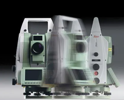
High-speed, versatile laser scanning can now be achieved using the latest technology from Leica Geosystems. The firm's sophisticated ScanStation C10 package features a new high-definition surveying (HDS) scanner that is said to increase surveying productivity and accuracy for both routine surveys and large, complex projects.
Precision pinpointing
March 1, 2012
Leica Geosystems says that its TS30 package is a new high precision Total Station that meets highest standards in all surveying applications. Distances can now be measured with Leica Geosystems' proven PinPoint EDM Technology with an unprecedented precision of 0.6mm + 1ppm on prisms. On natural surfaces a high accuracy of 2mm + 2ppm up to 1,000m can be achieved.
Affordable excavator GPS grade control
February 29, 2012
Hemisphere GPS says that its new Earthworks excavator grade control system suits use with small to medium-sized contractors.