Esri and Heliguy to cooperate

Esri UK has signed a partnership with drone developer Heliguy as part of its strategy to offer all elements of a drone service.
February 15, 2021 Read time: 2 mins
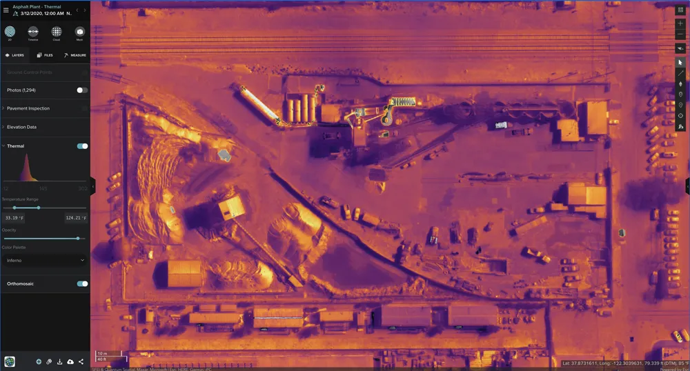
Thermal imaging using Esri UK Site Scan

The partnership will provide customers with drone hardware, pilot training and flying services from Heliguy, adding to Esri’s existing drone flight planning, data capture, data processing and GIS software.

Current Esri drone software customers include Skanska Norway, Arcadis and PCL Construction in North America. Meanwhile, Heliguy, an unmanned aerial vehicle specialist, manages some of Europe’s largest drone programmes, working with construction firms such as Balfour Beatty and Atkins.

Esri UK and Heliguy will work on joint projects to introduce new and more efficient workflows by bringing together customers’ GIS and Survey teams who have traditionally worked separately on drone-related projects. The goal is to streamline processes, from drone management and data capture, through to data analysis and better sharing of outputs across a business, including integration with BIM and CAD workflows.

“By providing a single source of hardware and software, the partnership will help customers maximise their investment in drones and GIS,” said Craig Evenden, head of construction and BIM at Esri UK. “As drone usage grows, accelerated by the COVID-19 pandemic, the [construction] community is demanding more integrated programmes that can easily grow across their business. Heliguy’s vast experience and training capabilities, coupled with Esri’s cloud-based drone and GIS software are a perfect match for the AEC industry’s new enterprise requirements.”

Esri UK customers include Arcadis, Mott MacDonald, Costain, Crossrail, the Skanska, Costain and STRABAG Joint Venture and Highways England. Formed in 2006, Heliguy is based in the UK with an office in Dallas in the US state of Texas.

For more information on companies in this article

Related Content

  • Sophisticated machine control solution from Topcon
    June 1, 2022
    Topcon Positioning says that its new MC-Max machine control solution is a scalable solution for use with mixed-fleets of heavy equipment.
  • Topcon expanding operations with acquisition
    February 21, 2018
    Topcon Corporation has acquired all the outstanding shares of ClearEdge3D for an undisclosed sum. This deal adds a technology leader in the engineering and construction software industry to Topcon’s portfolio. ClearEdge3D’s EdgeWise software is intended to speed as-built modeling workflows by utilising automated feature extraction algorithms and other patented technologies. Its Verity construction verification software compares laser scan point cloud data of recently completed construction work against
  • Accurate utilities detection
    November 26, 2024

    Trimble and Radiodetection are collaborating to improve the technology used in the utility measurement and mapping process. Integrating the Trimble Catalyst DA2 GNSS system and Radiodetection’s RD MapTM+ application and precision locator products helps to streamline utility-locating workflows to provide accurate measurement capabilities and generate underground utilities maps in a single field operation.

  • Cleveland Bridge is all decked out on the England’s A14 scheme
    June 4, 2019
    As part of Highways England’s A14 upgrade project from Cambridge to Huntington, Cleveland Bridge installed two 1,050tonne pre-assembled bridge decks in just 11 hours. Months of detailed planning and client liaison ensured the 47.5m-long bridge decks, each containing 330tonnes of steel and 720tonnes of concrete, were successfully travelled to the site and lowered onto the abutments. On-site civil engineering works were undertaken by the A14 Integrated Delivery Team, a joint venture between Costain,