Esri and Heliguy to cooperate

Esri UK has signed a partnership with drone developer Heliguy as part of its strategy to offer all elements of a drone service.
February 15, 2021 Read time: 2 mins
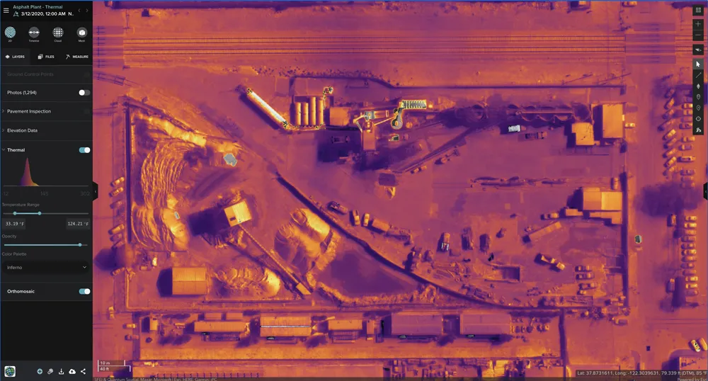
Thermal imaging using Esri UK Site Scan

The partnership will provide customers with drone hardware, pilot training and flying services from Heliguy, adding to Esri’s existing drone flight planning, data capture, data processing and GIS software.

Current Esri drone software customers include Skanska Norway, Arcadis and PCL Construction in North America. Meanwhile, Heliguy, an unmanned aerial vehicle specialist, manages some of Europe’s largest drone programmes, working with construction firms such as Balfour Beatty and Atkins.

Esri UK and Heliguy will work on joint projects to introduce new and more efficient workflows by bringing together customers’ GIS and Survey teams who have traditionally worked separately on drone-related projects. The goal is to streamline processes, from drone management and data capture, through to data analysis and better sharing of outputs across a business, including integration with BIM and CAD workflows.

“By providing a single source of hardware and software, the partnership will help customers maximise their investment in drones and GIS,” said Craig Evenden, head of construction and BIM at Esri UK. “As drone usage grows, accelerated by the COVID-19 pandemic, the [construction] community is demanding more integrated programmes that can easily grow across their business. Heliguy’s vast experience and training capabilities, coupled with Esri’s cloud-based drone and GIS software are a perfect match for the AEC industry’s new enterprise requirements.”

Esri UK customers include Arcadis, Mott MacDonald, Costain, Crossrail, the Skanska, Costain and STRABAG Joint Venture and Highways England. Formed in 2006, Heliguy is based in the UK with an office in Dallas in the US state of Texas.

For more information on companies in this article

Related Content

  • Yotta upgrades asset management package
    May 19, 2015
    Yotta is now offering the latest version of its Horizons visualised asset management platform. Version 2.6 of the package is said to provide a better user experience with improved visualisation. The latest version of the cloud-based solution also offers improved transparency with upgraded reporting providing clear and auditable work trails. Users of Horizons 2.6 can now directly link documents and images in Horizons, improving access to detailed information about a specific asset through the use of phot
  • Easing temporary highway danger
    February 22, 2013
    Some of the latest speedometer technology has been successfully trialled in French highway work zones, while tireless work continues across Europe and the United States to reduce the number of work zone deaths and serious injuries involving road workers and motorists. Guy Woodford reports The number of roadworkers being killed and seriously injured on England’s motorways and major trunk roads more than doubled between 2007 and 2010 – from no deaths and 14 serious injuries. This rise has led to to major camp
  • Mott MacDonald picks up Highways England’s operations centre deal
    March 28, 2018
    Mott MacDonald will set up an asset management system as part of Highways England’s new technology operations centre. Under the T-TOC contract - Tools for the Technology Operations Centre – Mott MacDonald will work with Fujitsu which will develop a suite of software systems to monitor and manage electronic assets across Highways England’s network. Highways England has nearly 100,000 intelligent infrastructure devices across England’s strategic road network – trunk roads and motorways. T-TOC will enable a
  • Drivewyze: US e-inspections on the rise
    February 18, 2022
    Drivewyze says that its weigh station programme is in a phase-one deployment that expedites CSA-crediting Level III inspections in station in the US.