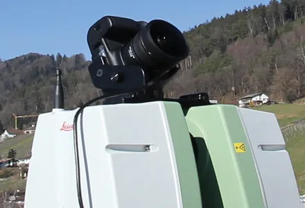
Sophisticated scanning tool from Leica Geosystems

A new laser scanning tool from Leica Geosystems offers accurate and fast 3D imaging laser scanning capabilities. The Leica BLK360 is said to be compact and easy to use, offering powerful spherical image capture duties. The firm says that the unit allows professionals to capture 360° imagery within minutes.
November 8, 2017 Read time: 1 min
A new laser scanning tool from 265 Leica Geosystems offers accurate and fast 3D imaging laser scanning capabilities. The Leica BLK360 is said to be compact and easy to use, offering powerful spherical image capture duties. The firm says that the unit allows professionals to capture 360° imagery within minutes.


Users place the lightweight BLK360 on a level surface or tripod and, with the push of a single button, it captures the HDR spherical imagery and takes a 360,000 point/second laser scan. Getting measurements right first time, the BLK360 features +-4mm accuracy at 10m and an overall 0.6 - 60m range. Within three minutes, the spherical image and laser scan is completed and ready to view in the 685 Autodesk ReCap Pro for mobile app, which runs on an iPad Pro. From there, users can take measurements, add markup and annotations or share onsite data in the office.

For more information on companies in this article

Related Content

  • Picture perfect from Leica
    July 18, 2012
    Advanced imaging capability has been added to the Leica ScanStation C10 laser scanner. The new option consists of a direct digital camera mount on the ScanStation C10 scanner and tight, automated integration of external camera images into the scanner’s on-board controller and data storage system. Cyclone v7.4 supports the new option.
  • Topcon announces increased 3D scanning integration with Autodesk
    August 17, 2015
    Topcon Positioning Group says it has improved workflow compatibility for the GLS-2000 3D laser scanner and ScanMaster software with Autodesk solutions. With the latest version of Autodesk ReCap, the GLS-2000 pairs with Topcon ScanMaster software to collect, process, edit and deliver 3D point cloud data from a laser scanner. ReCap allows users to perform tasks such as scan conversion, editing and viewing point cloud data. It also provides integration with Autodesk’s portfolio of design software. Aut
  • ScanStation C10: sophisticated
    March 1, 2012
    High-speed, versatile laser scanning can now be achieved using the latest technology from Leica Geosystems. The firm's sophisticated ScanStation C10 package features a new high-definition surveying (HDS) scanner that is said to increase surveying productivity and accuracy for both routine surveys and large, complex projects.
  • Leica Cyclone teams up with NCTech’s iSTAR camera database
    January 19, 2016
    Users of Leica Cyclone, a 3D point cloud processing software, can now automatically import and align high-dynamic range (HDR) data from NCTech’s iSTAR camera database. The result is enhanced images delivered faster and easier, according to both companies. “It is also the accuracy to which these images fit the 3D point cloud data that is paramount. NCTech’s iSTAR camera produces high-quality HDR imaging at the accuracy everyone expects,” said Faheem Khan, vice president, business development for Leica Geosys