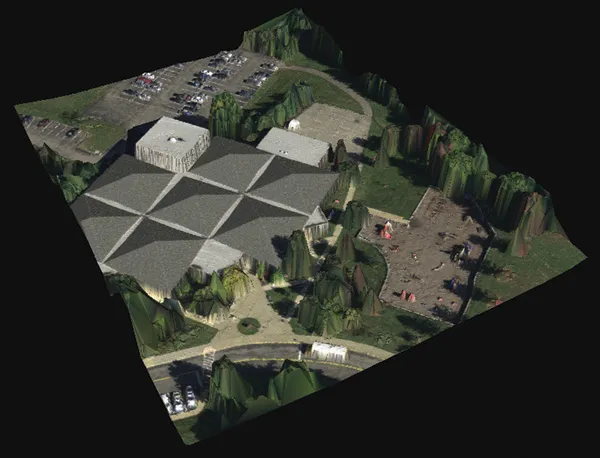
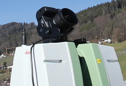
Users of Leica Cyclone, a 3D point cloud processing software, can now automatically import and align high-dynamic range (HDR) data from NCTech’s iSTAR camera database. The result is enhanced images delivered faster and easier, according to both companies. “It is also the accuracy to which these images fit the 3D point cloud data that is paramount. NCTech’s iSTAR camera produces high-quality HDR imaging at the accuracy everyone expects,” said Faheem Khan, vice president, business development for Leica Geosys
Users of 265 Leica Cyclone, a 3D point cloud processing software, can now automatically import and align high-dynamic range (HDR) data from NCTech’s iSTAR camera database.
The result is enhanced images delivered faster and easier, according to both companies.
“It is also the accuracy to which these images fit the 3D point cloud data that is paramount. NCTech’s iSTAR camera produces high-quality HDR imaging at the accuracy everyone expects,” said Faheem Khan, vice president, business development for Leica Geosystems High-Definition Surveying.
“Including this capability directly into Leica Cyclone provides fully optimised workflows for maximum productivity. This starts from data collection through to deliverable production that leverages new products, such as Leica TruView Global and JetStream to tackle the increasingly complex challenge of multi-platform, multi-device and multi-discipline project delivery.”
Previously, Leica Cyclone users accessed the iStar imagery database through NCTech’s ColourCloud software application, which produced coloured point clouds in E57 format. The latest agreement means that the export and re-import of this highly accurate data is eliminated, speeding up and simplifying the overall 3D point cloud creation process, said Khan.
Cameron Ure, chief executive of NCTech, said the company’s iSTAR products are focussed on capturing the most accurate colour data as rapidly as possible. The development “provides direct access for Leica Cyclone users across the world to colour their point clouds using iSTAR’s panoramic HDR imaging”.
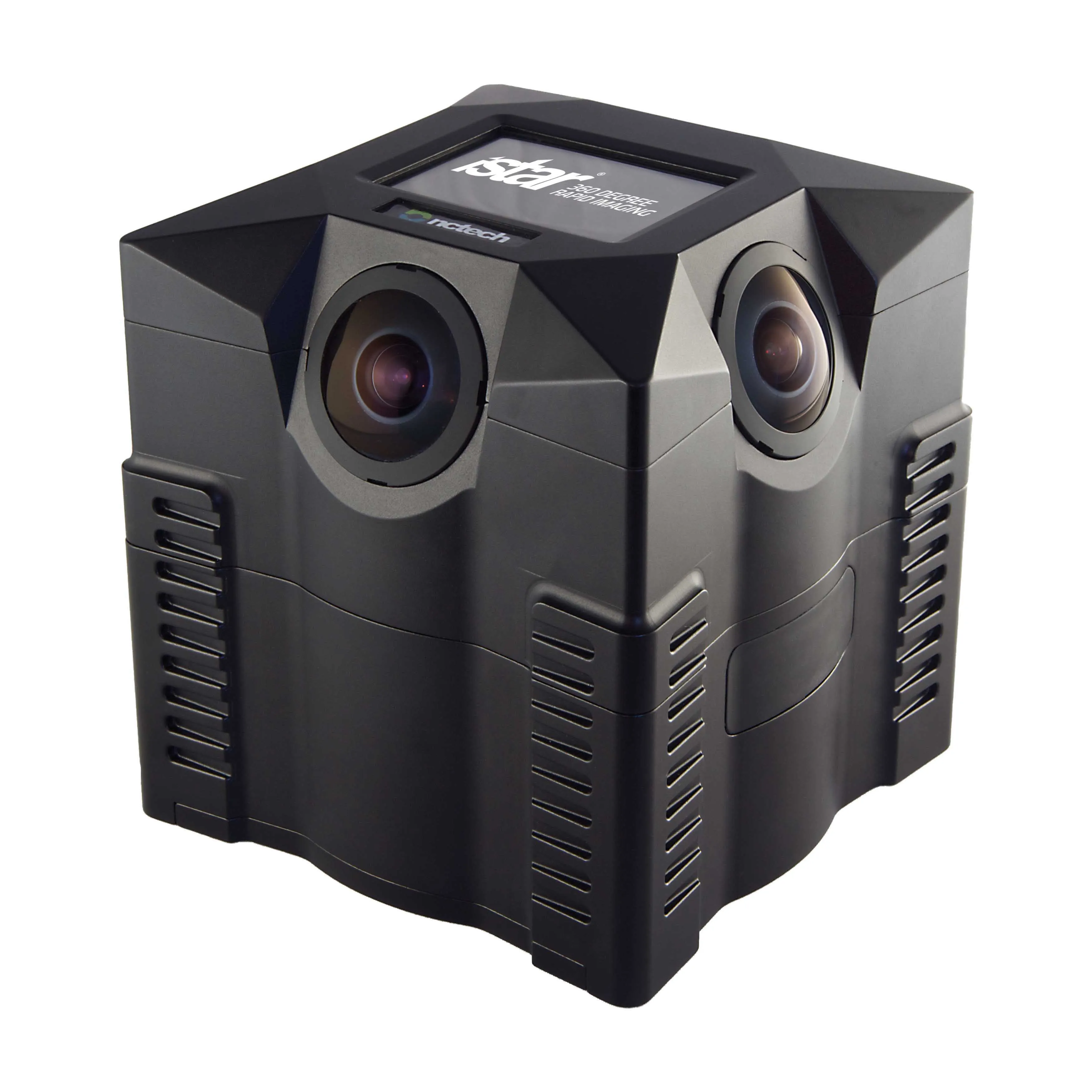
NCTech designs and manufactures 360-degree reality imaging systems that automate and streamline the workflow of image documentation and can be used repeatedly, accurately, consistently by anyone, anywhere.
NCTech is headquartered in Edinburgh, Scotland and is funded by Archangel Investors and the Scottish Co-Investment Fund.
Leica is part of7121 Hexagon, a Swedish global technology group focused on precision measuring technologies. Hexagon is divided into three business areas: Geospatial Measuring (surveying and GPS); Industrial metrology; and technologies.
The result is enhanced images delivered faster and easier, according to both companies.
“It is also the accuracy to which these images fit the 3D point cloud data that is paramount. NCTech’s iSTAR camera produces high-quality HDR imaging at the accuracy everyone expects,” said Faheem Khan, vice president, business development for Leica Geosystems High-Definition Surveying.
“Including this capability directly into Leica Cyclone provides fully optimised workflows for maximum productivity. This starts from data collection through to deliverable production that leverages new products, such as Leica TruView Global and JetStream to tackle the increasingly complex challenge of multi-platform, multi-device and multi-discipline project delivery.”
Previously, Leica Cyclone users accessed the iStar imagery database through NCTech’s ColourCloud software application, which produced coloured point clouds in E57 format. The latest agreement means that the export and re-import of this highly accurate data is eliminated, speeding up and simplifying the overall 3D point cloud creation process, said Khan.
Cameron Ure, chief executive of NCTech, said the company’s iSTAR products are focussed on capturing the most accurate colour data as rapidly as possible. The development “provides direct access for Leica Cyclone users across the world to colour their point clouds using iSTAR’s panoramic HDR imaging”.
NCTech designs and manufactures 360-degree reality imaging systems that automate and streamline the workflow of image documentation and can be used repeatedly, accurately, consistently by anyone, anywhere.
NCTech is headquartered in Edinburgh, Scotland and is funded by Archangel Investors and the Scottish Co-Investment Fund.
Leica is part of