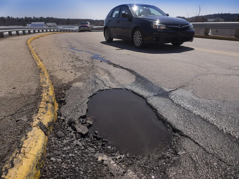
The Swedish Transport Administration (Trafikverket) has contracted three companies to develop a solution for using passenger cars to gather information about the condition of roads.
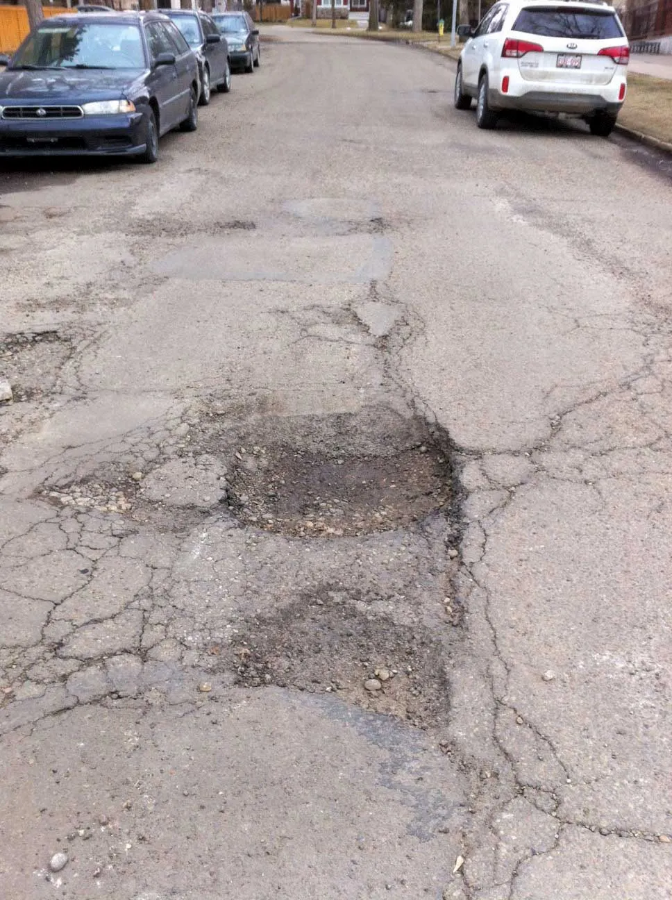
Mercedes-Benz Sweden, NIRA Dynamics and Univrses will start the project begins by studying areas of damage that cannot be captured by normal road surface measurements, for example potholes, frost damage and other winter damage. Currently, the Administration collects information about the condition of roads only intermittently and through specialist measurement techniques.
Fredrik Lindström, national coordinator for road surface measurements at Trafikverket, said anonymised vehicle data from connected passenger cars makes it possible to get better decision-making information, which in turn can lead to better road maintenance.
The project is implemented as a strategic collaboration between the Administration and government agency Vinnova's strategic innovation program Infra Sweden. Vinnova administers state funding for research and development.
NIRA Dynamics is a Swedish company based in n Linköping that focuses on research and development of signal processing and control systems for the automotive industry. It supplies automotive original equipment manufacturers and suppliers in Europe, North America, Latin America, and Asia with its products and systems.
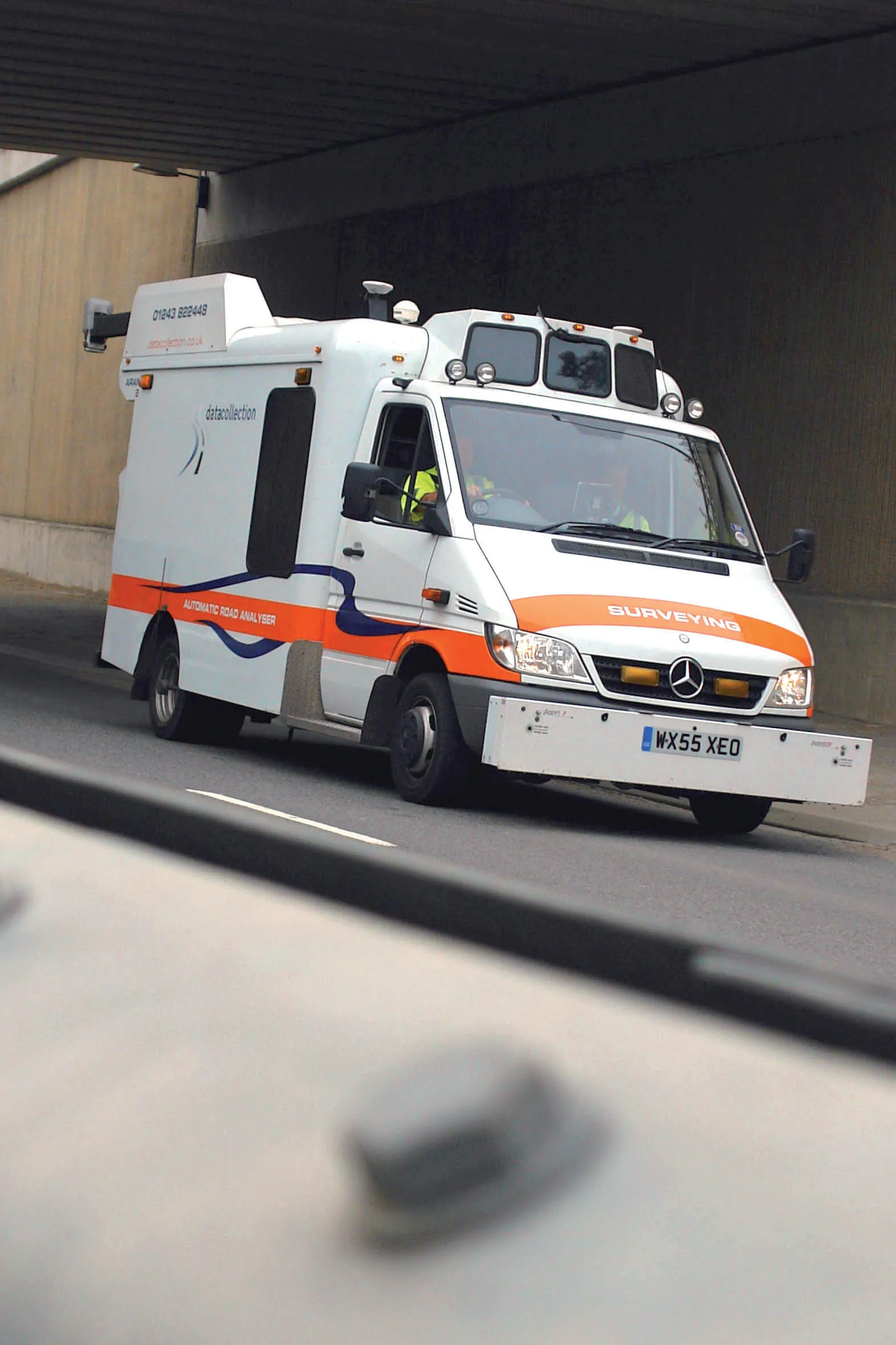
NIRA Dynamics' core product is its tire pressure indicator, an indirect tire-pressure monitoring system capable of detecting under-inflation simultaneously in up to four tires. However, NIRA Dynamics is developing sensor fusion based systems for different vehicle applications. It is working on road surface conditions analysis using data from connected vehicles, RWIS, radar/satellite images and weather prognoses to provide a real-time picture of the road status.
Last October, at the German Road and Traffic Congress 2022, Nira announced that it was working with HELLER Ingenieurgesellschaf on behalf of Germany’s Lower Saxony State Authority for Road Construction and Transport. The project is looking at continuous monitoring of road conditions with real-time vehicle data from the VW Group.
Darmstadt-based HELLER Ingenieurgesellschaft is provides road maintenance management. It supports road authorities record and assess the condition of traffic infrastructure and helps develops maintenance strategies such as prioritising repairs.
With the software modules installed in series-production vehicles of the Volkswagen Group - VW, Audi, Seat and Skoda - NIRA has been recording and assessing road conditions in many European countries since the beginning of 2021. In Germany, the data is available nationwide and with a high update rate.
Univrses is a Swedish creator of smart city data analysis solutions, such as 3DAI City, an artificial intelligence platform that enables urban and highway data to be gathered in real time. Scalable live maps of roadside environments enable businesses, municipalities and authorities to make data-driven decision, optimise their operations and increase urban safety.