Leica Geosystems is offering its improved SpiderWeb v4.0 package as part of the new reference station software update. This improved suite of solutions also includes the GNSS Spider v4.0 and SpiderQC v4.0 packages.
RSS265 Leica Geosystems is offering its improved SpiderWeb v4.0 package as part of the new reference station software update. This improved suite of solutions also includes the GNSS Spider v4.0 and SpiderQC v4.0 packages. The SpiderWeb v4.0 features a new business centre web portal that is combined for SpiderWeb and GNSS Spider Network RTK Services as well as an upgrade to the co-ordinate computation service function.
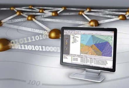
The SpiderWeb package is a software solution for the presentation of GNSS network and data over the Internet. This delivers fast access to data for post processing and allows a user to distribute GNSS data sets from individual stations or networks to users through conventional web browsers. Using this web portal provides an integrated and secure solution for online subscription and management of all GNSS network services. It integrates SpiderWeb and GNSS Spider services and allows a user to view, register and manage real time and post-processing services. The system can monitor service usage, enable exchange of data and view online network and rover status. The system allows users to quickly obtain accurate, post-processed coordinates without the need for office software according to the firm. Using this package provides an advanced and versatile yet simple and efficient to use solution for GNSS data internet services and network service providers can focus on the business aspects and optimise the scope of services being offered.
Meanwhile the new SpiderQC v4.0 provides a suite of tools to help select the best location for reference stations. The system allows users to perform quality control of the reference station data, detect site movements and visualise and monitor the integrity of single base and network RTK corrections in real-time. The new version supports quality control and data analysis of Galileo and GIOVE data including the E1, E5a, E5b and E5a+b (AltBOC) signals. Multi-frequency Galileo or GPS data can be used for advanced data analysis not possible before such as phase multipath estimation. With support for standard data formats including RINEX v2.11 and v3.0, Leica SpiderQC is compatible with all Leica and third party receivers. New features are now available for visualising and analysing the information recorded by Leica GNSS Spider or other reference station software when rover users connect to the system. Network operators can see who is connecting to a network, for how long and which products they are using. Improved support for high precision Leica Nivel200 inclination sensors further improves the ability to detect in real time movements. High precision inclination sensors can detect very small movements of the antenna independently and more accurately than the GNSS system itself.