Yotta develops new tools for sophisticated GIS package

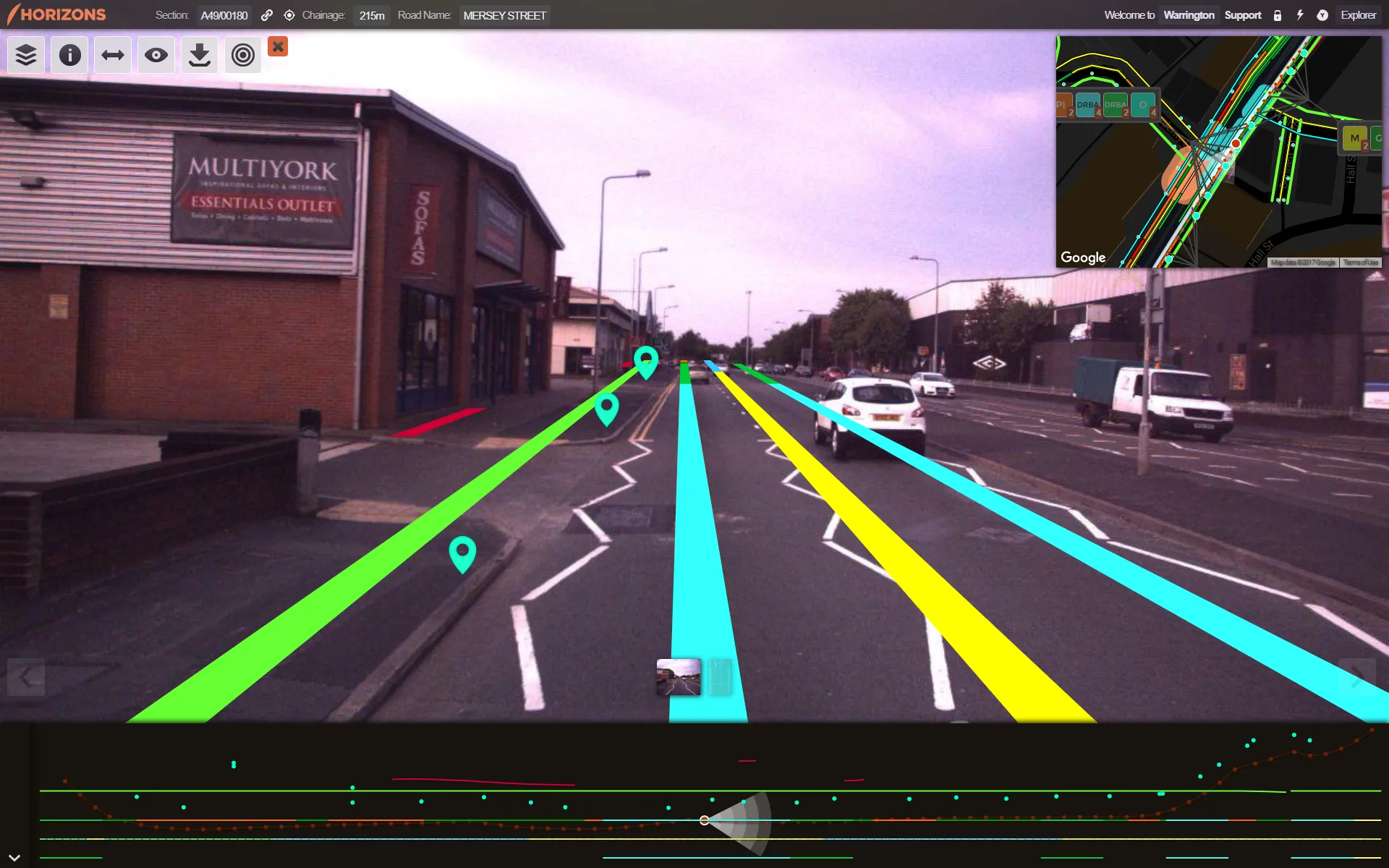
Highway technology and services company Yotta DCL has announced new features for Horizons. The web-based platform integrates GIS, pavement and asset management for highways authorities and agencies to use in a visualised asset management system. The new version 2.3 adds features and functionality across three modules: Explorer, Analysis and Management. Explorer allows users to view, load and visualise a range of datasets, including base network data, their condition in fine detail, plus relevant asset or co
April 25, 2013 Read time: 2 mins

New features are boosting the capabilities of Yotta’s Horizons software

Highway technology and services company Yotta DCL has announced new features for Horizons.

The web-based platform integrates GIS, pavement and asset management for highways authorities and agencies to use in a visualised asset management system. The new version 2.3 adds features and functionality across three modules: Explorer, Analysis and Management.

Explorer allows users to view, load and visualise a range of datasets, including base network data, their condition in fine detail, plus relevant asset or construction information. A new “deep linking” feature shares connections to the exact location of assets and associated data

New features are boosting the capabilities of Yotta’s Horizons software using unique web addresses. The data-analysis enhancements allow users to streamline the creation of optimised forward works plans with modelling of non-deteriorated parameters such as footway network survey (FNS) data. There is also a new “Reduce By Treatment” effect in the treatment options and a CO2 impact option can be summarised in the data analysis reports. The management module now features “Layer Upload/ Import” and a layer building functionality for easy customisation and creation of data sub-sets.

The northern UK town of Rochdale is targeting priority highways maintenance schemes with strategic support from road asset specialist 5153 Yotta DCL. Consultants from this highway technology and survey company used Horizons, its visualised asset management software based on the web, to create works programmes for the town’s carriageway and footway network. This latest contract builds on previous work done by the company including coarse visual inspections (CVI), scanner surveys, footway network surveys and Video Asset Inventory Collection. Horizons provides GIS, pavement management and asset management systems. All of the Borough Council’s previously captured survey data is used by the system to accurately score defects and prioritise work schemes.

Graphics addition

2614 Bricsys, which makes the dwg engineering design software BricsCAD has added the graphics rendering software provider Lightworks to its BricsCAD Solution Store. The Artisan rendering application from Lightworks can be trial downloaded or purchased. In BricsCAD Pro and Platinum editions, designers working in 3D can render high quality virtual reality images.

For more information on companies in this article

Related Content

  • Asset management can be optimised with new technology
    August 22, 2013
    An array of asset management technologies and capabilities are now available to help clients optimise infrastructure assessments. Global survey and geotechnical group, Fugro, has signed a multi-year agreement with Dutch pavement consultant, KOAC•NPC. This move will see the firms combine capabilities to undertake highway surface condition contracts in the Netherlands. Under the agreement, Fugro will collect surface condition data using its ARAN road scanning vehicle. KOAC•NPC, will carry out the post pro
  • Efficient asset management delivers
    April 25, 2013
    Maximising the economic benefit of infrastructure assets can be achieved through delivering better quality maintenance. Increasing utilisation of infrastructure follows on from those assets being in better condition. Clearly by tracking infrastructure condition closely, huge gains can be made in addressing technical issues before they become more serious and more costly, as well as minimising disruption. In UK city Birmingham, high resolution aerial photography from Bluesky is helping the city council under
  • Better maintenance is on the Horizon for UK’s Warrington Council
    May 15, 2018
    Good, readable analysis of road surfaces to ensure sufficient maintenance funding is an essential part of asset management. The technical side of ensuring a good road surface is integral to maintaining safe, superior highway infrastructure. But securing sufficient government funding for such work – repairs and new-build – based on the current road surface is also essential. To evaluate road conditions and structure for such a business case, one UK local council turned to software provider Yotta.
  • Fugro wins 3-year pavement assessment contract with UK council
    December 13, 2012
    Fugro has secured a three-year contract with Luton Borough Council in southern England to provide a range of highway and footway investigations, including the Council’s annual SCANNER surveys using Fugro’s ARAN (Automatic Road Analyser) survey system. The survey package also includes SCRIM (surface friction) testing of Luton’s A, B and C roads, and CVI (coarse visual inspection) of unclassified roads. Cambridge-based Fugro transport specialists will process the survey data to generate NI (national indicator