Fast modelling

The latest version of the PTV Visum transportation planning software offers easier and faster dynamic modelling according to the firm.
May 17, 2023 Read time: 2 mins


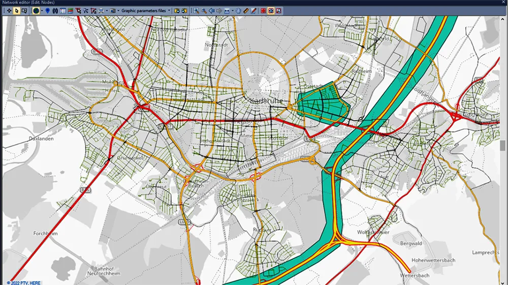
The new version means that users can blend mesoscopic and macroscopic assignments in the same model run, which allows them to evaluate more projects in less time. This is said to leverage the dynamic perspective and high level of detail provided by simulation-based assignments (SBA) for critical parts of the model. Furthermore, the mesoscopic SBA now allows lane level modelling, which unlocks new use cases that were previously only possible in microscopic simulation.

Meanwhile, PTV Visum 2023 brings tight integration with Activity-Sim, the popular open-source package for Activity Based demand Modeling (ABM) and provides a renewed network-wide signal optimisation algorithm. For easier modelling of bicycle traffic, users can now import bicycle networks from OpenStreetMap (OSM). Besides many other improvements, Public Transit analysis gets a boost by extended and drastically accelerated import of e-Ticketing data.

In addition, the visualisation tool PTV Visum Publisher was upgraded for the new release. It provides personalised cloud-based dashboards with illustrative visualisations, by which transportation modellers can share their project stories with anyone. The 2023 edition of the traffic engineering software PTV Vistro improves trip generation by adding ITE TripGen data to the model via ITE’s web-app. Moreover, the improved Universal Traffic Data Format (UTDF) import allows users to quickly integrate layout, lanes, phasing, timing plans and volumes. Thus, users can import data from various traffic models and signal controller systems for future analysis in Vistro, Vissim, or Visum.

The new features of PTV Optima empower traffic operators to better deal with demand changes. Also simulating the impact of traffic deviations and rerouting information in case of temporary road closure has been simplified.

For more information on companies in this article

Related Content

  • Smombies! Look out!
    February 12, 2021
    Our city streets are being invaded by smartphone zombies, but help is on the way
  • Improved laser scanning capabilities
    February 23, 2012
    Leica Geosystems is broadening its software offering with its new Leica Cyclone v7.2 package, which is said to improve office processing capabilities. The package has been developed to address key market needs and trends in the processing and use of rich, as-built point cloud data from high definition laser scanning technology. According to the firm the package can help reduce laser scanning project costs, including office time, allowing projects to use more scans and higher scan densities.
  • Yotta develops new tools for sophisticated GIS package
    April 25, 2013
    Highway technology and services company Yotta DCL has announced new features for Horizons. The web-based platform integrates GIS, pavement and asset management for highways authorities and agencies to use in a visualised asset management system. The new version 2.3 adds features and functionality across three modules: Explorer, Analysis and Management. Explorer allows users to view, load and visualise a range of datasets, including base network data, their condition in fine detail, plus relevant asset or co
  • Sharing point cloud data with Topcon
    March 12, 2018
    A new package from Topcon Positioning Group can help with collaboration and sharing for 3D point cloud data. This web-based service is for integration with the MAGNET Collage desktop mass data processing software — MAGNET Collage Web. According to the firm, the MAGNET Collage Web allows users to access data through a web browser that integrates with the MAGNET Collage Office version. The package means that users can publish and share mass data maps in a user-friendly and intuitive 3D web-based environment