Software solutions providers Bentley and Trimble will collaborate to develop construction modeling products for asset performance that can be used by clients after handover of a project.
The announcement was made simultaneously at their separate conferences -- the Bentley Year in Infrastructure 2014 event in London, UK, and Trimble Dimensions 2014 in Las Vegas.
Construction modeling includes modeling of temporary works, intelligent positioning, splitting and sequencing, detailing for fabrication, work
RSSSoftware solutions providers 6197 Bentley and 2122 Trimble will collaborate to develop construction modeling products for asset performance that can be used by clients after handover of a project.
The announcement was made simultaneously at their separate conferences -- the Bentley Year in Infrastructure 2014 event in London, UK, and7898 Trimble Dimensions 2014 in Las Vegas.
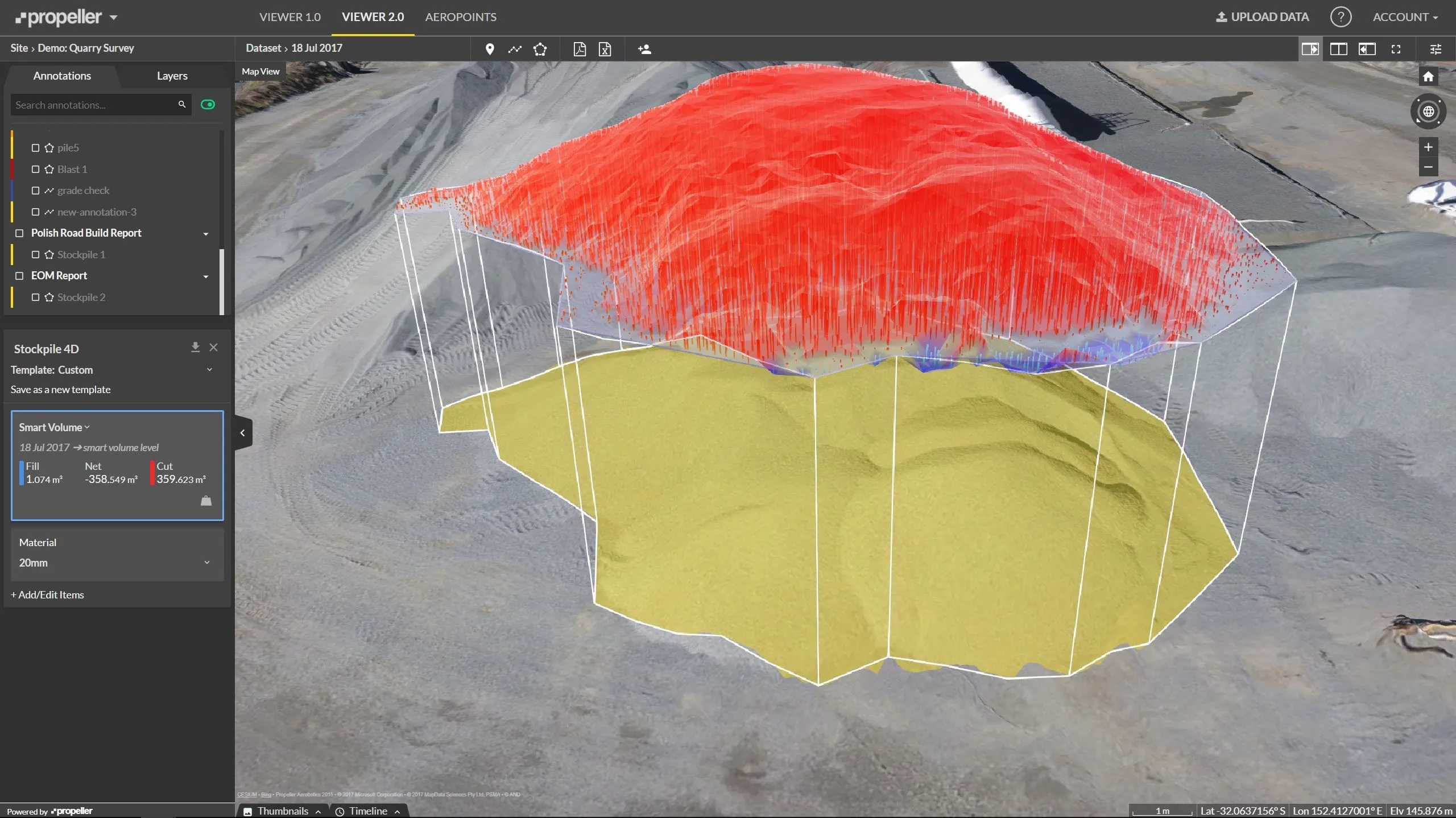
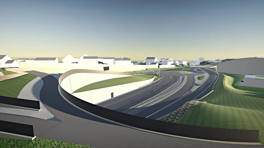
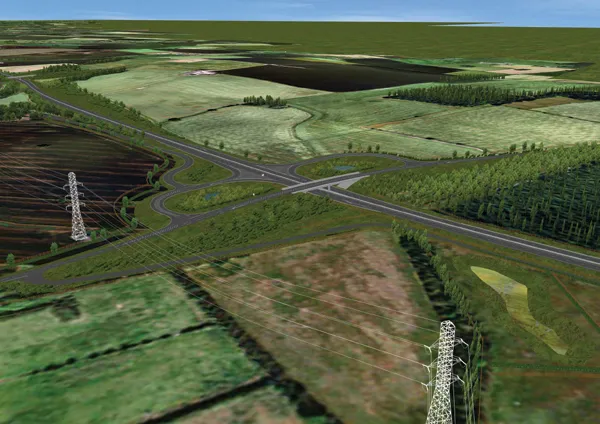
Construction modeling includes modeling of temporary works, intelligent positioning, splitting and sequencing, detailing for fabrication, workface planning, construction work packaging, and support for distributed construction.
Architects and engineers perform design modeling with Building Information Modeling (BIM) toolsets that support optioneering and analytical modelling. This enables owners to make better decisions about running their assets after handover, including operations and maintenance.
However, some of the most advanced BIM deliverables have simply not been useful for constructors' requirements. To overcome this, many constructors have created their own discrete 3D models for the limited purposes of construction visualization. But these models often don’t survive into handover, a loss of valuable information that could help clients better understand their asset.
Bentley and Trimble propose to save the architects' and engineers' work and overlay it with as-built changes. As part of this, the two companies said they will cooperate to advance standards, such as the Open Geospatial Consortium's "intrinsic geo-context" down to construction levels of detail.
Bryn Fosburgh, vice president responsible for Trimble's construction technology divisions, said Bentley and Trimble are “working together on projects to get the most advantage of constructible models”.
Harry Vitelli, Bentley Systems vice president for construction and field, said Bentley's collaboration with Trimble will transform the design-to-construction workflow. “For example, by enabling greatly enhanced information mobility through Bentley's recently announced ProjectWise CONNECT Edition and Trimble's recently announced Trimble Connect platform,” he said.
The announcement was made simultaneously at their separate conferences -- the Bentley Year in Infrastructure 2014 event in London, UK, and
Construction modeling includes modeling of temporary works, intelligent positioning, splitting and sequencing, detailing for fabrication, workface planning, construction work packaging, and support for distributed construction.
Architects and engineers perform design modeling with Building Information Modeling (BIM) toolsets that support optioneering and analytical modelling. This enables owners to make better decisions about running their assets after handover, including operations and maintenance.
However, some of the most advanced BIM deliverables have simply not been useful for constructors' requirements. To overcome this, many constructors have created their own discrete 3D models for the limited purposes of construction visualization. But these models often don’t survive into handover, a loss of valuable information that could help clients better understand their asset.
Bentley and Trimble propose to save the architects' and engineers' work and overlay it with as-built changes. As part of this, the two companies said they will cooperate to advance standards, such as the Open Geospatial Consortium's "intrinsic geo-context" down to construction levels of detail.
Bryn Fosburgh, vice president responsible for Trimble's construction technology divisions, said Bentley and Trimble are “working together on projects to get the most advantage of constructible models”.
Harry Vitelli, Bentley Systems vice president for construction and field, said Bentley's collaboration with Trimble will transform the design-to-construction workflow. “For example, by enabling greatly enhanced information mobility through Bentley's recently announced ProjectWise CONNECT Edition and Trimble's recently announced Trimble Connect platform,” he said.