Firm Grip: Liebherr, Leica and Steelwrist

The Leica Co-Pilot system controlling the Steelwrist X32 tiltrotator makes the job that little bit quicker and more accurate.
By David Arminas March 11, 2021 Read time: 2 mins
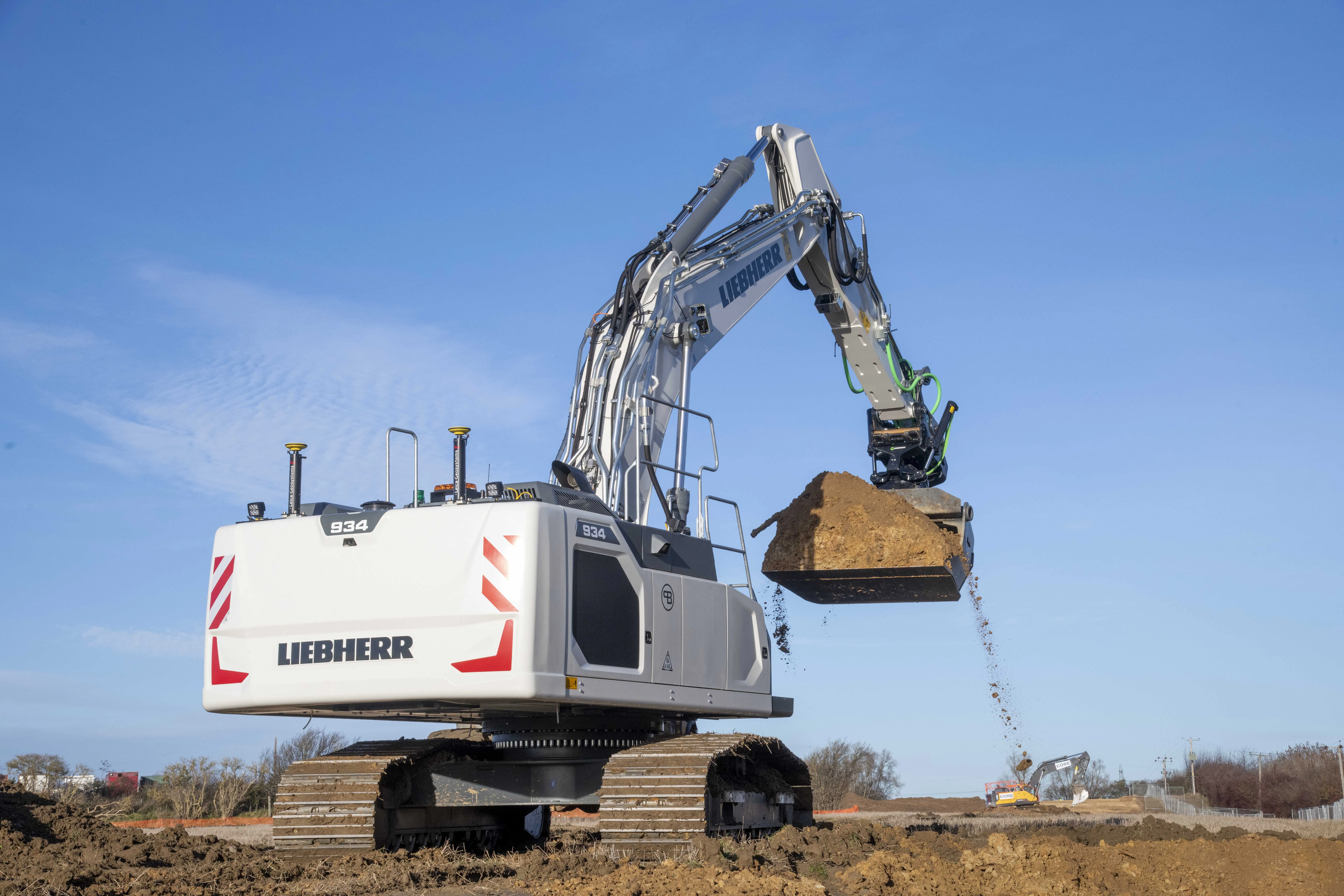
Winning combination: the Leibherr R 934 G8 crawler fitted with GPS guidance from Leica Geosystems and with a Steelwrist X32 tiltrotator attachment

The first Liebherr excavator in the world with a factory-fitted Leica machine control system has gone into service with a UK civil engineering contractor.

An R 934 G8 crawler, the first to leave the factory in France since Liebherr and Leica Geosystems joined forces last year, has been added to the fleet at Brad-Pave. It is equipped with the Leica 3D passive system soon to be updated to include automatic inclination/rotation function.

Brad-Pave - which employs only four people and is based in England - specialises in road construction, deep drainage and earthmoving.

The machine arrived in the UK towards the end of last year with an operating weight of almost 38.5 tonnes. But soon after, a Steelwrist X32 tiltrotator on 80mm pins was added, taking the total package to just over 40 tonnes.

“We’ve used GPS guidance for a number of years and having the opportunity to have an integrated system on a Liebherr excavator was an ideal scenario for us,” said Paul Bradshaw, director of Brad-Pave.

“We are hoping that one of the benefits of taking this option will be the increased reliability of a built-in system. Not only does it do away with the requirement for traditional setting-out but it is almost 100% fool-proof. The addition of the Leica Co-Pilot system controlling the Steelwrist will just make any project that little bit quicker and more accurate,” said Bradshaw.

The partnership between Liebherr and Leica Geosystems enables customers to buy generation 6 and 8 crawler and wheeled excavators with 2D or 3D control systems as an option.

Leica Geosystems, part of the Hexagon Group, supplies of sensors, software and services for surveying, construction, infrastructure, mining, mapping and other geospatial content-dependent industries.

For more information on companies in this article

Related Content

  • Komatsu introducing intelligent excavator
    December 8, 2014
    Komatsu has continued its development of Intelligent Machine Control (IMC) systems, in cooperation with global partner Topcon, with the launch of the PC210LCi-10, the first fully integrated OEM machine control crawler excavator. Unlike its IMC-equipped D61PXi/EXi dozer that was introduced last year, the popular 21 tonne excavator has been unveiled first in Europe, rather than in Japan or the USA. The machine, which is built at Komatsu UK’s excavator plant in Birtley in the North East of England, offers sem
  • Data collection key to software developments
    February 13, 2012
    The collection and handling of data are key technology drivers in the software sector. New methods of data collection and manipulation are driving significant developments in software at present. The latest technology allows designers and engineers to collect, store and manipulate ever larger amounts of data. Growing use of mobile field equipment for both data collection and field management is driving interactive systems. And in an interview this month Autodesk senior vice-president for the construction an
  • Caterpillar goes big today on future technologies
    March 6, 2017
    Caterpillar has stressed how the use of innovative data analysis hardware and software can boost construction, mining and quarrying jobsite productivity by up to 40%. The US equipment giant says it is leading the industry by introducing the best products and technology, while also delivering a full portfolio of solutions.
  • Leica Cyclone teams up with NCTech’s iSTAR camera database
    January 19, 2016
    Users of Leica Cyclone, a 3D point cloud processing software, can now automatically import and align high-dynamic range (HDR) data from NCTech’s iSTAR camera database. The result is enhanced images delivered faster and easier, according to both companies. “It is also the accuracy to which these images fit the 3D point cloud data that is paramount. NCTech’s iSTAR camera produces high-quality HDR imaging at the accuracy everyone expects,” said Faheem Khan, vice president, business development for Leica Geosys