Firm Grip: Liebherr, Leica and Steelwrist

The Leica Co-Pilot system controlling the Steelwrist X32 tiltrotator makes the job that little bit quicker and more accurate.
By David Arminas March 11, 2021 Read time: 2 mins
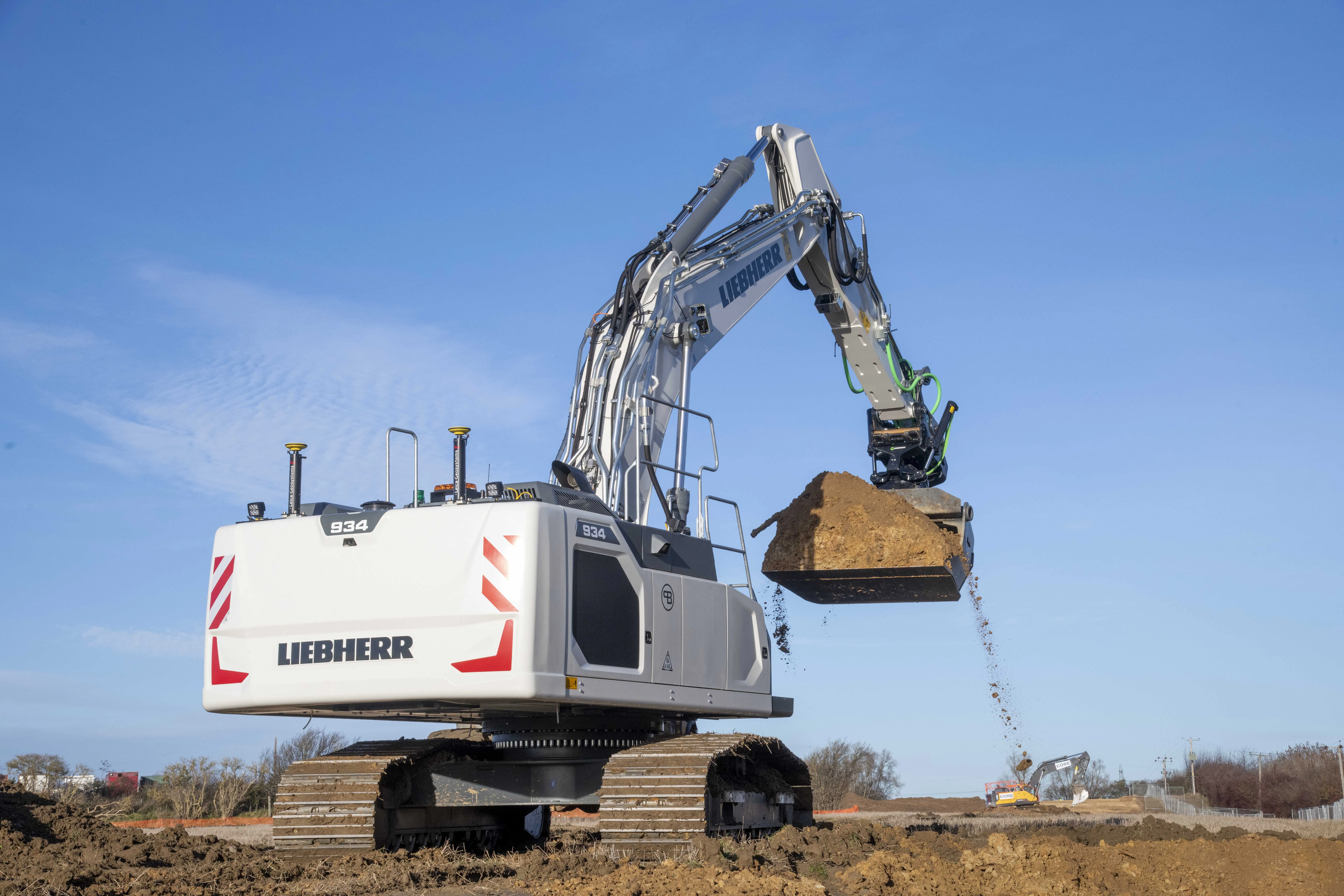
Winning combination: the Leibherr R 934 G8 crawler fitted with GPS guidance from Leica Geosystems and with a Steelwrist X32 tiltrotator attachment

The first Liebherr excavator in the world with a factory-fitted Leica machine control system has gone into service with a UK civil engineering contractor.

An R 934 G8 crawler, the first to leave the factory in France since Liebherr and Leica Geosystems joined forces last year, has been added to the fleet at Brad-Pave. It is equipped with the Leica 3D passive system soon to be updated to include automatic inclination/rotation function.

Brad-Pave - which employs only four people and is based in England - specialises in road construction, deep drainage and earthmoving.

The machine arrived in the UK towards the end of last year with an operating weight of almost 38.5 tonnes. But soon after, a Steelwrist X32 tiltrotator on 80mm pins was added, taking the total package to just over 40 tonnes.

“We’ve used GPS guidance for a number of years and having the opportunity to have an integrated system on a Liebherr excavator was an ideal scenario for us,” said Paul Bradshaw, director of Brad-Pave.

“We are hoping that one of the benefits of taking this option will be the increased reliability of a built-in system. Not only does it do away with the requirement for traditional setting-out but it is almost 100% fool-proof. The addition of the Leica Co-Pilot system controlling the Steelwrist will just make any project that little bit quicker and more accurate,” said Bradshaw.

The partnership between Liebherr and Leica Geosystems enables customers to buy generation 6 and 8 crawler and wheeled excavators with 2D or 3D control systems as an option.

Leica Geosystems, part of the Hexagon Group, supplies of sensors, software and services for surveying, construction, infrastructure, mining, mapping and other geospatial content-dependent industries.

For more information on companies in this article

Related Content

  • VIDEO: Telstra drone LIDAR maps Melbourne’s EastLink Mullum Tunnel
    April 13, 2018
    One of the applications for LIDAR is to make high resolution 3-D maps. Self-driving cars are pre-loaded with a LIDAR map of the trials area in which they are permitted to fully self-drive themselves. The cars also have their own LIDAR scanner which captures a real-time LIDAR view of the vehicle’s surroundings. The fully autonomous driving system within these prototype cars compares the real-time LIDAR view against the pre-loaded LIDAR map to significantly increase the accuracy of their self-positioning
  • Bitumen technology: from potholes to PMB plants
    November 21, 2014
    This month we look at how warm mix is helping to pave dirt roads, a new way to tackle potholes, and bring news of a new distribution centre for the UK - Kristina Smith reports The creation of a new mix design, incorporating MWV’s warm mix additive Evotherm, is providing cost-effective solutions for dirt roads in the US’s Charleston County. The first stretch to be paved with the new porous paving in April this year, Joseph White Road in the town of Adams Run, resulted in the estimated US$1.1 million construc
  • Hillhead promises industry showcase
    June 12, 2012
    Hillhead 2012, the three-day biennial flagship event for the quarrying, recycling and heavy construction industries, is set to be a sell-out. Guy Woodford looks at what a number of major companies will be exhibiting during the show being held next month at Buxton Quarry in Derbyshire With 400 exhibitors already confirmed Hillhead 2012, taking place 19-21 June, is set to draw bumper crowds and provide crucial new business opportunities for companies involved in quarrying, recycling and heavy construction. Ca