One of the applications for LIDAR is to make high resolution 3-D maps. Self-driving cars are pre-loaded with a LIDAR map of the trials area in which they are permitted to fully self-drive themselves. The cars also have their own LIDAR scanner which captures a real-time LIDAR view of the vehicle’s surroundings. The fully autonomous driving system within these prototype cars compares the real-time LIDAR view against the pre-loaded LIDAR map to significantly increase the accuracy of their self-positioning
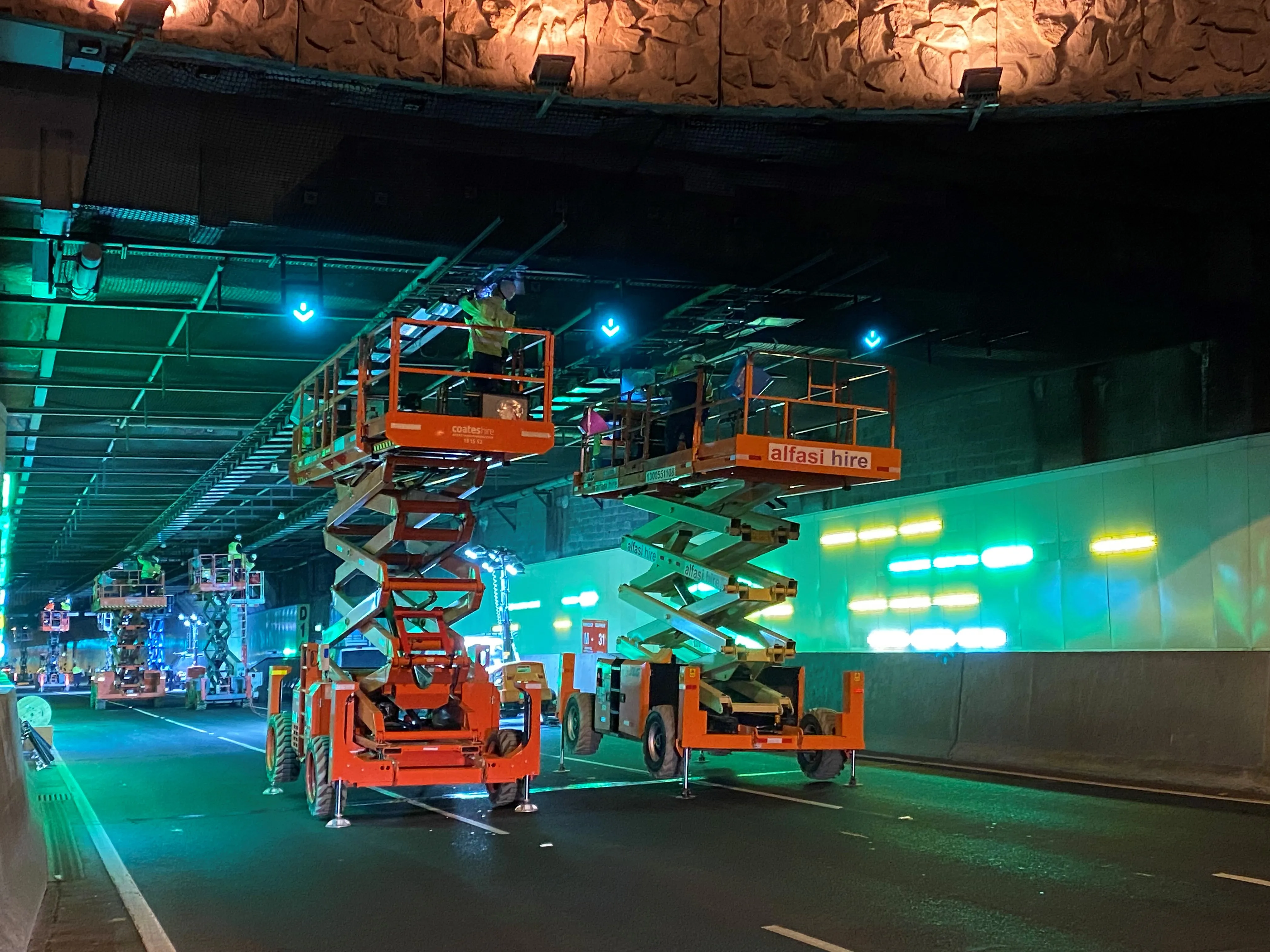
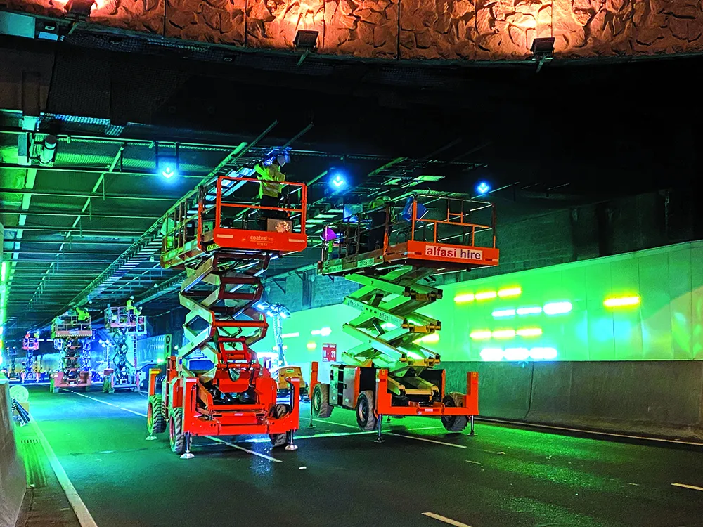
Melbourne’s EastLink Mullum Mullum Tunnel is a step closer to supporting trials of self-driving cars after a drone LIDAR-mapped the structure.
The guidance systems of most self-driving car prototypes require hig-resolution LIDAR maps of the road. When the tunnel was closed for overnight maintenance recently, drones piloted by operators from the Australian communications company Telstra collected the data.
Telstra uses the drones for inspecting its telecommunications infrastructure including high-rise equipment towers.
The 1.5km Mullum Mullum Tunnel is one of a twin-tunnel section of the EastLink under Mullum Mullum Creek; the other tunnel is called Dame Nellie Melba.
The 40km EastLink is an electronically tolled section of the M3 motorway around the eastern and south-eastern suburbs of Melbourne. The route which carries around 250,000 vehicles/day is part of Melbourne's Metropolitan Ring Road project. Operation of the route is ConnectEast, an Australian company that was responsible for the finance, design and construction of the highway at a cost of nearly US$2 billion.
LIDAR is a digital surveying technology that uses a rapidly pulsing laser light to build up an accurate 3-D representation of the area being surveyed.
One of the applications for LIDAR is to make high resolution 3-D maps.
Self-driving cars are pre-loaded with a LIDAR map of the trials area in which they are permitted to fully self-drive themselves. The cars also have their own LIDAR scanner which captures a real-time LIDAR view of the vehicle’s surroundings.
The fully autonomous driving system within these prototype cars compares the real-time LIDAR view against the pre-loaded LIDAR map to significantly increase the accuracy of their self-positioning system, as well as to help identify other objects that the car needs to avoid – such as pedestrians, cyclists, animals and other vehicles.
“Over the past year, EastLink has been trialling the latest driver assistance functions now available to the Australian public in some production vehicles,” said Doug Spencer-Roy, marketing manager for EastLink.
“Those trials have already identified opportunities to improve the operation of those functions. By starting the process of capturing high resolution LIDAR maps of EastLink, we have now embarked on preparing EastLink for safe trials, under controlled conditions, of fully self-driving vehicles.
“LIDAR maps of the EastLink tunnels can also support our maintenance activities by allowing details of tunnel infrastructure to be viewed in 3-D,” he said.
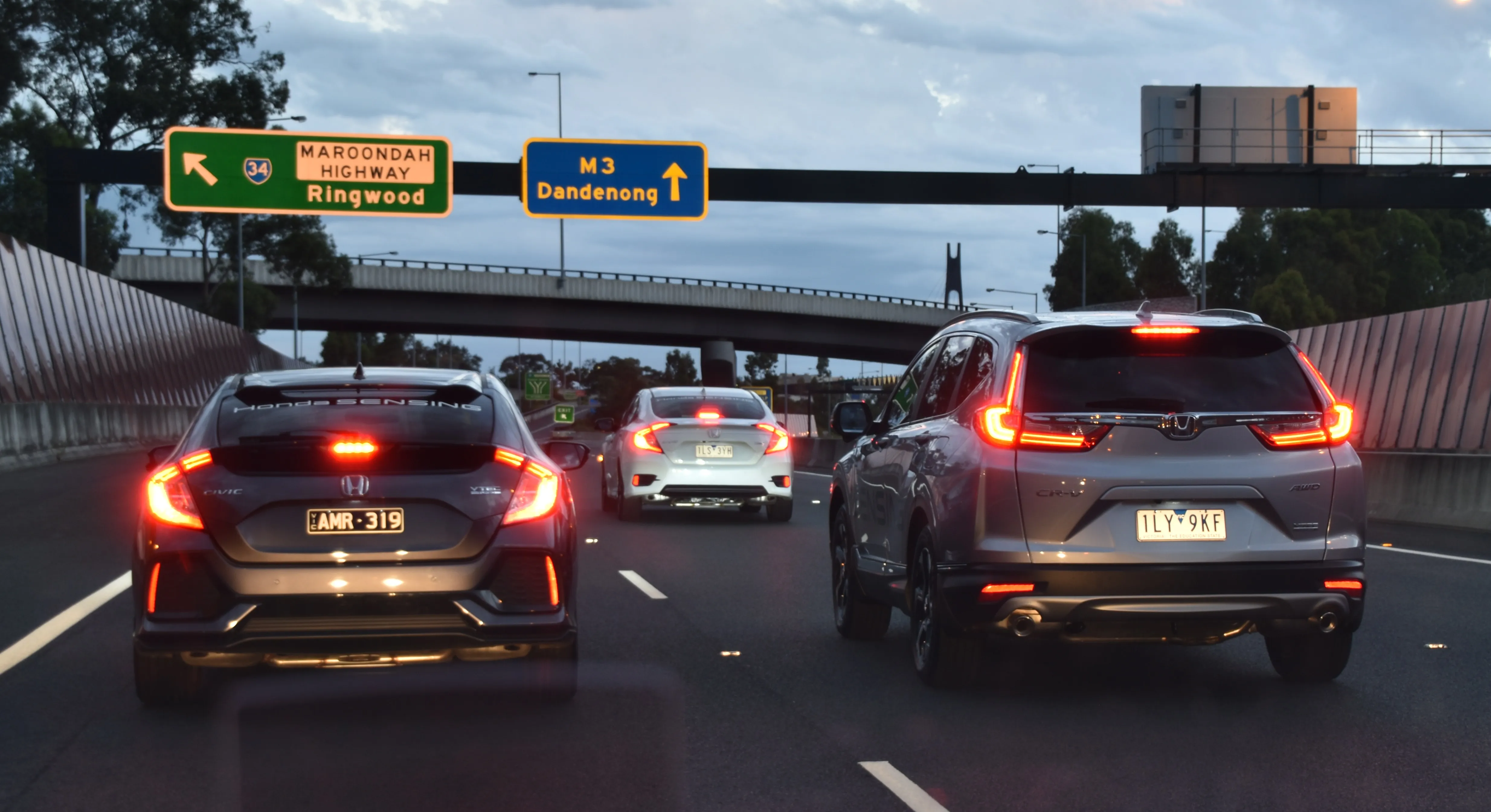
EastLink also recently televised a demonstration of automated driving along a section of the road. A Honda CR-V VTi-LX carried out automated speed plus steering control, using the adaptive cruise control and lane-keep assist functions in an area of Eastlink closed to traffic. It was broadcasted live on a Melbourne television station.
The vehicle, according to Spencer-Roy, steered itself along the freeway and automatically adjusted its speed. “In one scenario, representing a traffic jam caused by an accident, the vehicle was able to bring itself safely and automatically to a complete stop behind other vehicles stopped on the freeway.”
The trial followed results from EastLink’s Annual Victorian Self-Driving Vehicle Survey. More than half of the 15,000 respondents said that they have very little or no awareness of self-driving cars.
Only 15% of survey participants confirmed that their car had an adaptive cruise control function. Of those that have the function, more than a quarter said they do not use it. This feature, along with adaptive cruise control, lane-keep assist and other capabilities are said to be increasingly available in the latest passenger vehicles.
The guidance systems of most self-driving car prototypes require hig-resolution LIDAR maps of the road. When the tunnel was closed for overnight maintenance recently, drones piloted by operators from the Australian communications company Telstra collected the data.
Telstra uses the drones for inspecting its telecommunications infrastructure including high-rise equipment towers.
The 1.5km Mullum Mullum Tunnel is one of a twin-tunnel section of the EastLink under Mullum Mullum Creek; the other tunnel is called Dame Nellie Melba.
The 40km EastLink is an electronically tolled section of the M3 motorway around the eastern and south-eastern suburbs of Melbourne. The route which carries around 250,000 vehicles/day is part of Melbourne's Metropolitan Ring Road project. Operation of the route is ConnectEast, an Australian company that was responsible for the finance, design and construction of the highway at a cost of nearly US$2 billion.
LIDAR is a digital surveying technology that uses a rapidly pulsing laser light to build up an accurate 3-D representation of the area being surveyed.
One of the applications for LIDAR is to make high resolution 3-D maps.
Self-driving cars are pre-loaded with a LIDAR map of the trials area in which they are permitted to fully self-drive themselves. The cars also have their own LIDAR scanner which captures a real-time LIDAR view of the vehicle’s surroundings.
The fully autonomous driving system within these prototype cars compares the real-time LIDAR view against the pre-loaded LIDAR map to significantly increase the accuracy of their self-positioning system, as well as to help identify other objects that the car needs to avoid – such as pedestrians, cyclists, animals and other vehicles.
“Over the past year, EastLink has been trialling the latest driver assistance functions now available to the Australian public in some production vehicles,” said Doug Spencer-Roy, marketing manager for EastLink.
“Those trials have already identified opportunities to improve the operation of those functions. By starting the process of capturing high resolution LIDAR maps of EastLink, we have now embarked on preparing EastLink for safe trials, under controlled conditions, of fully self-driving vehicles.
“LIDAR maps of the EastLink tunnels can also support our maintenance activities by allowing details of tunnel infrastructure to be viewed in 3-D,” he said.
EastLink also recently televised a demonstration of automated driving along a section of the road. A Honda CR-V VTi-LX carried out automated speed plus steering control, using the adaptive cruise control and lane-keep assist functions in an area of Eastlink closed to traffic. It was broadcasted live on a Melbourne television station.
The vehicle, according to Spencer-Roy, steered itself along the freeway and automatically adjusted its speed. “In one scenario, representing a traffic jam caused by an accident, the vehicle was able to bring itself safely and automatically to a complete stop behind other vehicles stopped on the freeway.”
The trial followed results from EastLink’s Annual Victorian Self-Driving Vehicle Survey. More than half of the 15,000 respondents said that they have very little or no awareness of self-driving cars.
Only 15% of survey participants confirmed that their car had an adaptive cruise control function. Of those that have the function, more than a quarter said they do not use it. This feature, along with adaptive cruise control, lane-keep assist and other capabilities are said to be increasingly available in the latest passenger vehicles.