XenoTrack on track

XenoTrack Dual Lane was officially launched this month at GeoWeek, a major event for the geospatial and 3D sector that took place in the US city of Denver.
April 25, 2023 Read time: 1 min
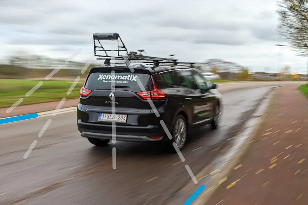
The latest version of XenomatiX’s road lidar XenoTrack inspection system covers two lanes in one pass.

XenomatiX, a solid state lidar company specialising in road asset management and digital twins of roads, launched the XenoTrack Single Lane system last year. Now, the company says that with the Dual Lane system, it “took a step-in easing 3D pavement measurement”.

Traditional road assessment systems are limited to measuring the width of one or part of a road lane on each pass. But XenoTrack Dual Lane surveys two neighbouring lanes in a single pass. While the vehicle drives in one lane, the system simultaneously measures the road surface condition of that lane and the neighbouring lane.

All XenoTrack products including the Dual Lane system, use a highly accurate lidar as main component, offering 3D and intensity maps of the road surface.

For more information on companies in this article

Related Content

  • Mandatory US minimum retroreflectivity
    November 14, 2022
    The US Federal Highway Administration announced the standards required in maintaining minimum levels of retroreflectivity for pavement markings.
  • Data collection key to software developments
    February 13, 2012
    The collection and handling of data are key technology drivers in the software sector. New methods of data collection and manipulation are driving significant developments in software at present. The latest technology allows designers and engineers to collect, store and manipulate ever larger amounts of data. Growing use of mobile field equipment for both data collection and field management is driving interactive systems. And in an interview this month Autodesk senior vice-president for the construction an
  • SICK’s Free Flow Profiler scans vehicles on the move
    August 27, 2019
    SICK has launched the Free Flow Profiler vehicle measurement system that enables highly accurate 3D profiling of vehicles across multiple lanes in free-flow traffic
  • VIDEO: Telstra drone LIDAR maps Melbourne’s EastLink Mullum Tunnel
    April 13, 2018
    One of the applications for LIDAR is to make high resolution 3-D maps. Self-driving cars are pre-loaded with a LIDAR map of the trials area in which they are permitted to fully self-drive themselves. The cars also have their own LIDAR scanner which captures a real-time LIDAR view of the vehicle’s surroundings. The fully autonomous driving system within these prototype cars compares the real-time LIDAR view against the pre-loaded LIDAR map to significantly increase the accuracy of their self-positioning