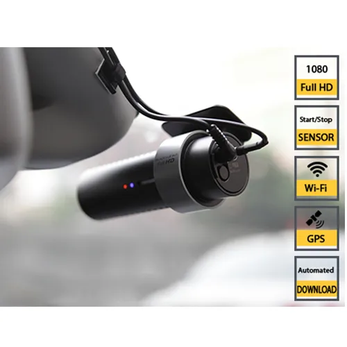
It comes with an integrated GPS, as well as integrated wifi, a proximity sensor to start-stop recording and voice feedback.
The Canadian company, based in Quebec City, says that the easy-to-use low-cost high-definition system allows contractors and agencies a tool to document their projects with very minimal management. It provides high-quality videos along with automatic video transfer and cloud-based storage.
Ver-Mac says that the WZMC-1000 system can help protect a company against litigation by ensuring accurate daily, weekly and monthly counts of deployed equipment. It also helps documentation of completed activities and can be used as an asset management tool to document quality and condition of a variety of assets.
Ver-Mac says that the system provides documentation that projects are set up correctly, device counts are accurate and a history of completed activities with a record of dates and time.
The camera is mounted on the windscreen of a car. Recording is started simply by putting a hand in front of the lens. After driving through a work zone, simply put a hand again in front of the camera to stop recording.
The system allows users to view the image of the video and the GPS position at the same time. Videos can also be downloaded for future quick reference.
Arriving back at the office, the videos will, with the wifi connection, be automatically downloaded to the cloud.