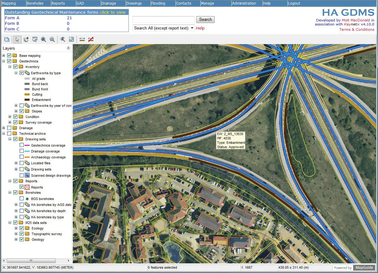
SMIGHT, maker of traffic data management systems and hardware, has teamed up with traffic management software developer
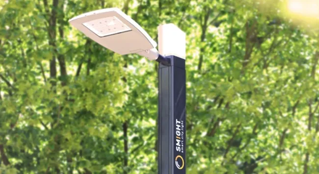
Cities and municipalities can use the new solution to analyse traffic flows and plan ahead to reduce traffic volume on roads and in regions. SMIGHT intelligent street lighting and multifunctional base towers can be equipped with features such as public WiFi, charging technology for electric cars or sensors for recording traffic data and environmental information.
Data can be analysed with traffic planning and management software PTV Visum. SMIGHT Traffic records the various road users and transmits the data to the smart city platform SMIGHT IQ. There the data is mapped as a real-time simulation and enables forward-looking analysis of potential traffic events.
Data collected in the past, for example, can be processed in PTV Visum software to assist in strategic transport planning and modelling. Additionally, traffic information collected in real time via intelligent street lighting can be fed into the operative traffic management system PTV Optima.
“This reduces the traffic load and enhances quality of life. No matter whether car, bus, or bike – the sheer number and variety of mobility options are posing new challenges for transport planners in cities and municipalities,” explained Oliver Deuschle, director of SMIGHT.
“The interplay of PTV and SMIGHT solutions can identify traffic disruptions before they even occur,” said Peter Möhl of PTV. SMIGHT, owned by German utility company