Exodigo digs deep in Tel Aviv

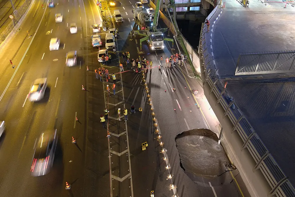
When a large sinkhole opened up on a busy highway in Tel Aviv, Israel, city transport authorities called in the underground mapping experts from Exodigo.
January 31, 2023 Read time: 2 mins
Exodigo uses sensors and cloud-based AI to produce accurate 3D maps of underground areas as deep as 10m (image courtesy Exodigo)

Exodigo’s AI/3D underground mapping tech assessed both current and future risks while the highway was shut down in that area. Exodigo's platform was used not only to assess what could safely open/resume operation, but to provide immediate corrective actions in areas suspected of being unstable to minimise the risk of sinkhole expansion.

The company says that its platform can detect any buried object, from man-made pipes and cables to soil layers, rocks, minerals, and even groundwater. It also works at any scale and terrain, from crowded urban environments to vast rural ones.

Using its advanced, non-intrusive underground mapping AI platform, Exodigo immediately scanned the area with multiple sensor types. The team quickly identified potential risks in surrounding areas on the highway and confirmed the integrity of the areas supporting train infrastructure through its multi-sensing AI platform.

Giving crews the ability to have an accurate, combined CT/MRI/X-ray scan of what is underground can help minimise risks in a wide range of both everyday construction/infrastructure activities and potentially fatal situations such as sinkholes.

According to Exodigo, no other technologies properly “see” underground. Meanwhile, the company’s technology rapidly creates digital, 3D geographic maps of the underground – utilities, pipes and cables, as well as details on soil layers, rocks, minerals and groundwater.

For more information on companies in this article

Related Content

  • Catsurveys introduces mobile GPR that covers 50km a day
    March 10, 2015
    Catsurveys Group’s latest mobile ground penetrating radar (GPR) unit can cover up to 50km a day to identify underground utilities, buried manholes, chambers, culverts, tunnels and other objects. The mobile GPR uses a multitude of low- and intermediatefrequency antennas to boost the quality of data. Double polarised antennas cover longitudinal and transverse scans to create clear images. The surveys combine GPS and total station theodolite recording to give pinpoint geolocations of all features of interest.
  • Trimble’s vision of a far more efficient future
    July 5, 2021
    Trimble is offering a future with more efficient, optimised construction operations for faster project delivery
  • Securing safer transportation infrastructure through non-destructive technology
    June 16, 2014
    Kevin Vine reports on the use of non-destructive testing for structural analysis of bridges Seven years ago, the overpass collapse in Laval, Québec that led to the death of five people brought to light severe issues with the state of the country’s bridges and transportation infrastructure. More recently, a crack in the Champlain Bridge to Montreal that forced over 160,000 commuters to find alternate routes to work reaffirmed a need for greater emphasis on early detection before a crisis occurs.
  • Valerann wins AI European Space Agency deal
    April 25, 2025
    Valerann’s traffic monitoring contract is from ESA’s Business Applications and Space Solutions (BASS) programme which supports services that use space technology and data in markets such as transportation.