Esri and Heliguy to cooperate

Esri UK has signed a partnership with drone developer Heliguy as part of its strategy to offer all elements of a drone service.
February 15, 2021 Read time: 2 mins
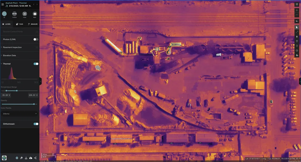
Thermal imaging using Esri UK Site Scan

The partnership will provide customers with drone hardware, pilot training and flying services from Heliguy, adding to Esri’s existing drone flight planning, data capture, data processing and GIS software.

Current Esri drone software customers include Skanska Norway, Arcadis and PCL Construction in North America. Meanwhile, Heliguy, an unmanned aerial vehicle specialist, manages some of Europe’s largest drone programmes, working with construction firms such as Balfour Beatty and Atkins.

Esri UK and Heliguy will work on joint projects to introduce new and more efficient workflows by bringing together customers’ GIS and Survey teams who have traditionally worked separately on drone-related projects. The goal is to streamline processes, from drone management and data capture, through to data analysis and better sharing of outputs across a business, including integration with BIM and CAD workflows.

“By providing a single source of hardware and software, the partnership will help customers maximise their investment in drones and GIS,” said Craig Evenden, head of construction and BIM at Esri UK. “As drone usage grows, accelerated by the COVID-19 pandemic, the [construction] community is demanding more integrated programmes that can easily grow across their business. Heliguy’s vast experience and training capabilities, coupled with Esri’s cloud-based drone and GIS software are a perfect match for the AEC industry’s new enterprise requirements.”

Esri UK customers include Arcadis, Mott MacDonald, Costain, Crossrail, the Skanska, Costain and STRABAG Joint Venture and Highways England. Formed in 2006, Heliguy is based in the UK with an office in Dallas in the US state of Texas.

For more information on companies in this article

Related Content

  • Leica Cyclone teams up with NCTech’s iSTAR camera database
    January 19, 2016
    Users of Leica Cyclone, a 3D point cloud processing software, can now automatically import and align high-dynamic range (HDR) data from NCTech’s iSTAR camera database. The result is enhanced images delivered faster and easier, according to both companies. “It is also the accuracy to which these images fit the 3D point cloud data that is paramount. NCTech’s iSTAR camera produces high-quality HDR imaging at the accuracy everyone expects,” said Faheem Khan, vice president, business development for Leica Geosys
  • Cummins sets new quarterly trading record in strong growth period
    November 6, 2023
    Cummins has set a new quarterly net cash from operating activities record of US$1.5bn, a huge rise on the $382mn in Q3 2022.
  • Stantec: coming to an infrastructure site near you
    April 13, 2017
    Acquisitive Canadian firm Stantec is snapping up more transportation expertise as it moves out of its home North American market. David Arminas reports. Last December, politicians from the US states of Kentucky and Indiana celebrated the opening of the second of two major bridges. A ribbon-cutting ceremony took place in cold wintry weather on the new 762m-long cable-stayed Lewis and Clark Bridge. The event marked the finish of the prestigious three-and-half-year Ohio River Bridges Project.
  • Yotta expands its Horizons software deal with Amey internationally
    February 6, 2017
    Software technology company Yotta has announced a five-year extension to its contract with Amey, a UK public and regulated services provider The extension, valued at more than €1.3 million, allows Amey to roll out licences for Yotta’s visualised asset management solution Horizons to subscribers in Australia, New Zealand and Spain in addition to those based in the UK. The service and maintenance provider will also be able to use Horizons in an additional six end-customers. Horizons is a visualised Softwar