Campbell Scientific launches smarter weather station, Weatherbrain

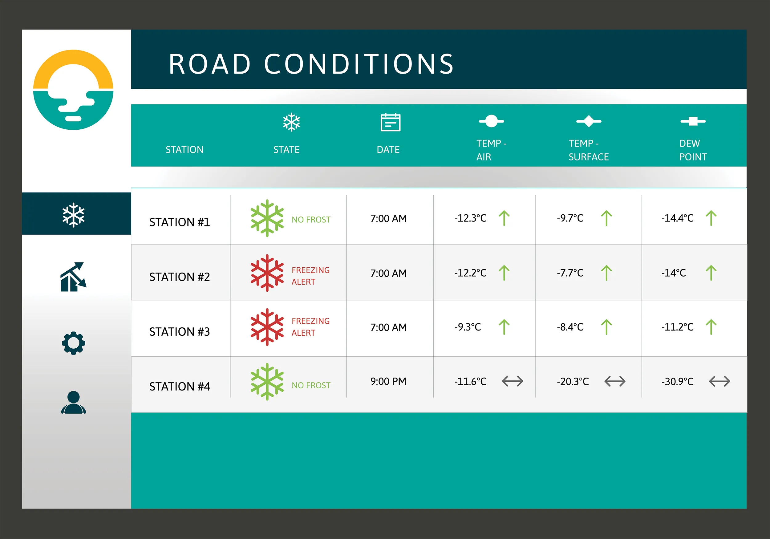
Campbell Scientific Canada has launched its WeatherBrain meteorological system for highways after a year of testing in the city of Magog, Canada. WeatherBrain is a software package that produces readable meteorological data for predicting road and weather conditions, allowing more efficient use of road crews.
February 9, 2018 Read time: 2 mins
Weatherbrain predictions can be more accurate than those from traditional weather stations, according to Campbell Scientific Canada
Campbell Scientific Canada has launched its WeatherBrain meteorological system for highways after a year of testing in the city of Magog, Canada


WeatherBrain is a software package that produces readable meteorological data for predicting road and weather conditions, allowing more efficient use of road crews.

Campbell Scientific said that WeatherBrain’s forecasting, analysis and decision support capabilities can save users time, money and effort on their winter road maintenance programmes.

For the year-long test in Magog, in the province of Quebec, Campbell Scientific covered the city’s 550km of roads with a myriad of weather stations. Individually, these stations act as traditional road weather information systems – RWIS – to monitor snow thickness both on and off roadways. They also collect data on air temperature and dew point.

The problem with traditional RWIS stations is that they collect meteorological data about current conditions via road surface and atmospheric sensors and a datalogger. The datalogger compiles information gathered from the sensors, then delivers the often-cryptic piles of data to the end-user for their analysis and interpretation.

WeatherBrain stations are different, according to Campbell Scientific, because they collate, analyse and present the data in much more detail and in a more easily understood format than traditional stations. Collectively, WeatherBrain’s stations make up a densified network of data points.

An inability to accurately interpret meteorological data remains can result in the over-use and misuse of road salts to prevent accidents.

Similar to traditional RWIS, WeatherBrain consists of a series of RWIS stations equipped with sensors to monitor snow thickness, air temperature, dew point and other facts. However, WeatherBrain has the capacity to pull in geo-relevant third party data, providing a more robust data set to allow for increased relevancy and accuracy.

Extensive algorithms take this geo-relevant data set and create nowcasts and forecasts for the next 12 hours. Based on these nowcasts and forecasts, the software produces actionable indicators that show the user when they’ll need to take action, effectively putting them ahead of impending weather events.

For example, based on the systems forecast, Campbell Scientific said that WeatherBrain can predict a black ice event will occur in 4 hours, so road maintenance operators can schedule their road crews to take proactive maintenance, eliminating the risk altogether.

Related Content

  • Bitumen additives raise environmental questions
    February 14, 2012
    New products, including additives, are coming onto the market to help reduce the cost of producing bitumen. Patrick smith reports. According to Eng. Paolo Visconti of Iterchimica, environmental issues and the health and safety of operators of manufacturing plants and workers laying bituminous mixes have raised long debates on the possible harmfulness of fumes which are emitted when heating these mixes at the temperatures (160-180°C) required for their production. "If, on the one hand, the effects on operato
  • Traffic management software tools
    March 5, 2012
    A joint development project between Delcan Corporation and Intelligent Devices Incorporated (IDI) has resulted in the sophisticated Intelligent NETworks product. This is an integrated product that combines the IDI Intelligent Control NTCIP system with the Delcan advanced transportation applications of NETworks. The system can be linked to dynamic message signs (DMS), CCTV and vehicle detector stations (VDS), traffic intersections, as well as environment road weather sensor stations.
  • Europe's smart road pricing project
    April 12, 2012
    New trials pave the way for smart road pricing using Global Navigation Satellite Systems (GNSS). In recent years, the concept of road charging has been gaining acceptability among Europe's policymakers.
  • Paving a Japanese airport within strict time constraints
    September 19, 2012
    In Japan, major efforts are being made to both conserve energy and materials, while also delivering high quality airport runways. At Haneda Airport, as well as at the Fukuoka, Chitose and Sendai airports, innovative use is being made of asphalt paving equipment from Sumitomo. The latest model HA60W J paver from Sumitomo is being used to lay warm mix asphalt, while the contractors is also using sophisticated control technology. To minimise disruption to flight schedules, construction work at Haneda has been