Campbell Scientific launches smarter weather station, Weatherbrain

Campbell Scientific Canada has launched its WeatherBrain meteorological system for highways after a year of testing in the city of Magog, Canada. WeatherBrain is a software package that produces readable meteorological data for predicting road and weather conditions, allowing more efficient use of road crews.
February 9, 2018 Read time: 2 mins
Weatherbrain predictions can be more accurate than those from traditional weather stations, according to Campbell Scientific Canada
Campbell Scientific Canada has launched its WeatherBrain meteorological system for highways after a year of testing in the city of Magog, Canada


WeatherBrain is a software package that produces readable meteorological data for predicting road and weather conditions, allowing more efficient use of road crews.

Campbell Scientific said that WeatherBrain’s forecasting, analysis and decision support capabilities can save users time, money and effort on their winter road maintenance programmes.

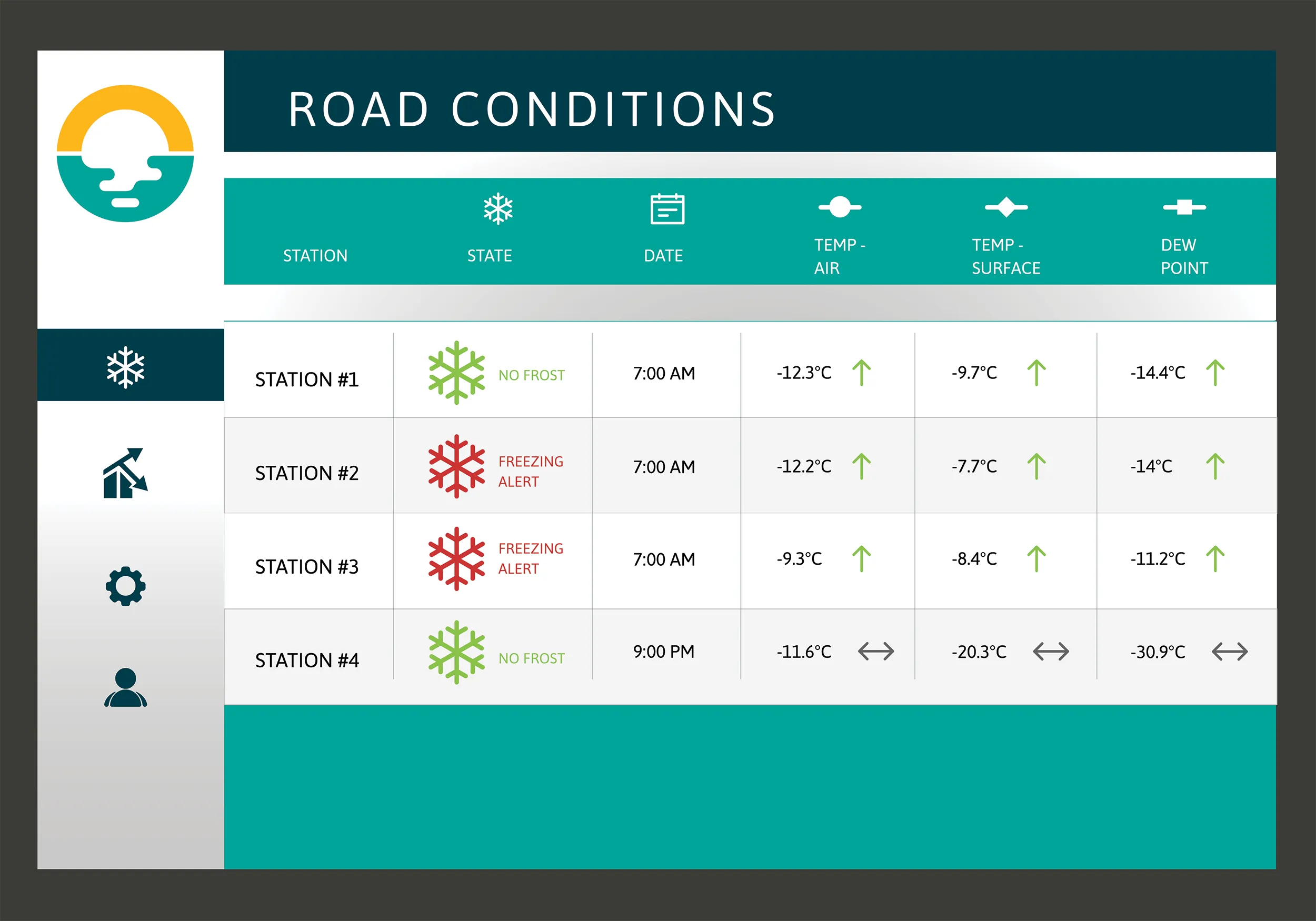
For the year-long test in Magog, in the province of Quebec, Campbell Scientific covered the city’s 550km of roads with a myriad of weather stations. Individually, these stations act as traditional road weather information systems – RWIS – to monitor snow thickness both on and off roadways. They also collect data on air temperature and dew point.

The problem with traditional RWIS stations is that they collect meteorological data about current conditions via road surface and atmospheric sensors and a datalogger. The datalogger compiles information gathered from the sensors, then delivers the often-cryptic piles of data to the end-user for their analysis and interpretation.

WeatherBrain stations are different, according to Campbell Scientific, because they collate, analyse and present the data in much more detail and in a more easily understood format than traditional stations. Collectively, WeatherBrain’s stations make up a densified network of data points.

An inability to accurately interpret meteorological data remains can result in the over-use and misuse of road salts to prevent accidents.

Similar to traditional RWIS, WeatherBrain consists of a series of RWIS stations equipped with sensors to monitor snow thickness, air temperature, dew point and other facts. However, WeatherBrain has the capacity to pull in geo-relevant third party data, providing a more robust data set to allow for increased relevancy and accuracy.

Extensive algorithms take this geo-relevant data set and create nowcasts and forecasts for the next 12 hours. Based on these nowcasts and forecasts, the software produces actionable indicators that show the user when they’ll need to take action, effectively putting them ahead of impending weather events.

For example, based on the systems forecast, Campbell Scientific said that WeatherBrain can predict a black ice event will occur in 4 hours, so road maintenance operators can schedule their road crews to take proactive maintenance, eliminating the risk altogether.

Related Content

  • Unganda investing in road maintenance and management
    October 8, 2014
    The Ugandan Government is working to improve the country’s infrastructure, with new links planned as well as a new project tackling asset management. Fugro is leading a team on a pioneering project to build a pavement and asset management system for the road network of Kampala in Uganda as part of this focus on infrastructure. The company is working with international asset management specialists from TRL and local Ugandan mapping and GIS specialist Aerophoto Systems Engineering on behalf of the client, Kam
  • An array of innovative software and GIS solutions will boost construction efficiency
    July 18, 2012
    New software and GIS innovations will help boost construction efficiency - Mike Woof reports Major software suppliers continue to develop their technology and offer new products to the market. Major developments from leading firms will help improve operations for contractors in many segments of the construction industry, from initial design and planning through to maintenance. Version 8 of the well-known ARCADY program for assessment of roundabout capacity is just released by UK transport research and soft
  • Tunnel vision with TrafiBot Dual AI camera
    September 24, 2024
    Flir’s TrafiBot Dual AI offers a fast thermal core, the most reliable 14-bit early fire detection for road tunnels and robust artificial intelligence for the highest detection performance.
  • Tunnel vision with TrafiBot camera
    November 26, 2024

    Flir has launched the closed circuit TrafiBot Dual AI multispectral camera system specifically to improve safety in tunnels and on bridges.

    Flir, part of Teledyne Technologies, noted that it is in tunnels and on bridge that where drivers are most at risk for hitting unseen objects or being trapped by fast-growing vehicle fires.