Campbell Scientific launches smarter weather station, Weatherbrain

Campbell Scientific Canada has launched its WeatherBrain meteorological system for highways after a year of testing in the city of Magog, Canada. WeatherBrain is a software package that produces readable meteorological data for predicting road and weather conditions, allowing more efficient use of road crews.
February 9, 2018 Read time: 2 mins
Weatherbrain predictions can be more accurate than those from traditional weather stations, according to Campbell Scientific Canada
Campbell Scientific Canada has launched its WeatherBrain meteorological system for highways after a year of testing in the city of Magog, Canada


WeatherBrain is a software package that produces readable meteorological data for predicting road and weather conditions, allowing more efficient use of road crews.

Campbell Scientific said that WeatherBrain’s forecasting, analysis and decision support capabilities can save users time, money and effort on their winter road maintenance programmes.

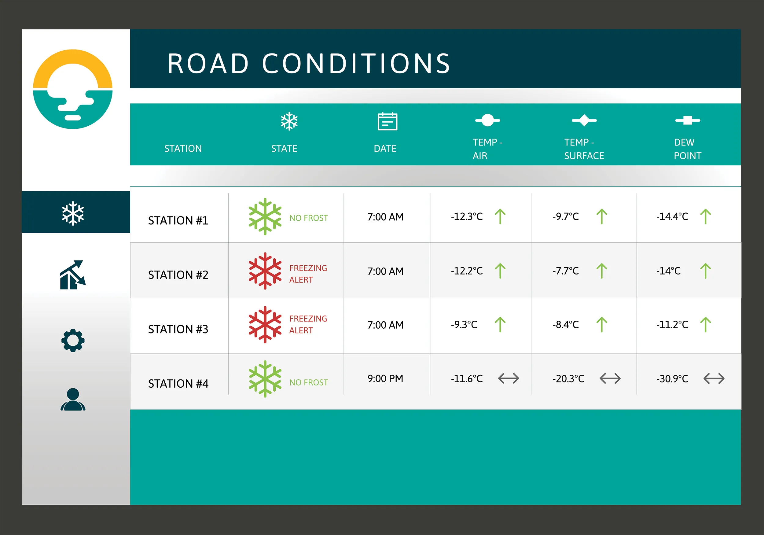
For the year-long test in Magog, in the province of Quebec, Campbell Scientific covered the city’s 550km of roads with a myriad of weather stations. Individually, these stations act as traditional road weather information systems – RWIS – to monitor snow thickness both on and off roadways. They also collect data on air temperature and dew point.

The problem with traditional RWIS stations is that they collect meteorological data about current conditions via road surface and atmospheric sensors and a datalogger. The datalogger compiles information gathered from the sensors, then delivers the often-cryptic piles of data to the end-user for their analysis and interpretation.

WeatherBrain stations are different, according to Campbell Scientific, because they collate, analyse and present the data in much more detail and in a more easily understood format than traditional stations. Collectively, WeatherBrain’s stations make up a densified network of data points.

An inability to accurately interpret meteorological data remains can result in the over-use and misuse of road salts to prevent accidents.

Similar to traditional RWIS, WeatherBrain consists of a series of RWIS stations equipped with sensors to monitor snow thickness, air temperature, dew point and other facts. However, WeatherBrain has the capacity to pull in geo-relevant third party data, providing a more robust data set to allow for increased relevancy and accuracy.

Extensive algorithms take this geo-relevant data set and create nowcasts and forecasts for the next 12 hours. Based on these nowcasts and forecasts, the software produces actionable indicators that show the user when they’ll need to take action, effectively putting them ahead of impending weather events.

For example, based on the systems forecast, Campbell Scientific said that WeatherBrain can predict a black ice event will occur in 4 hours, so road maintenance operators can schedule their road crews to take proactive maintenance, eliminating the risk altogether.

Related Content

  • EarthSense Systems releases air pollution map of the UK
    June 26, 2018
    EarthSense Systems has published MappAir, a high-resolution map of air pollution throughout the entire UK MappAir shows how air pollution - specifically nitrogen dioxide - changes across the country and within towns and cities, highlighting likely sources and potential clean-air refuge areas. It combines data from satellites and its EarthSense Systems’ own air quality monitoring sensors along with open source data. The result, using complex modelling, creates a highly accurate map at 100m resolution, says
  • Brine spraying can boost winter road safety and cut materials costs
    February 16, 2015
    A study on the use of a brine sprayer on the A8 Autobahn in Germany has yielded valuable data - *Jo Rommeswinkel writes. Since 2007, Autobahnplus Services (a+S) has been providing the operation and maintenance services on the 52km concession Autobahn A8 between Munich and Augsburg in Bavaria, a region renowned for its severe winter maintenance conditions. The Munich Augsburg section comprises 48km of six-lane dual carriageway and 4km of four-lane dual carriageway. Part of the road surface consists of low-no
  • Weigh-in-motion key to maximising road life
    February 24, 2012
    The market and technology for weigh-in-motion systems continues to evolve – Mike Woof writes. for both mature and developing highway infrastructure networks, traffic densities play an important role in determining road wear and life. Monitoring traffic volumes and individual vehicle weight is crucial for ensuring roads can cope in the long term and that maintenance can be planned, while the problem of overloading can be eliminated.
  • Golden Ice' demonstrates precision salt spreading in Prague
    March 15, 2012
    The EU-funded 'Golden Ice' project has demonstrated a new EGNOS-guided system for safer, more economical and more ecologically responsible salt distribution on winter roads.