Fotech picked up the 2021 Project of the Year award from FOSA – the Fiber Optic Sensing Association. FOSA is a non-profit organisation created in Washington DC in 2017 with the mission of educating industry, government and the public on the benefits of fibre-optic sensing.
The aim of the Air Quality Simulation Project, led by Staffordshire County Council, is to improve the air quality at the busy A52/A520 Cellarhead crossroads. The project required a comprehensive traffic simulation model using data obtained from fibre-optic sensing.
There will be a reduction of nitrogen oxide (NOx) and carbon dioxide (CO2) emissions thanks to a worldwide trend to move from petrol- and diesel-powered vehicles to electric vehicles. However, the arguably more serious particulate (PMx) emissions could increase with the growing uptake of electric vehicles which are typically heavier and cause more wear and tear to tyres and road surfaces. Keeping these vehicles moving smoothly without unnecessary braking will pay dividends for curbing these often-overlooked emissions.
With this in mind, the Air Quality Simulation Project was established to look at improving air quality through smart traffic management.
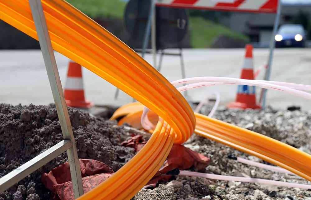
Fotech’s DAS technology was implemented on around 1km of standard telecommunications fibre in each direction from the Cellarhead crossroads. This was to detect, classify, locate and track vehicles travelling towards the junction. DAS technology essentially turns the fibre-optic cable network into thousands of vibration sensors that can detect vehicles over as distance of several kilometres.
The technology sends thousands of pulses of light along a cable every second and monitors the fine pattern of light reflected back. When acoustic or vibrational energy – such as that created by a passing vehicle – creates a strain on the optical fibre, this changes the reflected light pattern. By using advanced algorithms and processing techniques, DAS analyses these changes to identify and categorise the disturbance. Each type of disturbance has its own signature and the technology can tell an operator in real time what happened, exactly where it happened and when it happened.
Vital to creating the traffic simulation model were Fotech’s special machine learning to monitor vehicles with a very high degree of confidence. The technology easily distinguished between vehicle types such as cars, light- and heavy-duty vehicles and, by monitoring their movements, anticipated their arrival times at the crossroads.
In the next phase of the project, data from the traffic simulation model will feed into smart traffic control algorithms which can be used to schedule the lights in a way that allows deceleration and acceleration to be reduced. This will keep vehicles moving more freely - particularly the heavier polluters - and cut emissions caused by stop-start traffic.
One of the main benefits of DAS technology is its ability to provide real-time data. This data may be used to make real-time changes to traffic light phasing and improve traffic flow in the wider project. The success of this model has much wider implications, however, with DAS becoming central to calculating vehicle emissions, managing traffic flow and reducing congestion