According to Zehntner, the Swiss manufacturer of testing instruments, despite some initial costs, quality control quickly pays for itself, especially with budgets getting tighter. Its solutions include three models which can be used according to requirements. For example, its ZVR 6000 is primarily designed for the fast comparative assessment of the night visibility (RL) of road markings. However, says Zehntner, the ZVR 6000 can accomplish much more including the inspection of dry or wet road markings under
According to 1285 Zehntner, the Swiss manufacturer of testing instruments, despite some initial costs, quality control quickly pays for itself, especially with budgets getting tighter.
Its solutions include three models which can be used according to requirements. For example, its ZVR 6000 is primarily designed for the fast comparative assessment of the night visibility (RL) of road markings. However, says Zehntner, the ZVR 6000 can accomplish much more including the inspection of dry or wet road markings under real conditions, in the same geometry as the driver sees it and get a first-hand impression on the visual appearance, the distribution and embedding of glass beads.
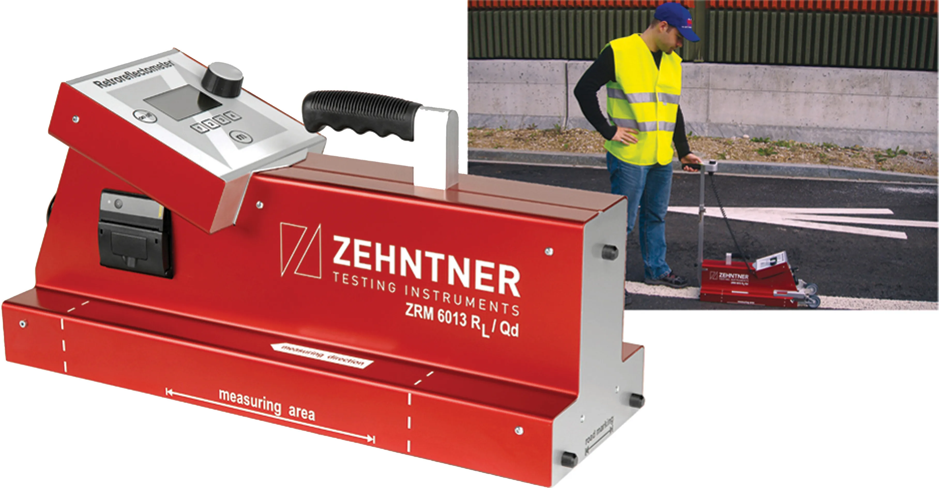
Zehntner's ZRM 6013 is a said to be "high precision measuring instrument for all applications" offering on-the-spot measurement of night and day visibility (RL and Qd) within seconds while gathering important ambient data like GPS coordinates, temperature and humidity. Data is downloadable to the computer for comprehensive documentation and reporting.
The company's ZDR 6020 offers a dynamic measuring system for the fast and precise recording of the RL and important ambient data of long distances or large areas.
The markings of complete road networks are measured at speeds up to 120km/hr and the data is displayed (for evaluation, a well-arranged Excel sheet or a graphic representation on digital maps provides an easy overview of the condition of the markings).
"We gave careful thought to user friendliness. Our customers expect compact, rugged instruments with state-of-the-art technology, says Peter Zehntner, owner and managing director.
Its solutions include three models which can be used according to requirements. For example, its ZVR 6000 is primarily designed for the fast comparative assessment of the night visibility (RL) of road markings. However, says Zehntner, the ZVR 6000 can accomplish much more including the inspection of dry or wet road markings under real conditions, in the same geometry as the driver sees it and get a first-hand impression on the visual appearance, the distribution and embedding of glass beads.
Zehntner's ZRM 6013 is a said to be "high precision measuring instrument for all applications" offering on-the-spot measurement of night and day visibility (RL and Qd) within seconds while gathering important ambient data like GPS coordinates, temperature and humidity. Data is downloadable to the computer for comprehensive documentation and reporting.
The company's ZDR 6020 offers a dynamic measuring system for the fast and precise recording of the RL and important ambient data of long distances or large areas.
The markings of complete road networks are measured at speeds up to 120km/hr and the data is displayed (for evaluation, a well-arranged Excel sheet or a graphic representation on digital maps provides an easy overview of the condition of the markings).
"We gave careful thought to user friendliness. Our customers expect compact, rugged instruments with state-of-the-art technology, says Peter Zehntner, owner and managing director.