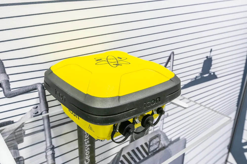
Versatile machine control package from Leica Geosystems

By Mike Woof April 25, 2024 Read time: 2 mins
Leica Geosystems is broadening its range of 3D solutions with its new iCON gps 120 antenna

Leica Geosystems is widening its array of 3D machine control solutions with the introduction of its Leica iCON gps 120. This smart antenna offers customers a versatile machine control solution.

The nw Leica iCON 120 Machine Smart Antenna is integrated into the existing Leica MC1 solution platform and extends the machine control solution to more applications and machine types. Construction machines such as compaction rollers, which usually require only lower levels of accuracy without heading, can now be equipped with a tailor-made Leica MC1 machine control solution. This allows streamlined operations and consistent workflows between heavy construction equipment that vary in application requirements. Using the Leica MC1 machine control solution allows operators to carry out jobs more quickly and accurately, boosting fleet efficiency and reducing waste.

Construction customers can start with a single GNSS solution using a satellite-based augmentation system (SBAS) or HxGN SmartNet PPP service. If they need higher specifications, they can upgrade to an RTK solution with low or high accuracy by adding the communication unit Leica CR50. With a second iCON gps 120 Machine Smart Antenna, customers get a full high-accuracy dual GNSS solution with heading. A key feature of the design is that the antennas can be switched easily between Leica MC1 prepared machines due to the simple quick disconnect system.

“This solution is more versatile than our previous solution. You can take it from one machine to another and it’s perfect for rental machines. It’s an addition to our range, not a replacement for an existing unit,” according to Tommi Kauppinen, vice president, Heavy Construction, Machine Control Field Solutions at Leica Geosystems.
 

For more information on companies in this article

Related Content

  • Sophisticated software solutions offering surveying innovation and construction efficiency
    August 28, 2014
    An array of new software tools will deliver greater efficiencies to construction companies – Mike Woof writes. Sophisticated software systems are delivering advanced solutions to traditional construction tasks. Key developments have been made by major players in the sector, such as Bentley Systems, Fugro Roadware, Leica Geosystems and Topcon Sokkia. From Bentley comes a new package that will help road construction activities in urban areas featuring a heavy concentration of underground utilities. This n
  • Leica Geosystems wins prestigious UK contract
    March 9, 2012
    After an 18 month competitive tendering process, Leica Geosystems has been awarded the contract to supply over two hundred survey grade Leica Viva GS15 GNSS receivers to Ordnance Survey, the national mapping agency for Great Britain.
  • Factory fitting
    August 30, 2023
    Leica Geosystems has established new agreements with key OEMs including LiuGong Dressta Machinery and Caterpillar. The agreement with LiuGong Dressta is for a new Leica Ready kit for factory fitting on the TD-15M and TD-16N dozers. According to Leica Geosystems, this will offer contractors the benefit of sophisticated tools for digitalisation. Using machine control technology helps to optimise costs and enables more efficient and sustainable operations, reducing the need for manual stakeouts, optimising fuel usage and minimising the amount of materials and transportation required.
  • Accurate positioning with Leica Geosystems
    June 19, 2017
    The new Zeno GG04 smart antenna from Leica Geosystems is said to increase access to GIS and boost tracking performance. This is said to deliver a versatile solution that can improve the accuracy of GNSS mobile devices with real-time Kinematic (RTK) and precise point positioning (PPP). Paired with the Zeno GG04, any Zeno or third party mobile device with Android or Windows OS can now collect precise positioning data with Leica Geosystems’ GNSS technology and 555-channel tracking performance. With PPP, users