Trimble’s new SitePulse System empowers field managers

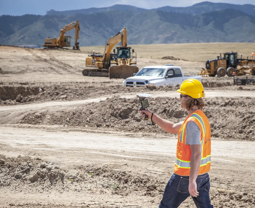
Trimble has launched what it claims is an affordable and easy-to-use site positioning System for superintendents, foremen and field engineers on heavy civil construction sites. Instead of using paper plans, the Trimble SitePulse System empowers field managers with the same 3D constructible model and digital information that is used by construction surveyors, grade checkers and machine operators. Trimble SitePulse field software is ideal for construction managers who do not have a surveying background. The
June 9, 2015 Read time: 2 mins
2122 Trimble has launched what it claims is an affordable and easy-to-use site positioning System for superintendents, foremen and field engineers on heavy civil construction sites.

Instead of using paper plans, the Trimble SitePulse System empowers field managers with the same 3D constructible model and digital information that is used by construction surveyors, grade checkers and machine operators.

Trimble SitePulse field software is ideal for construction managers who do not have a surveying background. The software runs on either the Trimble Site Tablet or any third-party Android tablet, giving contractors the flexibility to choose the hardware platform that best fits their needs and budget.

The new Trimble SPS585 GNSS Smart Antenna is a versatile receiver can be moved quickly from a truck to a range pole using a built-in magnetic mount. The SPS585 can access multi-constellation GNSS satellites and provides typical positioning accuracy of 10cm using Trimble RTX–based services, which stream GNSS corrections via satellite to the receiver without the need for a traditional base station.

The Trimble SitePulse System leverages Trimble Connected Site technology, including VRS networks, Internet Base Station Service (IBSS) and wireless data sync to provide efficient system configuration and streamlined workflows.

For more information on companies in this article

Related Content

  • High accuracy mapping without base stations
    June 15, 2020
    Highly accurate UAV mapping can now be achieved without the need for base stations. This development comes from Applanix, part of the Trimble Group.
  • Connected Tech for Construction Continuity
    December 11, 2020
    No one could have predicted the situation we found ourselves in in 2020, with a global pandemic bringing the economy to its knees, projects delayed overnight, rapid restarts, remote management, and challenging labor dynamics.
  • Topcon’s new survey solution
    October 27, 2016
    Topcon Positioning Group’s new surveying suite features four integrated solutions, comprising three hardware products and a single software system. The firm says that this package provides users with a powerful survey system. The Topcon Elite Survey Suite includes the new GT series of robotic total stations, HiPer HR hybrid GNSS receiver, FC-5000 field computer and MAGNET 4.0 software system. According to Topcon, users can benefit from advanced geo-positioning products and technology in one system.
  • Trimble announces key technology developments
    January 24, 2019
    Trimble is expanding its range of machine control technology options for users of graders and excavators with key new releases. One is for the LOADRITE Payload Management system, which can now be utilised on excavators already equipped with the Trimble Earthworks Grade Control Platform. The other systems are new versions of the Trimble Earthworks Grade Control Platform that can be used with graders or deliver automatic guidance for tiltrotators. These are key developments for the firm, boosting its ran