
Supergeo offers GIS training tool

Supergeo Technologies says that its latest packages offer effective training for both GIS users and non-GIS professionals, as well as new tools for sharing geospatial data. The training offering comes in the shape of free online courses with extensive learning materials. The firm says that it is a leader in the field with its state-of-the-art GIS technology and is able to assist personnel from various industries to address different tasks with spatial information. A comprehensive series of online course
April 27, 2015 Read time: 3 mins
New packages from Supergeo Technologies improve GIS data sharing and training
8077 Supergeo Technologies says that its latest packages offer effective training for both GIS users and non-GIS professionals, as well as new tools for sharing geospatial data. The training offering comes in the shape of free online courses with extensive learning materials.

The firm says that it is a leader in the field with its state-of-the-art GIS technology and is able to assist personnel from various industries to address different tasks with spatial information. A comprehensive series of online courses, based on SuperGIS as operating practices, is available to support users to fully understand the basic concepts of GIS and GIS software manipulation.

The SuperGIS Online Courses are said to be easy to understand and suitable for beginners. These allow users to comprehend the operation on different platforms with real case scenarios. In addition to complete course slides and operating video, the courses also come with practical exercises and quizzes. Users can examine learning outcomes and internalise this to advance future career development.

The courses include: desktop GIS and analyst extensions, SuperGIS toolkit, satellite image processing; server GIS and map service publishing, customisation by JavaScript, mobile application SDK; mobile GIS: GIS data collection on Windows, iOS and Android devices, GPS track record, AR and guiding point.

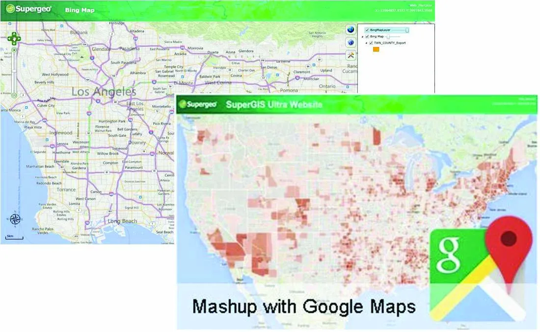
Meanwhile the powerful GIS Web Manager in SuperGIS Server 3.2 is designed to help enterprises share diverse geospatial data. The latest SuperGIS Server 3.2 is optimised for use by developers, administrators, and front-side users. For administrators the built-in SuperGIS Server Manager provides a new interface to manage all the built applications. Administrators can better manage SuperGIS Server on the fly. Also, the new interface of SuperGIS Server Manager enables users to overlay maps with online maps like OpenStreetMap and Bing Maps with ease, making GIS data sharing and website establishing much easier and faster.

For developers the new APIs and samples have been added on Supergeo Developer Network (SGDN), to help developers be equipped with better gears to make high-quality and customised maps. The latest API references and Help can be found in the installation package of SuperGIS Server.

And for client users, all web applications have an optimal Table of Content, allowing better control of the layers. Meanwhile a new print tool means that users can easily print the map whenever required.

For more information on companies in this article

Related Content

  • Yotta develops new tools for sophisticated GIS package
    April 25, 2013
    Highway technology and services company Yotta DCL has announced new features for Horizons. The web-based platform integrates GIS, pavement and asset management for highways authorities and agencies to use in a visualised asset management system. The new version 2.3 adds features and functionality across three modules: Explorer, Analysis and Management. Explorer allows users to view, load and visualise a range of datasets, including base network data, their condition in fine detail, plus relevant asset or co
  • Efficient stockpile and site monitoring
    October 23, 2017
    Effective monitoring of aggregates stockpiles as well as face excavation can deliver greater quarrying efficiency. One of the latest innovations in quarrying is the use of drones, which provide major benefits for optimising operations. The use of affordable drone hardware and software solutions can help reduce stockpile inventory time by as much as 70%. Through the recent partnership between Trimble and Propeller, drone data can now be an everyday tool in quarries by proving a transformational impact
  • Rapid adoption of GPS machine control
    April 5, 2012
    The high sophistication of GPS machine control systems has resulted in a fast pace of technological advancement. The three major players in the machine control sector, Leica Geosystems, Topcon and Trimble have all made major gains in recent years. The sophistication of the latest systems can combine satellite position data from the GPS and GLONASS networks with information from total stations to provide precise, high speed machine operation. Further more the firms have also prepared themselves for the intro
  • Topcon to smoothen roads with SmoothRide system
    February 28, 2018
    Topcon Positioning has developed a sophisticated package that can help deliver better road surface quality. The firm’s latest SmoothRide data collection package is said to make the mapping of road conditions easier and more efficient. The new RD-M1 Collect 2.0 package has an improved interface and a new graphical interface status bar that indicates the optimum speed for collecting road information based on the project requirements.