Spot on with Trimble’s X7 3D scanner

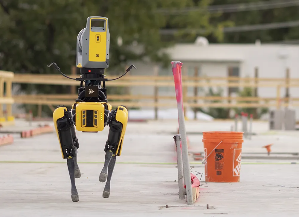
The X7 solution was jointly developed by Trimble and Boston Dynamics.
By Mike Woof November 25, 2021 Read time: 2 mins
Autonomous surveying and scanning is possible using the new package from Trimble

Remote surveying and scanning can be achieved using the autonomous robotic system available from Trimble. The package combines the Spot robot autonomous rover unit with the Trimble X7 3D laser scanner and Trimble FieldLink software.

This solution has been jointly developed between Trimble and Boston Dynamics and allows autonomous operation on construction sites. The system takes advantage of the robot's ability to navigate challenging, dynamic and potentially unsafe environments. Trimble's 3D data capture technology can deliver a continuous flow of information between the field and the office for documentation of jobsite progress.

The innovative package allows users to make important decisions, rather than waiting for the information to be relayed to project staff. The integration is focused on the automated capture of field construction data through the use of Trimble 3D capture technology and the Spot robot. The autonomous workflow for the X7 laser scanner uses fully integrated Spot robot controls in FieldLink software to create a predefined path of waypoints for Spot to follow and collect laser scans.

Laser scans collected using the X7 scanner and the Spot robot can be tied to a jobsite project coordinate system, as well as individual scan stations. The data is collected, and then made into a composite point cloud in real-time on the Trimble tablet controller before leaving the site. While performing autonomous operations, Spot's docking station enables in-field charging of batteries on both the robot and the X7 3D laser scanner, and also provides the continuous transfer of data through a Gigabit Ethernet connection to the office.

For more information on companies in this article

Related Content

  • MOBA temperature scanner enhances road quality
    January 6, 2017
    From mixing plant to compaction, the temperature of asphalt is critical. Cold asphalt can lead to road damages, which result in additional costs of up to 46% due a shorter lifetime of the road. With optimum composition of both asphalt material and process flow being priorities in the road construction process, the new MOBA PAVE-IR temperature scanner system enhances both.
  • MOBA temperature scanner enhances road quality
    April 15, 2013
    From mixing plant to compaction, the temperature of asphalt is critical. Cold asphalt can lead to road damages, which result in additional costs of up to 46% due a shorter lifetime of the road. With optimum composition of both asphalt material and process flow being priorities in the road construction process, the new MOBA PAVE-IR temperature scanner system enhances both.
  • IRF World Congress 2024: Christian U. Haas of Umovity interview ahead of the Congress
    October 1, 2024
    With its combination of software, hardware and services, Umovity accelerates end-to-end traffic planning and management globally. Christian U. Haas, chief executive of Umovity, recently spoke to the IRF ahead of the IRF World Congress to be held this month in Istanbul, on the challenges and opportunities facing the mobility sector.
  • Software alliance improves productivity
    June 12, 2012
    In the fast moving world of construction software, major innovations are happening on a continuous basis. All the leading players are making notable contributions to the sector. A new strategic alliance just announced between the management and data handling software giant Pitney Bowes, and design and construction software producer Autodesk, will help create an end to end range of products and tools for rapidly evolving BIM strategies in the industry. In particular in should help develop an integrated suite