Sophisticated surveying tool from Topcon

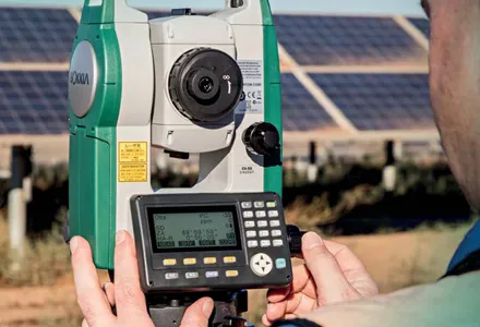
Topcon Postioning is now offering a sophisticated surveying tool in the shape of an auto-collimating total station for surveying professionals looking for a motorised solution. The firm says that this rugged waterproof total station benefits from the latest TSshield technology for advanced security and maintenance. The system can also be upgraded to Autotracking when the customer is ready to advance further to robotic applications. The GT-503M can be used for Tunnel Guidance and Periodic Monitoring applicat
September 4, 2019 Read time: 2 mins
342 Topcon Postioning is now offering a sophisticated surveying tool in the shape of an auto-collimating total station for surveying professionals looking for a motorised solution. The firm says that this rugged waterproof total station benefits from the latest TSshield technology for advanced security and maintenance. The system can also be upgraded to Autotracking when the customer is ready to advance further to robotic applications. The GT-503M can be used for Tunnel Guidance and Periodic Monitoring applications.


Key features include direct drive motors capable of turning 85°, in a small and lightweight package that is auto-collimating. This also features the LongLink Communications system with a range of 300m, advanced angle accuracy and the TSshield advanced security and maintenance package. The system offers an 800m non-prism range and a 4,500m prism range, as well as a laser pointer and sunlight readable display.

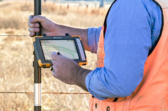
The new dual SIM module allows the customer to insert their own data SIM card in the GT-503M total station to communicate directly to MAGNET Enterprise. The telematics card installed can communicate to the TSshield servers, which can then review if the total station has any existing error codes, the version of the firmware that is installed, as well as the total station geographical location. From this information, a message can be sent to the total station and advise the operator if further action is available or necessary. The new dual SIM module allows the customer to insert their own data SIM card in the GT-503M total station for real-time site communications.

The GT-503M can find a prism and lock within the field of view simplifying the steps for the operator to find the prism. There is no need to focus the GT-503M to find the prism.

For more information on companies in this article

Related Content

  • Sokkia’s sophisticated survey system
    May 25, 2016
    Sokkia is now adding two new editions to its CX total station series, both featuring enhanced reflectorless operation. The new CX-50 is designed to provide an entry-level option with a fast and powerful EDM. The CX-100LN is built to offer a long-range reflectorless EDM. The CX-50 is said to be easy to use and highly accurate, offering reflectorless electronic distance measurement (EDM) of up to 350m, and EDM of 4,000m with the use of a prism. The firm says that in addition, the CX-100LN features a 2,000m
  • Topcon’s advanced software for construction
    December 12, 2018
    Topcon Positioning is introducing the latest version of its MAGNET 5 software. This new version includes upgrades to the MAGNET Field, Office and Enterprise applications designed for advanced performance, third-party integration, and construction planning and oversight capability. The package offers new flexible display options and additional customisable data labels. Additionally, operators can view GNSS status when the controller is connected to a total station in Hybrid mode, and show offsets as a visua
  • Positioning tools continue to improve
    July 16, 2012
    Topcon says that its new IP-S2 package combines GNNS positioning capabilities with inertial sensors, while the firm also has a solution for customers wanting to mix and match receiver components. The IP-S2 is a vehicle-mounted, mobile 3D tool that offers precision mapping and surveying capabilities. The package collects data using 3D laser scanners, LIDAR, and/or cameras, and this is then integrated, time-stamped and geo-referenced. The customer can use this assembled data to combine LIDAR point cloud and d
  • Efficient surveying
    February 10, 2012
    According to Spectra Precision, its latest outdoor data collectors can optimise surveying operations. The sophisticated Ranger 3 data collector series and the Nomad 900 series are designed to operate with Spectra Precision Survey Pro field software and offer advanced surveying capabilities. Spectra Precision now offers three Ranger 3 models, the 3L, 3XC and 3RC. These data collectors come standard with an 800MHz processor, 256MB of memory, a full VGA display, integrated Bluetooth, GPS, compass and 802.11 Wi