Sophisticated geopositioning tool from Topcon

Topcon says that its new T-18 handheld controller offers accuracy for geopositioning, construction, mapping and vertical construction applications. The controller includes a sunlight-readable display with a 1GHz processor, 1GB of internal storage, and up to 10 hours of battery life. “For MAGNET Field data collection, the T-18 controller offers a durable ergonomic solution with faster processing, a larger screen, better connectivity and longer battery life than previously available comparable systems,” said
October 9, 2018 Read time: 2 mins
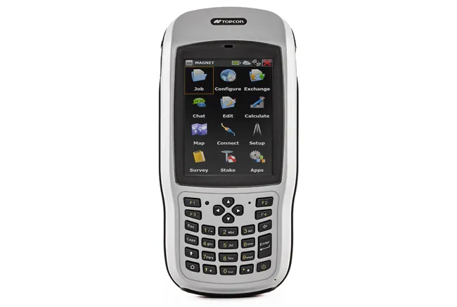
Topcon’s new T-18 unit offers advanced geopositioning capabilities
342 Topcon says that its new T-18 handheld controller offers accuracy for geopositioning, construction, mapping and vertical construction applications.  The controller includes a sunlight-readable display with a 1GHz processor, 1GB of internal storage, and up to 10 hours of battery life. “For MAGNET Field data collection, the T-18 controller offers a durable ergonomic solution with faster processing, a larger screen, better connectivity and longer battery life than previously available comparable systems,” said Ray Kerwin, director of global surveying products.


The T-18 features a 3.5G cellular modem for connectivity with Topcon MAGNET solutions for sending and receiving data to the cloud company account.  The firm says that the cellular option makes it easier to communicate with field crews when projects need to be changed or if important data is required back in the office. The modem can be used for RTK correction services. Additional key features include standard Bluetooth and Wi-Fi connectivity, as well as an IP65 rating for dust and water protection in demanding job site conditions.

For more information on companies in this article

Related Content

  • Topcon’s new Enterprise Solutions workflow management system controls all jobs
    March 7, 2014
    Topcon Positioning Group has released a new workflow management system designed to connect all of a contractor’s sites, data, crews and equipment. Unveiled at Conexpo 2014 this week, Topcon Enterprise Solutions offers constant communication, data sharing, scheduling, updating, support activities and accurate productivity data in real-time, no matter where the job or office is located.
  • Topcon’s advanced software for construction
    December 12, 2018
    Topcon Positioning is introducing the latest version of its MAGNET 5 software. This new version includes upgrades to the MAGNET Field, Office and Enterprise applications designed for advanced performance, third-party integration, and construction planning and oversight capability. The package offers new flexible display options and additional customisable data labels. Additionally, operators can view GNSS status when the controller is connected to a total station in Hybrid mode, and show offsets as a visua
  • New NetRover range from Leica
    February 7, 2012
    Leica Geosystems is expanding its Viva GNSS range with the addition of the new NetRover package. This comprises the GS08 receiver, a sophisticated RTK network rover and the new Leica Viva CS10 3.5G field controller. The field controller has a fully integrated high-speed 3.5G modem to connect to RTK reference networks and allow mobile broadband internet connectivity for field-to-office data transfer. In addition to 3.5G, the new field controller can also include Bluetooth, WiFi and TPS radio for further conn
  • On-site computing power
    August 2, 2012
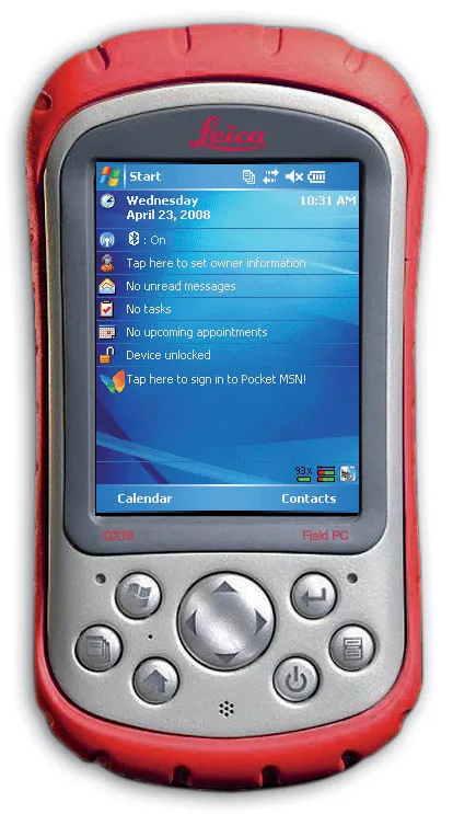
    Leica Geosystems is expanding its range with the launch of its Leica DX10 Field Controller. This robust site PDA is designed specifically for use in the tough construction environment, is compact, versatile and powerful. The Leica DX10 delivers high performance and reliability and can cope with vibration, shock and temperature extremes. It features an ergonomically shaped case and weighs just 482grammes. Features include Bluetooth capabilities, a high contrast colour display, a 520MHz Intel Xscale processor