Sophisticated base station receiver

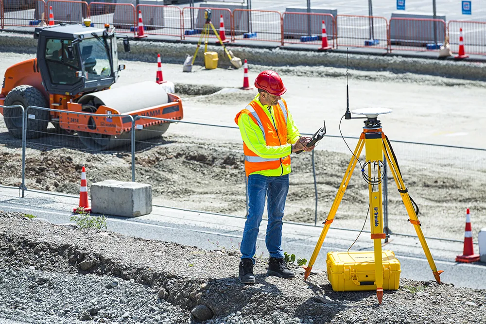
Trimble has introduced the R750 GNSS Modular Receiver, a connected base station for use in civil construction and geospatial applications. The R750 is said to provide improved base station performance, giving contractors and surveyors more reliable and precise positioning in the field.
March 1, 2022 Read time: 2 mins
Trimble is now offering a sophisticated new base station receiver system

The R750 can be used to broadcast Real-Time Kinematic (RTK) corrections for a wide range of applications, including seismic surveying, monitoring and civil construction. Access to available satellite signals is said to provide improved performance and reliability when used with a Trimble ProPoint Global Navigation Satellite System (GNSS) rover. ProPoint can boost performance in challenging GNSS conditions, with groundbreaking signal management.

Featuring a built-in LTE modem, the R750 offers corrections via the internet, making it easier to extend the range of a base station with cellular coverage. The built-in modem also provides remote access and management, delivery of email alerts and notifications, and data transfer capabilities between the field and the office.

The R750 is said to deliver better satellite tracking and connectivity. It offers the ability to manage a base station remotely and receive status notifications about the unit while in the office. This reduces downtime and the need to travel to the site.

For monitoring applications, the R750 provides precision capabilities for construction and geospatial customers deploying automated systems. Combined with Trimble 4D Control real-time monitoring software, users can capture high-frequency 3D positions for alarming and reporting on movement. The R750 offers multiple communication methods that provide flexibility for customers on how they deploy their monitoring system.

For more information on companies in this article

Related Content

  • Remote surveying and scanning
    January 18, 2022
    Remote surveying and scanning can be achieved using the autonomous robotic system available from Trimble. The package combines the Spot robot autonomous rover unit with the Trimble X7 3D laser scanner and Trimble FieldLink software.
  • In control, with advanced technology
    August 15, 2019
    Machine control technology continues to advance, with new systems offering contractors major gains in working efficiency The latest developments in machine control technology once again push the bar in terms of advancements. The latest systems allow contractors to work even more effectively and efficiently than before. Doosan has unveiled one of the first uses globally of 5G technology to remotely control construction and quarrying machines. The firm has coined the term ‘TeleOperation’ to describe the
  • Laser scanning focuses on asset management
    January 9, 2015
    Laser scanners and improved data collection and analysis software are making light of asset management surveying. David Arminas reports The age of the laser scanner is upon us, taking over from traditional manual methods of surveying, data collection and processing. These new technical developments are making it much easier to process and use the data captured and are providing highways engineers with powerful tools to record, map and visualise their assets. This is good news for highways authorities
  • Cat’s wider range
    May 20, 2019
    Caterpillar is offering new machine control packages for use with dozers Caterpillar is widening its range of solutions for dozers with the introduction of the GRADE with 3D system for its D3K2, D4K2 and D5K2 models. This package is an automated grade control system using GNSS technology to position the machine's blade, without operator input, from first rough cut to finish grade. In addition, GRADE with 3D incorporates the Cat AccuGrade Ready Option. This system allows the use of universal-total-stati