Sokkia’s accurate surveying tool

Sokkia has widened its iM line of manual total stations with the introduction of the iM-50. The firm says that the tool can be used for jobs such as site layout or as-built survey and claims that the unit delivers high-end performance and functionality. The iM-50 EDM features a prism range of up to 4,000m and up to 500m in reflectorless mode with a 1.5 mm/ 2ppm accuracy. The company claims that the beam can measure walls, corners, manholes on the road surface, even chain-link fences and tree branches
April 24, 2019 Read time: 1 min
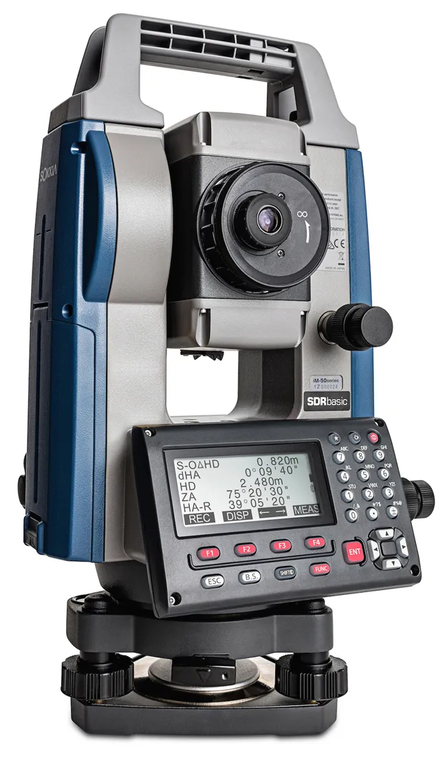
High surveying accuracy is claimed for Sokkia’s iM-50
1090 Sokkia has widened its iM line of manual total stations with the introduction of the iM-50.


The firm says that the tool can be used for jobs such as site layout or as-built survey and claims that the unit delivers high-end performance and functionality. The iM-50 EDM features a prism range of up to 4,000m and up to 500m in reflectorless mode with a 1.5 mm/

2ppm accuracy. The company claims that the beam can measure walls, corners, manholes on the road surface, even chain-link fences and tree branches. The instrument offers integrated Bluetooth technology for connectivity with the controller.

Additional features include 50,000 points of internal memory, or up to 32GB USB flash drive external support, SDRbasic onboard software, and IP66 certification for operation in tough jobsite conditions.

For more information on companies in this article

Related Content

  • Developments in site survey solutions
    February 9, 2012
    Trimble is widening its portfolio of Connected Site survey solutions for the field and office. These upgraded tools allow surveyors to collect, share and deliver data faster to improve accuracy, efficiency and productivity.
  • Sophisticated software solutions offering surveying innovation and construction efficiency
    August 28, 2014
    An array of new software tools will deliver greater efficiencies to construction companies – Mike Woof writes. Sophisticated software systems are delivering advanced solutions to traditional construction tasks. Key developments have been made by major players in the sector, such as Bentley Systems, Fugro Roadware, Leica Geosystems and Topcon Sokkia. From Bentley comes a new package that will help road construction activities in urban areas featuring a heavy concentration of underground utilities. This n
  • Real time site monitoring technology
    July 19, 2012
    Leica Geosystems is broadening its site monitoring technology with the introduction of the GeoMoS package. This can be linked to the firm's existing GNSS Spider software to offer an array of TPS and GNSS monitoring tools. Combined, these tools provide a web-based service for visualisation and analysis of monitoring. Authorised users can access a monitoring project using a web browser, pocket PC or mobile phone. Using the GeoMoS Web service, graphs and views can be customised and be tailored to the needs of
  • ScanStation C10: sophisticated
    March 1, 2012
    High-speed, versatile laser scanning can now be achieved using the latest technology from Leica Geosystems. The firm's sophisticated ScanStation C10 package features a new high-definition surveying (HDS) scanner that is said to increase surveying productivity and accuracy for both routine surveys and large, complex projects.