Real time site monitoring technology

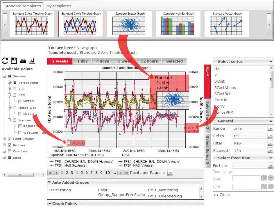
Leica Geosystems is broadening its site monitoring technology with the introduction of the GeoMoS package. This can be linked to the firm's existing GNSS Spider software to offer an array of TPS and GNSS monitoring tools. Combined, these tools provide a web-based service for visualisation and analysis of monitoring. Authorised users can access a monitoring project using a web browser, pocket PC or mobile phone. Using the GeoMoS Web service, graphs and views can be customised and be tailored to the needs of
July 19, 2012 Read time: 2 mins
265 Leica Geosystems is broadening its site monitoring technology with the introduction of the GeoMoS package. This can be linked to the firm's existing GNSS Spider software to offer an array of TPS and GNSS monitoring tools. Combined, these tools provide a web-based service for visualisation and analysis of monitoring. Authorised users can access a monitoring project using a web browser, pocket PC or mobile phone. Using the GeoMoS Web service, graphs and views can be customised and be tailored to the needs of each project. Multiple monitoring projects or sites can be included in GeoMoS Web, allowing authorised personnel to view sensitive data. Configuration tools bring the data to the web and interactive graphics allow an overview of the monitoring data, providing warnings when a project exceeds specified tolerances.

Meanwhile, improved surveying capabilities are claimed for the latest Total Stations product from Leica Geosystems. The new Leica FlexLine units are modular in design and hardware and software options can be selected to meets customer requirements. Purchasers can opt for pre-configured products or add specific hardware and software options to a base model and there are three pre-configured instruments within the FlexLine range. The Leica FlexLine TS02 is designed for standard measurement tasks, with a set of application software, a Bluetooth option, USB option and alpha-numeric keyboard option. The Leica FlexLine TS06 is versatile and comes with an alpha-numerical keyboard and a complete set of application software as standard while options include Bluetooth technology and a USB connection. The Leica FlexLine TS09 Total Station includes all FlexLine features from removable USB memory, Bluetooth technology, Emitting Guide Light and application software. Customers can also choose from a wide selection of additional hardware and software features.

For more information on companies in this article

Related Content

  • Leica Geosystems introduces smart monitoring of structures
    October 1, 2014
    Highly sophisticated, the Leica GeoMoS Now! From Leica Geosystems is a new web-based application enables on-the-go visualisation and analysis of structural and ground movement monitoring data. With this package, large quantities of geodetic and geotechnical data are said to be easier to handle with simplified workflows using automatic configuration and distribution tools. The package can quickly notify users of any changes in data for faster, more informed responses. Leica GeoMoS Now! allows users t
  • Leica Geosystems develops machine control
    November 29, 2012
    An array of sophisticated machine control and surveying tools are coming to market from Leica Geosystems. One of the key developments is an addition to its iCON range in the form of its iCONtrol package. The firm says that this offers contractors a portfolio of powerful machine control solutions that can communicate with iCONstruct sensors on site and the iCON office software. This customisable and versatile solution suits use in grading and excavating segment and can be used as a control system for constru
  • Latest GIS and software tools improve operations
    February 24, 2012
    Innovative GIS and software solutions are coming to market from the three key market players - Mike Woof reports Competition is strong in the field for GIS and surveying systems as well as the associated software. The three major players in the sector, Leica Geosystems, Topcon and Trimble, all invest heavily in research and development and continue to roll out new solutions for construction customers that will boost the efficiency of surveying as well as overall project implementation.
  • Sophisticated plotting
    February 7, 2012
    Leica Geosystems is offering its improved SpiderWeb v4.0 package as part of the new reference station software update. This improved suite of solutions also includes the GNSS Spider v4.0 and SpiderQC v4.0 packages.