Precision pinpointing

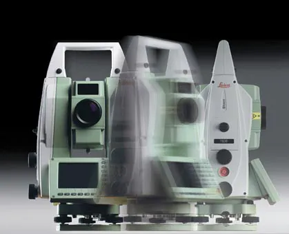
Leica Geosystems says that its TS30 package is a new high precision Total Station that meets highest standards in all surveying applications. Distances can now be measured with Leica Geosystems' proven PinPoint EDM Technology with an unprecedented precision of 0.6mm + 1ppm on prisms. On natural surfaces a high accuracy of 2mm + 2ppm up to 1,000m can be achieved.
March 1, 2012 Read time: 2 mins
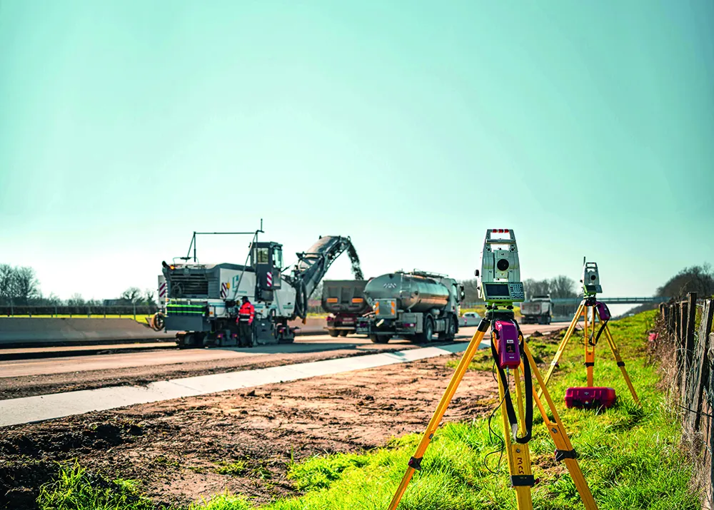
Precise positioning is possible with the new TS30 package from Leica Geosystems
265 Leica Geosystems says that its TS30 package is a new high precision Total Station that meets highest standards in all surveying applications. Distances can now be measured with Leica Geosystems' proven PinPoint EDM Technology with an unprecedented precision of 0.6mm + 1ppm on prisms. On natural surfaces a high accuracy of 2mm + 2ppm up to 1,000m can be achieved.

New direct drives using piezo technology were developed for the Leica TS30, allowing high tracking performance, with maximum acceleration and speed while maintaining accuracy under demanding conditions. This new technology allows automated one-person surveying and higher productivity.

Combined with the firm's Leica SmartWorx software, users can set the package up as a Leica TS30 SmartStation with the latest future proof GNSS antenna to provide immediate station coordinates. With the GNSS antenna on top of the 360° prism as a SmartPole, quick and accurate set-up can be achieved on-the-fly.

Features of the TS30 include long service intervals and low power consumption as well as a durable construction to withstand severe environments. The piezo drives allow for longer operation through low power consumption with sophisticated power management.

For more information on companies in this article

Related Content

  • Precision measurements
    February 7, 2012
    Nikon-Trimble is now offering the new Nikon 25mm and 127mm Total Stations, which are said to deliver improved accuracy over previous products.
  • Positioning tools continue to improve
    July 16, 2012
    Topcon says that its new IP-S2 package combines GNNS positioning capabilities with inertial sensors, while the firm also has a solution for customers wanting to mix and match receiver components. The IP-S2 is a vehicle-mounted, mobile 3D tool that offers precision mapping and surveying capabilities. The package collects data using 3D laser scanners, LIDAR, and/or cameras, and this is then integrated, time-stamped and geo-referenced. The customer can use this assembled data to combine LIDAR point cloud and d
  • Sophisticated software solutions offering surveying innovation and construction efficiency
    August 28, 2014
    An array of new software tools will deliver greater efficiencies to construction companies – Mike Woof writes. Sophisticated software systems are delivering advanced solutions to traditional construction tasks. Key developments have been made by major players in the sector, such as Bentley Systems, Fugro Roadware, Leica Geosystems and Topcon Sokkia. From Bentley comes a new package that will help road construction activities in urban areas featuring a heavy concentration of underground utilities. This n
  • French fine milling achieved
    January 10, 2025
    Contractor 2AGE-MCS achieved precision and speed in milling the Route Centre-Europe Atlantique in France with the use of 3D technology