New project software developed by Bentley

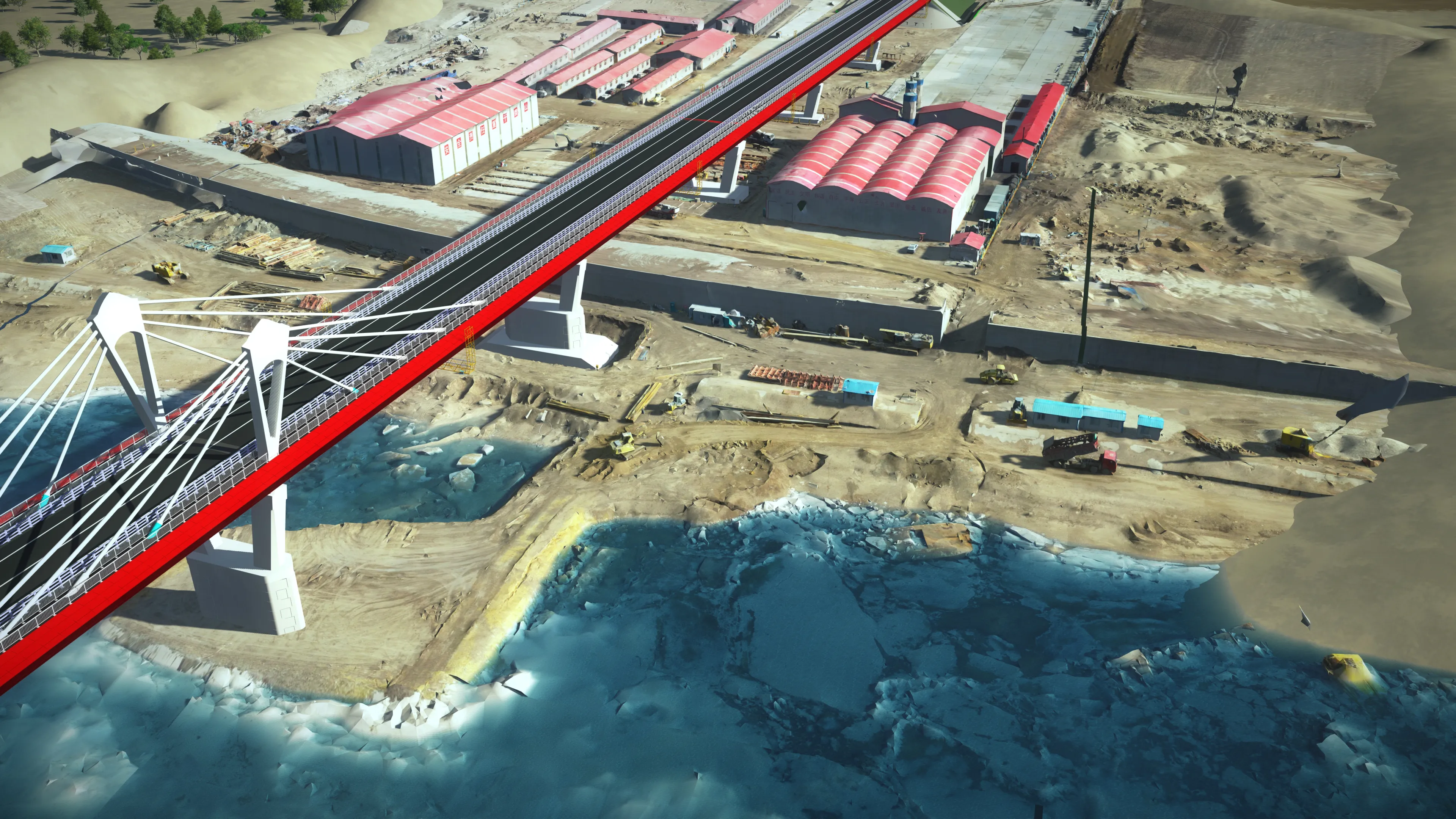
Bentley Systems claims that its OpenRoads ConceptStation modelling package allows highway engineering professionals to quickly build conceptual road and bridge models. The software allows rapid conceptual and preliminary design, using information obtained through point clouds, reality meshes, GIS, and other sources. OpenRoads ConceptStation combines engineering drawing tools and project costs to improve decision-making in the design phase. Benefits include increasing design productivity, identifying
February 8, 2018 Read time: 2 mins

4019 Bentley Systems claims that its OpenRoads ConceptStation modelling package allows highway engineering professionals to quickly build conceptual road and bridge models. The software allows rapid conceptual and preliminary design, using information obtained through point clouds, reality meshes, GIS, and other sources.

OpenRoads ConceptStation combines engineering drawing tools and project costs to improve decision-making in the design phase. Benefits include increasing design productivity, identifying potential high-risk items, and minimising development costs. Once the optimal design is identified, the user can upload the model to OpenRoads and OpenBridge to streamline highway and bridge design. OpenRoads ConceptStation models can be brought forward for detailed design work into OpenRoads Designer, ensuring that both the work and the data already generated is used as the project moves from concept through construction.

The package allows GeoCoordination services to find, download, import, and georeference contextual information to support 3D design modeling workflows, including point clouds, 3D reality meshes, terrain data, images, and GIS information. Engineering sketching tools can be used to create 3D models rapidly, and to design roads, bridges, ramps, guardrails, retaining walls, and other infrastructure designs. It offers automated generation of costs for the design, allowing engineers and planners to identify high-cost items or potential risks in the project, extract quantities, and analyse project costs. Integration of Bentley’s LumenRT visualisation and reality modelling software means that the user can produce real-time, realistic scenes without the need for intensive and lengthy pre-rendering. And the integration of PTV VISSIM also allows users to incorporate traffic analysis and planning for OpenRoads conceptual or detailed design.

Related Content

  • Bridge of international accord from Russia-China
    May 29, 2018
    A new bridge project joining China and Russia is a sign of international accord between the two nations – Mike Woof writes A new bridge spanning what China calls the Heilongjiang River and which is known as the Amur River in Russia, is a clear sign of an important international accord between the two countries. Discussions over the bridge project were first started between China and Russia in the 1980s, with both nations seeing many changes in leadership since that time. But while the political discussion
  • Leica Geosystems’ tools for site monitoring and handling GPR data
    October 11, 2017
    Leica Geosystems is offering new tools for construction firms for remote monitoring and for handling data from ground penetrating radar. With the GeoMoS Imaging package, users can stay up-to-date on remote monitoring; the live view allows observation and recording of areas of interest. A joystick provides remote access to the total station so that personnel can increase productivity and reduce time in the field.
  • Innovative GIS advances from Bluesky
    July 18, 2012
    Aerial survey specialist Bluesky is funding research into the development and use of a new system to map the UK’s cities and towns at night. Bluesky has teamed up with the University of Leicester to look at solutions using new high sensitivity camera sensor technology. Mounted on survey aircraft, the new system can record the location of street lights, illuminated road signs and other night-time sources of light. This can deliver an accurate resource for asset inventories, light pollution assessment and ene
  • Leica Cyclone teams up with NCTech’s iSTAR camera database
    January 19, 2016
    Users of Leica Cyclone, a 3D point cloud processing software, can now automatically import and align high-dynamic range (HDR) data from NCTech’s iSTAR camera database. The result is enhanced images delivered faster and easier, according to both companies. “It is also the accuracy to which these images fit the 3D point cloud data that is paramount. NCTech’s iSTAR camera produces high-quality HDR imaging at the accuracy everyone expects,” said Faheem Khan, vice president, business development for Leica Geosys