Monitoring field activities accurately

Boschung says that its bMoves tool is a novel digital solution for managing field services.
March 14, 2022 Read time: 1 min
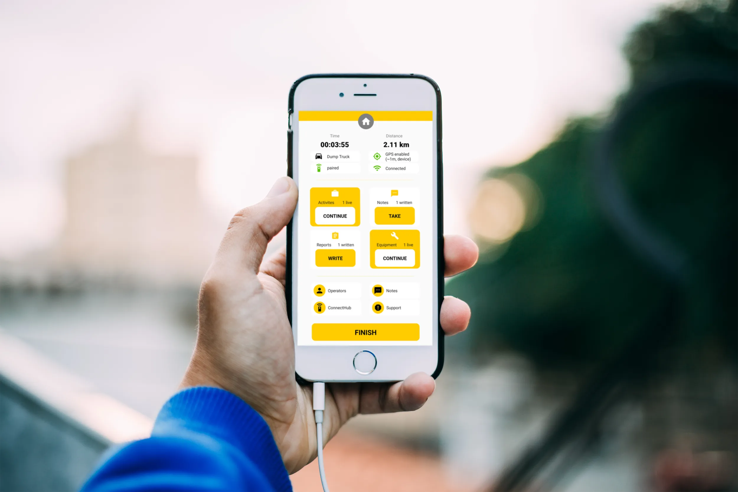
Using the bMoves app, interventions from each operator are displayed in real time on a phone, tablet or computer

With its intuitive design, bMoves allows maintenance departments of roads, airports and municipalities to improve field activity monitoring. Boschung says its innovative solution can support organisations in analytical and decision-making work.

Designed to ease the workload for maintenance departments, bMoves features tools to improve field services, onsite reporting and fleet management.

With the bMoves app, everything an operator does in the field is accurately recorded and located. The bMoves app for Android and iOS, features an easy-to use interface for efficient and reliable data acquisition. It can connect wirelessly to any vehicle and retrieve data, such as route or equipment usage.

Related Content

  • Remote control crushing
    July 16, 2012
    Following a trial of Metso Minerals' Nordberg Plant Management System at Hanson Aggregates' Ystrad Meurig Quarry, UK, the software has now been installed on a further six mobile machines at Lithalun Quarry. Metso installed the remote control system on the Lokotrack LT300HP for Hanson last year to allow the company to test the advantages of the wireless communication capabilities. The system has now been extended to the LT110 primary crusher, another LT300HP and its two ST358 and ST620 mobile screens.
  • HC series: iF Design Award for the new Hamm compactors
    July 1, 2022
    Hamm picks up its 38th design award in 25 years.
  • Topcon offers the potential for smoother roads
    May 11, 2018
    An improved package from Topcon Positioning will allow upgrades in road surface quality. The firm is launching an upgrade to its SmoothRide data collection software. This new RD-M1 Collect 2.0 package includes updates that make the mapping of road conditions easier and more efficient. The improved interface is designed to simplify setup and automatically detect the position of the wheel sensor during data collection.
  • Topcon’s new total station offers increased imaging duties
    January 6, 2017
    A powerful new geodetic reference receiver from Topcon is said to offer improved performance over earlier versions. This new motorised total station now comes with the addition of imaging capability. The DS-200i is said to offer real-time, touch-screen video and photo imaging to capture measured positions. It is equipped with a 5MP camera. The firm says that equipped with its MAGNET software, the tool has an intuitive interface to assist when staking out complex structures. The DS-200i has been designed so