
Monitoring field activities accurately

Boschung says that its bMoves tool is a novel digital solution for managing field services.
March 14, 2022 Read time: 1 min
Using the bMoves app, interventions from each operator are displayed in real time on a phone, tablet or computer

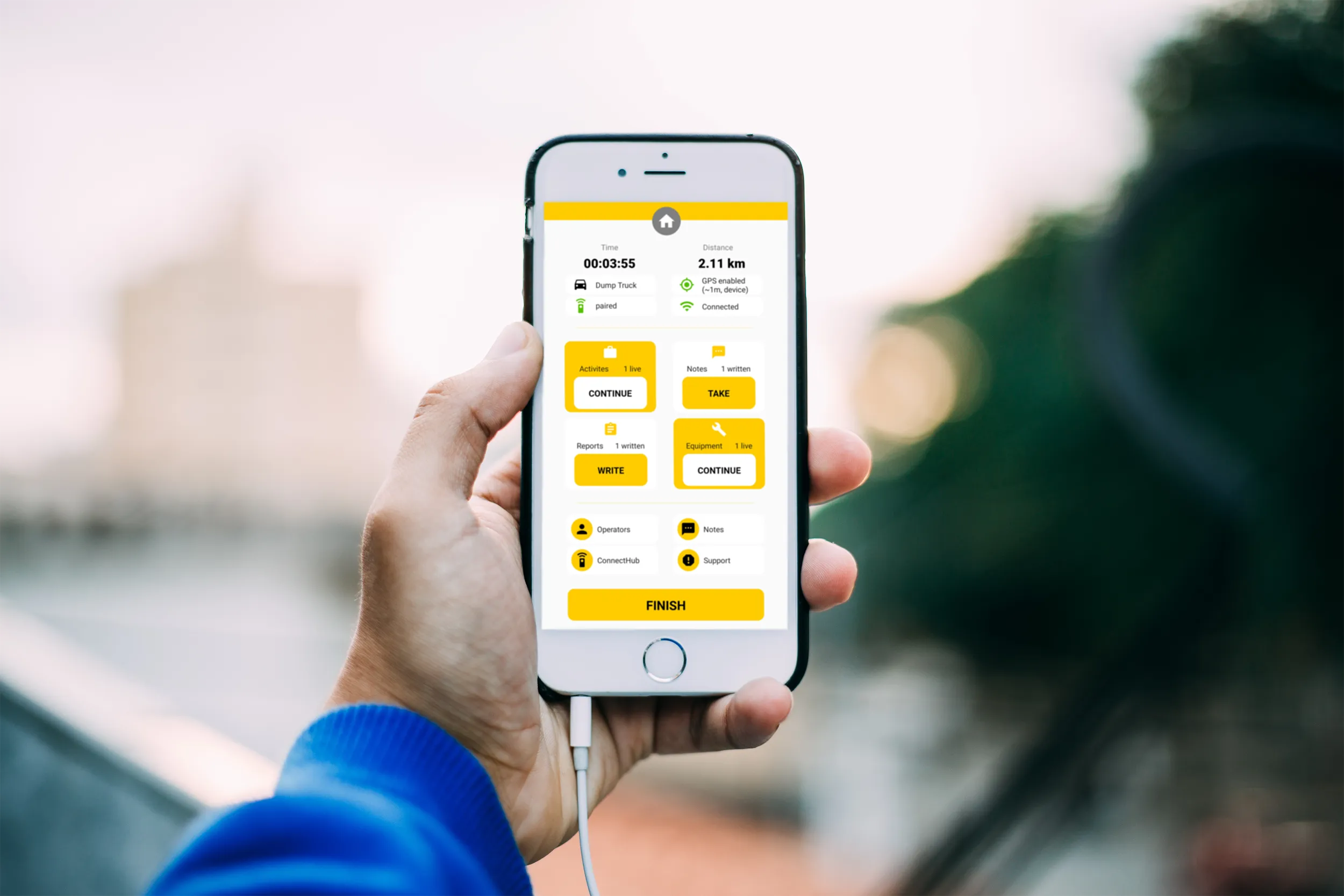
With its intuitive design, bMoves allows maintenance departments of roads, airports and municipalities to improve field activity monitoring. Boschung says its innovative solution can support organisations in analytical and decision-making work.

Designed to ease the workload for maintenance departments, bMoves features tools to improve field services, onsite reporting and fleet management.

With the bMoves app, everything an operator does in the field is accurately recorded and located. The bMoves app for Android and iOS, features an easy-to use interface for efficient and reliable data acquisition. It can connect wirelessly to any vehicle and retrieve data, such as route or equipment usage.

Related Content

  • Topcon’s new total station offers increased imaging duties
    February 2, 2015
    A powerful new geodetic reference receiver from Topcon is said to offer improved performance over earlier versions. This new motorised total station now comes with the addition of imaging capability. The DS-200i is said to offer real-time, touch-screen video and photo imaging to capture measured positions. It is equipped with a 5MP camera. The firm says that equipped with its MAGNET software, the tool has an intuitive interface to assist when staking out complex structures. The DS-200i has been designed so
  • Variable message signs deliver real time travel information
    April 10, 2012
    Variable Message Sign systems are helping ease traffic congestion and keeping drivers better informed on key highways across Europe and the rest of the world. Guy Woodford looks at some of their recent applications By coupling its Intelligent Travel Time System (ITTS) with Bluetooth technology, Alcatel-Lucent is measuring traffic flow in real time and conveying it seamlessly to local authorities in the French city of Vélizy-Villacoublay. The city, a major business enterprise hub 14km south-west of central
  • Mobile mapping tool
    October 14, 2022
    Leica Geosystems says that its sophisticated new Pegasus TRK system makes mobile mapping smart, autonomous and easy. This reality capture mobile mapping system is claimed to offer the benefits of artificial intelligence, autonomous workflows and intuitive interfaces.
  • Future-proofing construction & quarrying equipment sustainability
    February 16, 2023
    Sustainability is a huge topic across the construction and quarrying industry – not just in terms of what can be achieved tomorrow via carbon-free hydrogen fuel cells and hydrogen internal combustion engines of machine fleets, but today, through the use of smart technology to make jobsites more efficient and sustainable by getting work done right first time, every time