Monitoring field activities accurately

Boschung says that its bMoves tool is a novel digital solution for managing field services.
March 14, 2022 Read time: 1 min
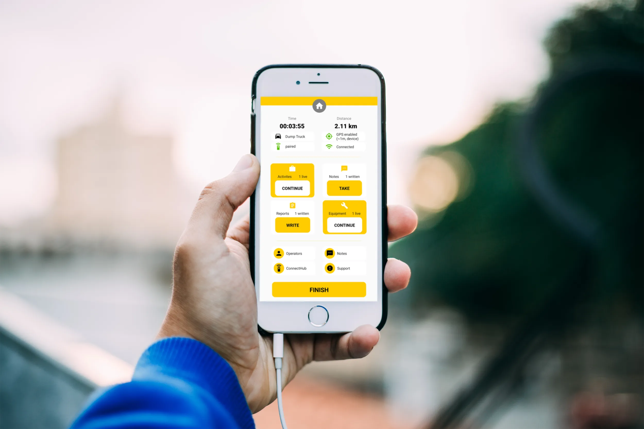
Using the bMoves app, interventions from each operator are displayed in real time on a phone, tablet or computer

With its intuitive design, bMoves allows maintenance departments of roads, airports and municipalities to improve field activity monitoring. Boschung says its innovative solution can support organisations in analytical and decision-making work.

Designed to ease the workload for maintenance departments, bMoves features tools to improve field services, onsite reporting and fleet management.

With the bMoves app, everything an operator does in the field is accurately recorded and located. The bMoves app for Android and iOS, features an easy-to use interface for efficient and reliable data acquisition. It can connect wirelessly to any vehicle and retrieve data, such as route or equipment usage.

Related Content

  • Connected Tech for Construction Continuity
    December 11, 2020
    No one could have predicted the situation we found ourselves in in 2020, with a global pandemic bringing the economy to its knees, projects delayed overnight, rapid restarts, remote management, and challenging labor dynamics.
  • A winter wonderland for Vaisala’s MD30 sensor
    November 18, 2019
    Accurately measuring road network conditions in real time requires rugged and durable mobile sensor technology, writes Rose Parisi* Monitoring road conditions is critical to performing efficient and effective maintenance that reduces risks posed by hazardous driving conditions. This is most critical during winter. Road weather information systems (RWIS) help support road maintenance decision-making through the measurement of atmosphere and pavement conditions. However, due to the static location and
  • New tablet solution for Leica Geosystems
    December 12, 2018
    Leica Geosystems is now using the rugged ZX70 Android tablet from Getac as the hardware for its new Leica Zeno GG04 plus Tablet Solution. The new partnership allows Leica Geosystems to bring geospatial data collection capabilities to customers in all terrains and weather conditions such as utilities, public services, transportation and construction. Leica Geosystems has developed a range of new software and hardware including its Zeno Mobile data collection app and Zeno GG04 plus smart antenna to capture a
  • Apps for all in Louisiana
    May 20, 2020
    Jason Barnes* looks at how a system of engagement (SoE) from software specialist Esri helped the US state of Louisiana’s transportation department create user-friendly apps