Mobile mapping tool

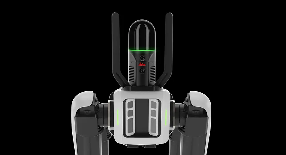
Leica Geosystems says that its sophisticated new Pegasus TRK system makes mobile mapping smart, autonomous and easy. This reality capture mobile mapping system is claimed to offer the benefits of artificial intelligence, autonomous workflows and intuitive interfaces.
October 14, 2022 Read time: 1 min
The new Pegasus TRK system from Leica Geosystems allows fast and accurate mobile mapping

The package features artificial intelligence capabilities and uses an advanced dynamic laser scanning and expandible imagery system for recording, measuring and visualising environments. This tool increases productivity with automated, intelligent workflows. The Pegasus TRK can be operated by one person, making mapping projects more efficient and cost-effective.

It is suitable for industry professionals new to the technology, while providing reliable, high-quality performance for applications in surveying, transportation and utilities.

The Pegasus TRK solution features an AI-enhanced camera and automatic camera calibration. To comply with privacy regulations, its AI can identify and blur identifiers, such as people and vehicles, in real time. The system can also be used to generate high-definition base maps for autonomous vehicles.

The Pegasus TRK connects with the new Leica Pegasus FIELD software for autonomous data collection and route planning in the field. It also connects with the Leica Cyclone Pegasus OFFICE for input into post-processing and publishing workflows. 

For more information on companies in this article

Related Content

  • Weigh-in-motion key to maximising road life
    February 24, 2012
    The market and technology for weigh-in-motion systems continues to evolve – Mike Woof writes. for both mature and developing highway infrastructure networks, traffic densities play an important role in determining road wear and life. Monitoring traffic volumes and individual vehicle weight is crucial for ensuring roads can cope in the long term and that maintenance can be planned, while the problem of overloading can be eliminated.
  • Accurate data capture with Hexagon
    January 2, 2022
    Hexagon is introducing the Leica BLK ARC and the Leica BLK2FLY tools, which offer speed, portability and mobility for autonomous mobile reality capture.
  • Rapid adoption of GPS machine control
    April 5, 2012
    The high sophistication of GPS machine control systems has resulted in a fast pace of technological advancement. The three major players in the machine control sector, Leica Geosystems, Topcon and Trimble have all made major gains in recent years. The sophistication of the latest systems can combine satellite position data from the GPS and GLONASS networks with information from total stations to provide precise, high speed machine operation. Further more the firms have also prepared themselves for the intro
  • Cultivate better on-site safety awareness by leveraging technology with Leica Geosystems
    August 10, 2023
    When a vital fiber-optic cable was cut during construction work in Germany, the impact was huge. There were telecom disruptions affecting the greater Frankfurt area, all departures and landings at Frankfurt Airport were suspended, and Lufthansa’s global IT system crashed. Leica Geosystems says it is vital to put in place “strategies to protect people, equipment, and assets… and to emphasise the crucial role digital solutions play in ensuring safety.”