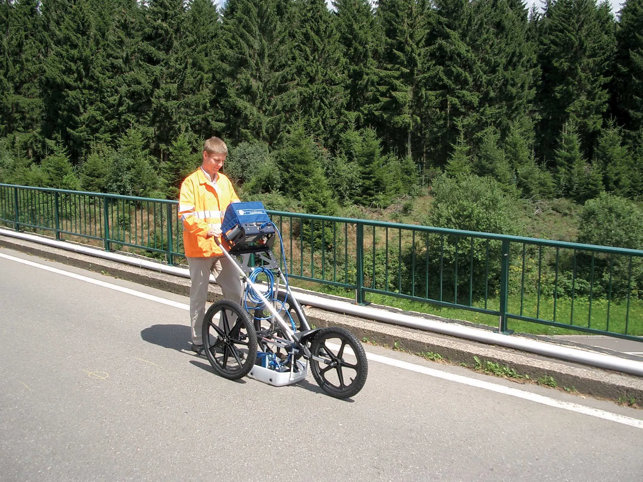
Leica’s new Digicat xf-Series cable locators and transmitters

Leica Geosystems has launched the latest additions to the Digisystem product range: the Leica Digicat xf-Series. With Leica Geosystems’ new xf-Series cable locators and transmitters, users are said to be able to accurately detect and trace utilities faster and over a greater distance. The Leica Digicat xf-Series is said by the Swiss firm to have been speci?cally designed with long distance tracing in mind. The ability to trace transmitter frequencies of 512Hz and 640Hz provides users with a greater tracing
April 3, 2013 Read time: 2 mins

Leica Geosystems has launched the latest additions to the Digisystem product range: the Leica Digicat xf-Series.

With 265 Leica Geosystems’ new xf-Series cable locators and transmitters, users are said to be able to accurately detect and trace utilities faster and over a greater distance.

The Leica Digicat xf-Series is said by the Swiss firm to have been specifically designed with long distance tracing in mind.

The ability to trace transmitter frequencies of 512Hz and 640Hz provides users with a greater tracing range as well as the ability to locate sewer-camera inspection systems. All new models are said by Leica to represent the latest design in cable technology. With modern Digital Signal Processing (DSP) and intelligent software, the locators, says Leica, continue to make light work of ground surveys.

All new models of the Leica Digicat xf-Series are said to make locating underground cables and pipes a simple and efficient task, increasing the operator’s productivity.

The Digicat 550i xf and 650i xf offer users the added benefit of depth estimation.

The Digicat 600i xf and 650i xf locators have the added benefit of an internal 32MB memory and Bluetooth wireless connectivity. Both models are said to integrate seamlessly with mobile mapping technology to log survey data, in addition to enabling wireless Bluetooth data transfer.

The newly developed Leica Digitex xf signal transmitters deliver a higher power output than previous models with the addition of extra low tracing frequencies. This improved performance is said by Leica to allow users to trace services over a greater distance, improve service detection in areas of high signal interference and to improve depth estimation when using a depth locator.

For more information on companies in this article

Related Content

  • Latest GIS and software tools improve operations
    February 24, 2012
    Innovative GIS and software solutions are coming to market from the three key market players - Mike Woof reports Competition is strong in the field for GIS and surveying systems as well as the associated software. The three major players in the sector, Leica Geosystems, Topcon and Trimble, all invest heavily in research and development and continue to roll out new solutions for construction customers that will boost the efficiency of surveying as well as overall project implementation.
  • Cultivate better on-site safety awareness by leveraging technology with Leica Geosystems
    August 10, 2023
    When a vital fiber-optic cable was cut during construction work in Germany, the impact was huge. There were telecom disruptions affecting the greater Frankfurt area, all departures and landings at Frankfurt Airport were suspended, and Lufthansa’s global IT system crashed. Leica Geosystems says it is vital to put in place “strategies to protect people, equipment, and assets… and to emphasise the crucial role digital solutions play in ensuring safety.”
  • GSSI offers bridge monitoring tool
    May 19, 2015
    GSSI is introducing the sophistictaed BridgeScan condition assessment system. This package is used for concrete inspection and utility mapping of bridges. Said to be both affordable and versatile, this ground penetrating radar (GPR) equipment can be used to assess concrete condition on bridge decks, as well as parking structures. Using this unit offers accurate assessments of concrete condition, which improves repair cost estimation and saves time and money. With BridgeScan, identification of rebar
  • Real time site monitoring technology
    July 19, 2012
    Leica Geosystems is broadening its site monitoring technology with the introduction of the GeoMoS package. This can be linked to the firm's existing GNSS Spider software to offer an array of TPS and GNSS monitoring tools. Combined, these tools provide a web-based service for visualisation and analysis of monitoring. Authorised users can access a monitoring project using a web browser, pocket PC or mobile phone. Using the GeoMoS Web service, graphs and views can be customised and be tailored to the needs of