
Innovation for mapping utilities

Gaist is offering a mapping solution it believes could boost efficiency for the utilities market
February 13, 2020 Read time: 2 mins
Accurate mapping of utilities can be achieved with the new package from Gaist

This novel infrastructure digital twin tool is now being offered to the utilities market. The package can cut the cost and time of construction works and can increase efficiency by 10% at 0.01% of the project cost.

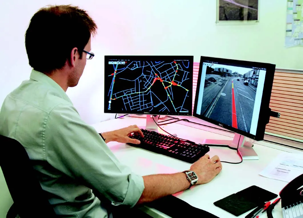
Gaist covers over 341,500km of the UK’s roads and pathways with more than a billion high-definition images. The firm says that this offers a complete and precise view of the highway network. Planners and engineers can explore the network from their desktop, enabling them to make cost-effective and informed decisions when planning and carrying out projects on roads.

This solution is said to add value to utility providers by identifying surface types and the accurate location of utility assets, as well as providing the ability to measure, which allows for accurate budgeting, planning design and delivery. The package allows providers to get it right first time. The data can also aid on-site inductions and briefings, mitigate health and safety risks and reduce costs through negating the need for on-site surveys.

Additionally, Gaist can provide complementary and value-added services such as ground-penetrating radar, traffic management, exact location of services and rod and rope duct proofing. The tool answers questions such as to what is needed to prepare for planned maintenance, or what percentage of roads are ready for fibre.

For more information on companies in this article

Related Content

  • Optimising Specialist Bitumen Handling with the MEST Bitutainer™
    June 1, 2025

    As roads become more advanced and surface performance expectations rise, traditional hot bitumen is no longer the only material in demand. Across the globe, highways projects are increasingly relying on high-performance binders, from polymer-modified bitumen (PMBs) to specialist emulsions and tack coats designed for specific temperature conditions or traffic volumes.

  • Yotta develops new tools for sophisticated GIS package
    April 25, 2013
    Highway technology and services company Yotta DCL has announced new features for Horizons. The web-based platform integrates GIS, pavement and asset management for highways authorities and agencies to use in a visualised asset management system. The new version 2.3 adds features and functionality across three modules: Explorer, Analysis and Management. Explorer allows users to view, load and visualise a range of datasets, including base network data, their condition in fine detail, plus relevant asset or co
  • Road surfacing: the case for sustainability
    March 5, 2020
    Erik Denneman* makes the social and business case for sustainable pavements for which much of the technology already exists.
  • Conquer technology interoperability gaps with DCW’s productivity-focused and digitally-connected platform
    July 14, 2022
    Digital Construction Works is all about the “transformative power of digital.” It is designed to be a leading integrator of construction technology services… a power that will help to deliver your projects smoothly, on time, and on budget. DCW’s mission is to “create innovative solutions to complex challenges by understanding the pressure firms are under to increase productivity, reduce risk… and deliver reliable, efficient project results.” Are you connected?