Improved survey data handling

Leica Geosystems says that its Leica MobileMatriX v3.0 package can be used to synchronise survey data with an enterprise geodatabase, transfer digital images taken from a mobile phone via Bluetooth and link it with a feature, in addition to many other improvements. The firms says that its MobileMatriX v3.0 package offers a flexible and powerful mobile GIS application and can be used in both large projects and small projects involving only a few field crews. Survey data can be replicated within the editing p
August 2, 2012 Read time: 2 mins
265 Leica Geosystems says that its Leica MobileMatriX v3.0 package can be used to synchronise survey data with an enterprise geodatabase, transfer digital images taken from a mobile phone via Bluetooth and link it with a feature, in addition to many other improvements. The firms says that its MobileMatriX v3.0 package offers a flexible and powerful mobile GIS application and can be used in both large projects and small projects involving only a few field crews.

Survey data can be replicated within the editing process for customers using ArcGIS to manage spatial data. This allows users to extend their geospatial applications to their colleagues in the field, creating unprecedented data management capabilities. By implementing Leica MobileMatriX 3.0 survey data synchronization in the project workflow, a client can now connect to an enterprise database and modify or re-compute the survey measurements. This improves the workflow between field and office and can provide time and cost savings up to 50%. With Leica MobileMatriX 3.0, the subcontractor can provide a finished geodatabase to the client, without resorting to a conversion process and current analysis has shown a potential time/cost savings of up to and beyond 30-50%.

For more information on companies in this article

Related Content

  • Leica’s GMX901plus GNSS receiver
    May 13, 2014
    The Leica GMX901plus is said by the Swiss firm to be an “affordable and rugged” GNSS receiver that delivers precise and reliable data about movements of sensitive structures such as mine walls, rock slopes, dams, and buildings. For time-critical applications that require high rate data and a higher accuracy the GMX901plus can be smoothly upgraded to a powerful L1/L2 GPS/GLONASS receiver with an update rate of 5Hz.
  • Topcon unveils Hybrid Robotic System
    January 21, 2014
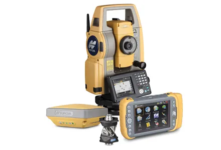
    Topcon Positioning Group has unveiled its Hybrid Robotic System, featuring the new DS series robotic total station and the recently announced MAGNET v2.0 software suite, a Topcon enterprise solution for the geomatics industry. Other Topcon components in the cutting-edge HRS include the economical HiPer SR GNSS receiver and Tesla large-screen tablet controller. The new system combines GNSS positioning and robotic measurements with an automated data workflow to provide added versatility and efficiency for
  • Industry agrees telematics data deal
    January 6, 2017
    Industry associations and manufacturers have reached an agreement on telematics data. A large group off heavy equipment manufacturers, fleet managers and two leading industry associations have agreed on unified communications for telematics.
  • Industry agrees telematics data deal
    February 25, 2014
    Industry associations and manufacturers have reached an agreement on telematics data. A large group off heavy equipment manufacturers, fleet managers and two leading industry associations have agreed on unified communications for telematics.