Accurate positioning with Topcon

By Topcon March 13, 2024 Read time: 1 min
Topcon says that its new Hybrid Positioning package offers versatility for positioning and optical robotic measurements

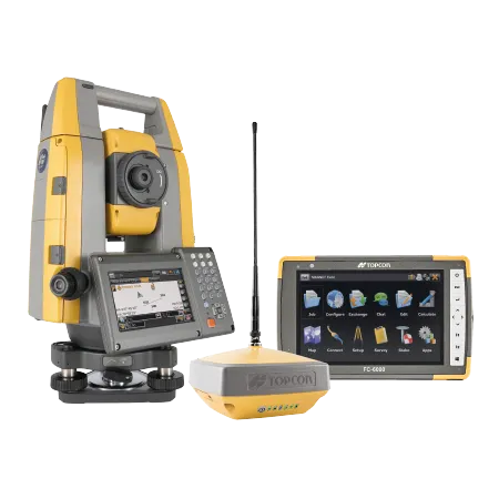
The new Hybrid Positioning system from Topcon is said to perform faster in the field than stand-alone robotic systems and is more versatile than RTK-only solutions. The latest Hybrid Positioning technology combines GNSS positioning and optical robotic measurements on one rover pole.

The unit offers a robotic total station and a lightweight GNSS receiver in a single package and is said to allow faster field work than stand-alone robotic or GNSS solutions. The system has a hybrid lock for rapid prism acquisition in dense areas and a hybrid switch for bouncing between optical measurements and GNSS positioning, as well as a hybrid resection to start set up at a safe and convenient location.

The system is compatible with all Topcon robotic total stations and allows the user to reacquire targets even in challenging conditions. A user can can select safe, convenient locations and define the unknown point of the instrument from GNSS measurements. The firm says that for maximum efficiency, users can pair the Hybrid Positioning technology with MAGNET Field data-collection software.
 

For more information on companies in this article

Related Content

  • New tablet solution for Leica Geosystems
    December 12, 2018
    Leica Geosystems is now using the rugged ZX70 Android tablet from Getac as the hardware for its new Leica Zeno GG04 plus Tablet Solution. The new partnership allows Leica Geosystems to bring geospatial data collection capabilities to customers in all terrains and weather conditions such as utilities, public services, transportation and construction. Leica Geosystems has developed a range of new software and hardware including its Zeno Mobile data collection app and Zeno GG04 plus smart antenna to capture a
  • Topcon announces increased 3D scanning integration with Autodesk
    August 17, 2015
    Topcon Positioning Group says it has improved workflow compatibility for the GLS-2000 3D laser scanner and ScanMaster software with Autodesk solutions. With the latest version of Autodesk ReCap, the GLS-2000 pairs with Topcon ScanMaster software to collect, process, edit and deliver 3D point cloud data from a laser scanner. ReCap allows users to perform tasks such as scan conversion, editing and viewing point cloud data. It also provides integration with Autodesk’s portfolio of design software. Aut
  • Frost Control gets the picture
    November 20, 2020
    Cameras have been added to the Mini RWIS from Frost Control Systems.
  • Topcon beefs up eXchange AutoCAD 3D civil engineering software
    March 10, 2015
    Topcon’s latest eXchange software add-on for AutoCAD Civil 3D civil engineering design software converts data into files compatible with Topcon 3D construction solutions as well as the MAGNET software system. The add-on even converts complex road designs with defined corridors into Topcon standard file formats, such as MJF (MAGNET Field job) for land surveying and construction layout, and TP3 (3D Topcon Project File) for machine control systems. After installation, users are offered the ability to log in to