
Topcon and Bentley: integration between MAGNET 4.0 and ProjectWise

Topcon Positioning Group and Bentley Systems have set up direct communication between Bentley’s design applications and Topcon mobile work force products with the upcoming MAGNET 4.0 release. With the direct communication from MAGNET Enterprise to Bentley’s ProjectWise, users of Topcon’s family of MAGNET and 3D-MC software solutions can now, while working in the field, access or receive i-models created by Bentley’s OpenRoads design modeling technology. By the end of June, survey data and as-built
June 7, 2016 Read time: 2 mins
342 Topcon Positioning Group and 4019 Bentley Systems have set up direct communication between Bentley’s design applications and Topcon mobile work force products with the upcoming MAGNET 4.0 release.  
 
With the direct communication from MAGNET Enterprise to Bentley’s ProjectWise, users of Topcon’s family of MAGNET and 3D-MC software solutions can now, while working in the field, access or receive i-models created by Bentley’s OpenRoads design modeling technology.

By the end of June, survey data and as-built conditions captured by Topcon's field devices can be brought back into Bentley's design applications using the same MAGNET to ProjectWise direct connection.
 
“The direct connection to Bentley’s ProjectWise in MAGNET Enterprise allows project managers to distribute i-models directly to their Topcon field devices,” said Jason Hallett, Topcon vice president of global product management. “With this drag-and-drop functionality, i-models from ProjectWise easily move from the MAGNET Enterprise Data Manager to the mobile work force.”

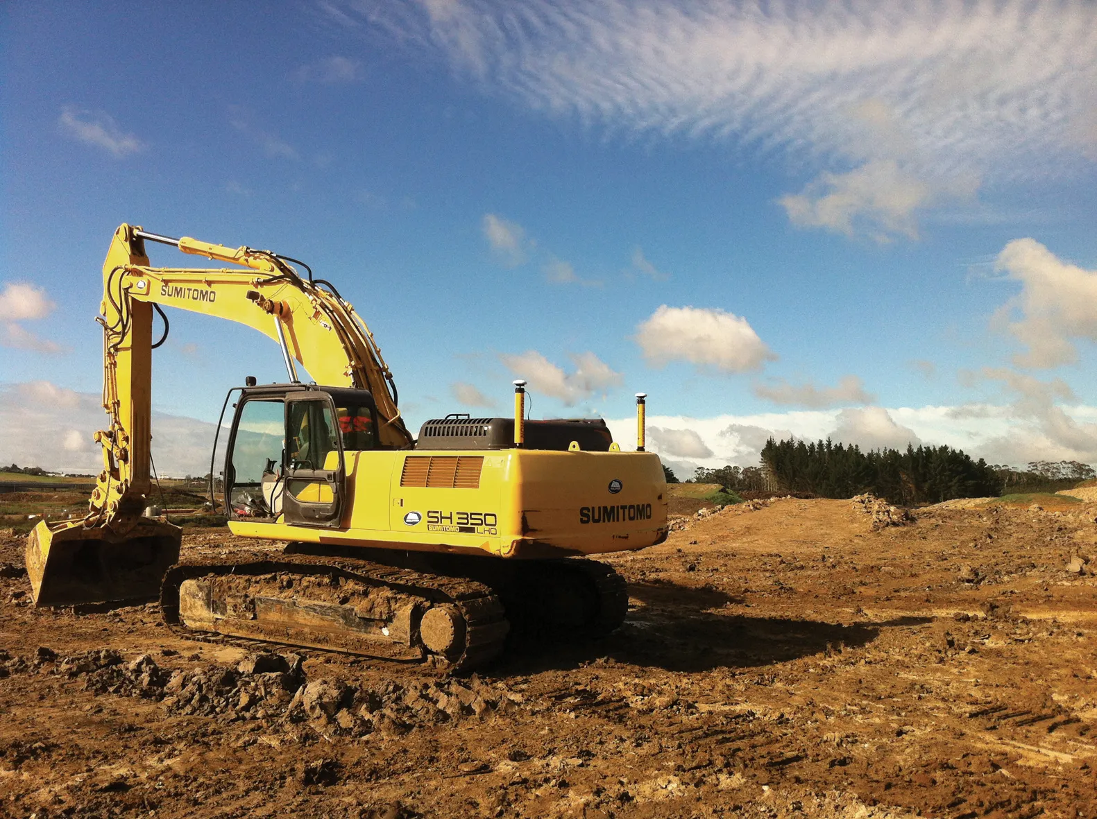
With the simplified workflow from ProjectWise to machines with a Sitelink3D connection from MAGNET Office or Enterprise, updated models can be quickly sent to a machine, reducing the chance of rework and ensuring the most current data can be sent to project team, said Hallett.
 
With the upcoming release, users will be able to deliver any MAGNET project files as i-models into ProjectWise for the purpose of capturing as-constructed conditions of infrastructure projects.
 
Dustin Parkman, Bentley vice president of product development, said that a mobile work force will be able to update i-models directly on the job site and then send them from the field back to ProjectWise with selected data - points, point lists, layers library - directly to an i-model.
 
“The integration between ProjectWise and MAGNET Enterprise has opened up endless new possibilities for construction-driven engineering workflows using OpenRoads and MAGNET Office,” said Parkman.

For more information on companies in this article

Related Content

  • MOBA's advanced positioning systems
    November 15, 2012
    MOBA Mobile Automation says it now offers excavator control systems for a range of requirements, with the introduction of its Easy Dig basic system, the LINK expansion stage and the high-end Vision 3D version. The new Easy Dig package is said to provide an affordable and easy-to-install excavator control system that measures depth, incline angle and range. Target and actual values are compared and displayed in real-time on the screen. The LINK offers a combination of 2D and 3D functions and is the most in
  • Topcon machine control units take the heat off an Alaskan contractor
    December 4, 2015
    Juniper, spruce, cranberry, cottonwood and rose. Most people think of pine trees and berries amid beautiful country fields. But for one contractor based just below the Arctic Circle in the US state of Alaska, the names represent a successful job completed using machine control. Valley General Construction recently finished a US$350,000 contract for the upgrading of country roads in the local borough of Matanuska-Susitna. The colourful names belong to roads in a heavily wooded residential subdivision located
  • Leica Cyclone teams up with NCTech’s iSTAR camera database
    January 19, 2016
    Users of Leica Cyclone, a 3D point cloud processing software, can now automatically import and align high-dynamic range (HDR) data from NCTech’s iSTAR camera database. The result is enhanced images delivered faster and easier, according to both companies. “It is also the accuracy to which these images fit the 3D point cloud data that is paramount. NCTech’s iSTAR camera produces high-quality HDR imaging at the accuracy everyone expects,” said Faheem Khan, vice president, business development for Leica Geosys
  • Smart constructioon with GIS, GPS design technology
    May 2, 2012
    A UK highway project has benefited from the latest software, GIS and GPS technology, Mike Woof reports. Sophisticated software, GIS and GPS technology has played an important role in a large highway upgrade project in the UK and helping to increase efficiency and drive down construction costs.