Fugro to use its ARAN system in Dutch surveying deal

Fugro, a geo-data specialist, is using the latest version of its Automatic Road Analyser (ARAN) in a new five-year pavement survey contract for Dutch highways. The contract, with an option to extend to 10 years, was awarded by the Dutch infrastructure agency Rijkswaterstaat. It includes the collection of surface condition and road measurement data from 8,600km of principal highways each year. The company’s Automatic Road Analyser - ARAN - which is adapted to meet European specifications and includes i
May 9, 2019 Read time: 2 mins
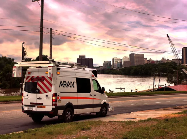
Fugro’s latest Automatic Road Analyser – ARAN – is surveying around 8,600km of Dutch main roads

6202 Fugro, a geo-data specialist, is using the latest version of its Automatic Road Analyser (ARAN) in a new five-year pavement survey contract for Dutch highways.

The contract, with an option to extend to 10 years, was awarded by the Dutch infrastructure agency Rijkswaterstaat. It includes the collection of surface condition and road measurement data from 8,600km of principal highways each year.

The company’s Automatic Road Analyser - ARAN - which is adapted to meet European specifications and includes improved crack detection technology. The platform enables surveys to be conducted at traffic speed, providing a cost-effective, safe, precise means of condition monitoring that enables asset managers to identify and predict deterioration and prioritise expenditure, according to the company, based in the Netherlands.

The ARAN provides fully automated collection of multiple data streams via positioning, video and laser imaging systems that can be tailored to project needs. Options include profile, camber, rutting, cracking, texture and roughness as well as pavement thickness and structure based on ground penetrating radar.

Rijkswaterstaat receives a clear picture of network condition in a format that complies with national standards, the company notes. With the condition surveys repeated annually, maintenance plans can be optimised to target areas of deterioration based on high resolution and repeatable datasets.

Richard Bun, Fugro’s project lead, said the updated ARAN “will further enhance the efficient transfer and usability of important data for Rijkswaterstaat’s asset management system”.

Fugro employing around 10,000 people in 65 countries. Clients are mainly in the energy and infrastructure industries, both offshore and onshore. In 2018, revenue was €1.7 billion. The company is listed on Euronext Amsterdam.

For more information on companies in this article

Related Content

  • Yotta DCL wins prized M40 UK surveying contract
    August 7, 2013
    Highway’s technology and surveying company Yotta DCL has won a contract to provide surveys for Carillion on the M40 between southern England and the West Midlands worth €433,641 (£375,000). Yotta DCL were awarded the five-year contract after being shortlisted through an e-auction, which sees vetted survey providers bid against each other for the survey work. Carillion holds the Operation and Maintenance agreement with UK Highways, which is the M40 DBFO (design, build, finance and operate) company. Yotta DC
  • Data collection key to software developments
    February 13, 2012
    The collection and handling of data are key technology drivers in the software sector. New methods of data collection and manipulation are driving significant developments in software at present. The latest technology allows designers and engineers to collect, store and manipulate ever larger amounts of data. Growing use of mobile field equipment for both data collection and field management is driving interactive systems. And in an interview this month Autodesk senior vice-president for the construction an
  • VIDEO: Telstra drone LIDAR maps Melbourne’s EastLink Mullum Tunnel
    April 13, 2018
    One of the applications for LIDAR is to make high resolution 3-D maps. Self-driving cars are pre-loaded with a LIDAR map of the trials area in which they are permitted to fully self-drive themselves. The cars also have their own LIDAR scanner which captures a real-time LIDAR view of the vehicle’s surroundings. The fully autonomous driving system within these prototype cars compares the real-time LIDAR view against the pre-loaded LIDAR map to significantly increase the accuracy of their self-positioning
  • AI-InfraSolutions, STEMMER improve asset ID
    November 20, 2024
    Their panoramic camera head is designed for automated data collection in applications such as traffic sign identification, road condition assessments and environmental monitoring.