Software innovations can help road construction and asset management – Mike Woof writes
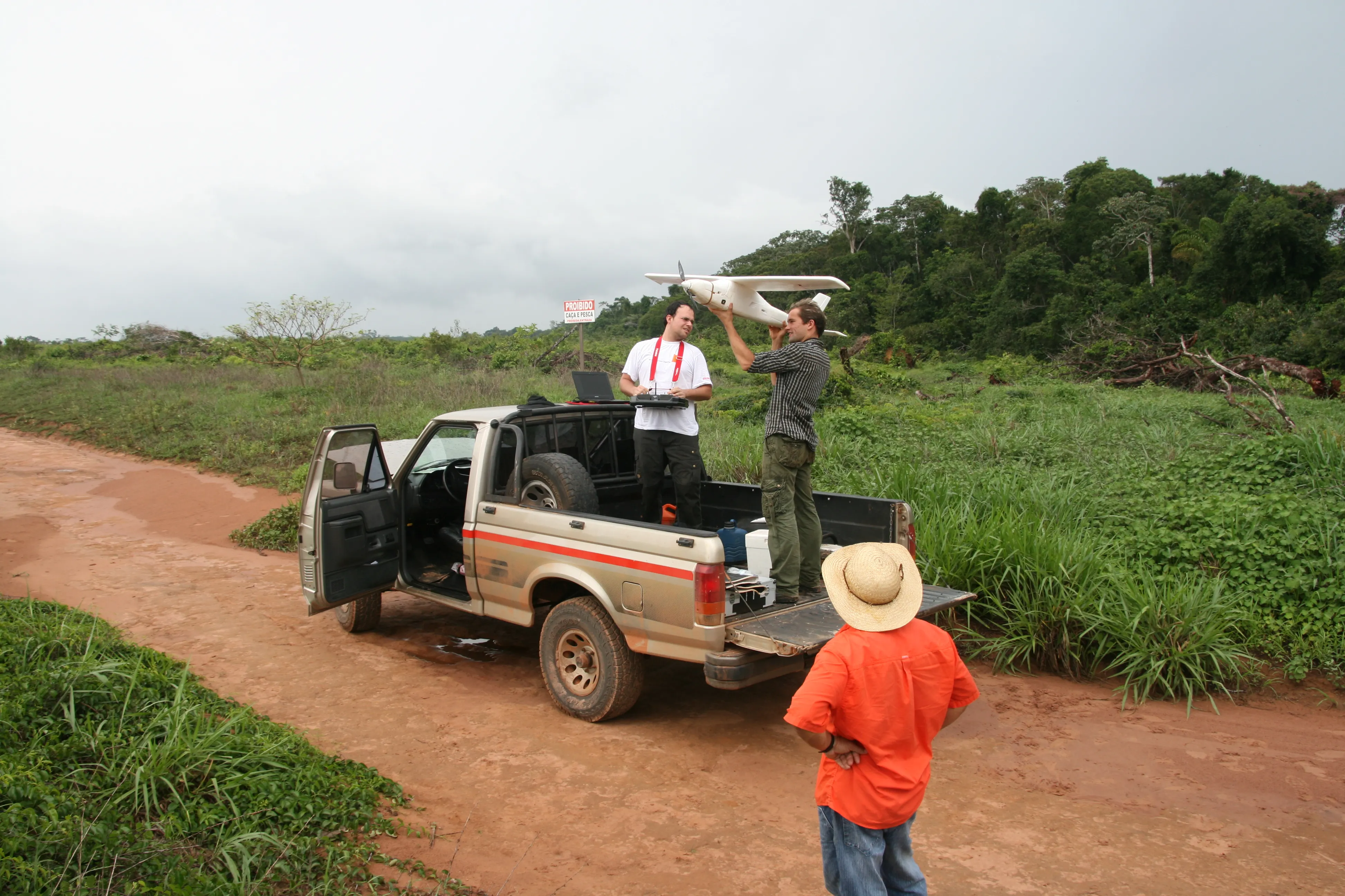
New developments in construction software offer major benefits for civil engineers, contractors and maintenance firms. The latest advances will help optimise the construction process, while also allowing easier monitoring of existing assets.
In terms of construction, Bentley Systems is again pushing the bar with regard to advanced software solutions. Its latest OpenRoads ConceptStation package is said to combine en
Software innovations can help road construction and asset management – Mike Woof writes
New developments in construction software offer major benefits for civil engineers, contractors and maintenance firms. The latest advances will help optimise the construction process, while also allowing easier monitoring of existing assets.
In terms of construction,4019 Bentley Systems is again pushing the bar with regard to advanced software solutions. Its latest OpenRoads ConceptStation package is said to combine engineering drawing tools and project costs to allow better decision-making in the conceptual design phase of a project. Improvements include increasing design productivity, identifying potential high-risk items, and lowering project development costs. Once the best design is identified, the user can upload a model to OpenRoads and OpenBridge, making the highway and bridge design process more straightforward.
The OpenRoads ConceptStation models can be brought forward for detailed design work into OpenRoads Designer, ensuring that the data generated during design is utilised as the project moves from concept into construction.
It has several key capabilities. The GeoCoordination services help to find, download, import, and georeference contextual information to support 3D design modelling workflows, such as point clouds, 3D reality meshes, terrain data, images, and GIS information. And the engineering sketching tools to create 3D models for roads, bridges, ramps, guardrails, retaining walls, and other infrastructure designs. Meanwhile there is automated generation of costs for the design, allowing engineers and planners to identify high-cost items or potential risks in the project. And the integration of LumenRT allows the production of real-time, realistic scenes without the need for intensive and lengthy pre-rendering. In addition, the integration of PTV VISSIM means that users can incorporate traffic analysis and planning for OpenRoads conceptual or detailed design.
Once projects have been designed and built, maintaining assets is crucial and a new version of an asset management and cataloguing system for road infrastructure is now available from Italian company Sitalia. This firm has also developed Android apps and a MySQL database named Genie to store all information.
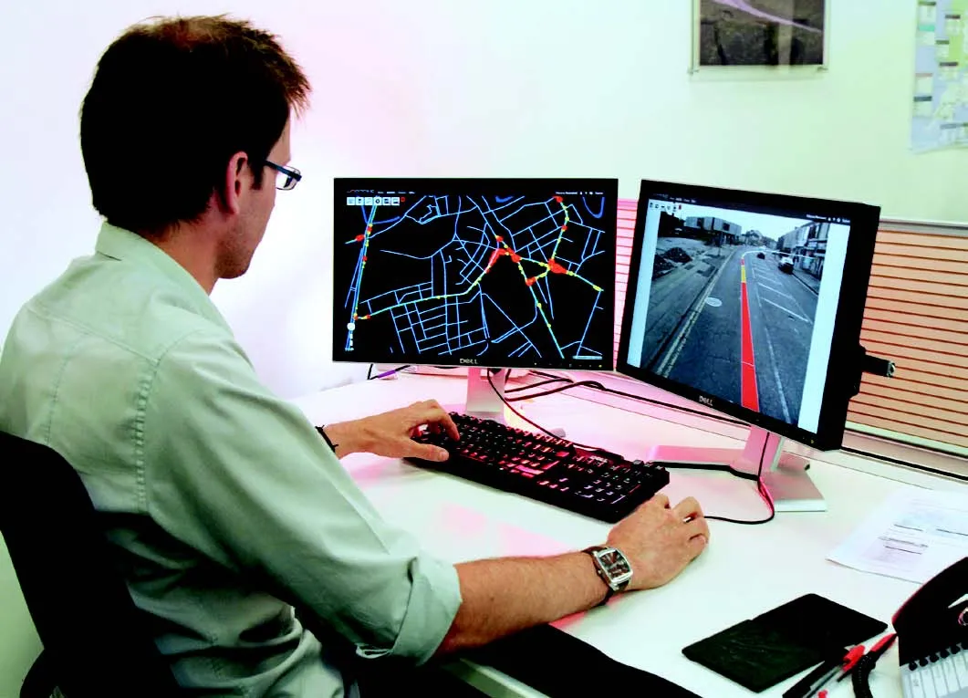
The software, called PKmaps V3, is the third edition of a modular system that can be used on PC-stations or on tablet PCs that feature integrated GPS and 3G communication. This allows accurate geolocation of spatial information.
The software merges GIS functionalities with maintenance control, connecting data with accident databases, road conformity evaluation and pavement degradation evaluation. The user is able to prioritise intervention where necessary on the road network and can see the price for each job in the budget function.
The PKmaps V3 package includes a specific module to show surveys provided by the Box-Video and Mini-Box, two instruments that have been developed by Sitalia for mobile mapping.
The software has been developed from scratch in collaboration with Italian universities and companies. It also incorporates experience of Italian, French and African projects.
In the last two years Sitalia has developed the database to store all Cadastrian objects and all other objects. The Genie tool provides the connection between office and field personnel, allowing the user to view all data and obtain summaries of work carried out. The firm has also developed an Android app called InfoAccident, which allows police to georeference crashes, compiling information regarding the vehicles and people involved. The application follows European standards for road crashes and privacy regulations. Meanwhile the App CheckList offers a complete tool for the listing of all road objects using the GPSConstat tool.
The software developed by Sitalia includes Road Cadastrian with a focus on civil engineering, road signs and urban street furniture. This also covers road pavement degradation and crashes.
At present SITALIA is developing its PKmaps V3 module on technological networks and is updating its App CheckList. The aim is to use the knowledge gained over the years in the area of Road Cadastrian development into the technological networks, where maintenance plays a major part and has to be planned properly.
New developments in construction software offer major benefits for civil engineers, contractors and maintenance firms. The latest advances will help optimise the construction process, while also allowing easier monitoring of existing assets.
In terms of construction,
The OpenRoads ConceptStation models can be brought forward for detailed design work into OpenRoads Designer, ensuring that the data generated during design is utilised as the project moves from concept into construction.
It has several key capabilities. The GeoCoordination services help to find, download, import, and georeference contextual information to support 3D design modelling workflows, such as point clouds, 3D reality meshes, terrain data, images, and GIS information. And the engineering sketching tools to create 3D models for roads, bridges, ramps, guardrails, retaining walls, and other infrastructure designs. Meanwhile there is automated generation of costs for the design, allowing engineers and planners to identify high-cost items or potential risks in the project. And the integration of LumenRT allows the production of real-time, realistic scenes without the need for intensive and lengthy pre-rendering. In addition, the integration of PTV VISSIM means that users can incorporate traffic analysis and planning for OpenRoads conceptual or detailed design.
Once projects have been designed and built, maintaining assets is crucial and a new version of an asset management and cataloguing system for road infrastructure is now available from Italian company Sitalia. This firm has also developed Android apps and a MySQL database named Genie to store all information.
The software, called PKmaps V3, is the third edition of a modular system that can be used on PC-stations or on tablet PCs that feature integrated GPS and 3G communication. This allows accurate geolocation of spatial information.
The software merges GIS functionalities with maintenance control, connecting data with accident databases, road conformity evaluation and pavement degradation evaluation. The user is able to prioritise intervention where necessary on the road network and can see the price for each job in the budget function.
The PKmaps V3 package includes a specific module to show surveys provided by the Box-Video and Mini-Box, two instruments that have been developed by Sitalia for mobile mapping.
The software has been developed from scratch in collaboration with Italian universities and companies. It also incorporates experience of Italian, French and African projects.
In the last two years Sitalia has developed the database to store all Cadastrian objects and all other objects. The Genie tool provides the connection between office and field personnel, allowing the user to view all data and obtain summaries of work carried out. The firm has also developed an Android app called InfoAccident, which allows police to georeference crashes, compiling information regarding the vehicles and people involved. The application follows European standards for road crashes and privacy regulations. Meanwhile the App CheckList offers a complete tool for the listing of all road objects using the GPSConstat tool.
The software developed by Sitalia includes Road Cadastrian with a focus on civil engineering, road signs and urban street furniture. This also covers road pavement degradation and crashes.
At present SITALIA is developing its PKmaps V3 module on technological networks and is updating its App CheckList. The aim is to use the knowledge gained over the years in the area of Road Cadastrian development into the technological networks, where maintenance plays a major part and has to be planned properly.