Savoy swept-path

Savoy Computing in the UK has been quick to launch a new version of its AutoTrack swept-path analysis software to take advantage of the latest AutoCAD 2012 platform.
February 21, 2012 Read time: 2 mins
2902 Savoy Computing in the UK has been quick to launch a new version of its AutoTrack swept-path analysis software to take advantage of the latest AutoCAD 2012 platform.

AutoTrack v9.10 has full native support for all AutoCAD 2012 and the products that sit above it such as Civil 3D in 32-bit and 64-bit variants.

A key feature now is that the drawing algorithms in AutoTrack take advantage of speed enhancements in AutoCAD, especially the temporary graphics displayed while grip editing and dragging. It gives a much more responsive feel says Savoy.

A context-sensitive AutoTrack ribbon has been programmed in so that clicking an AutoTrack object will automatically display the AutoTrack menu ribbon.

BLOB, Savoy's swept-path analysis software, is to be sold in Brazil by N A Tecnologia which becomes an authorised distributor and Savoy Partner. The Brazilian firm provides software, support and training to engineers in Brazil and South America.

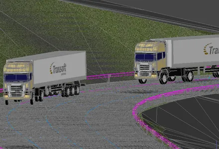
Canadian software house 349 Transoft Solutions has taken vehicle swept-path analysis to a new level with the launch of a three-dimensional version of its AutoTURN analyser.

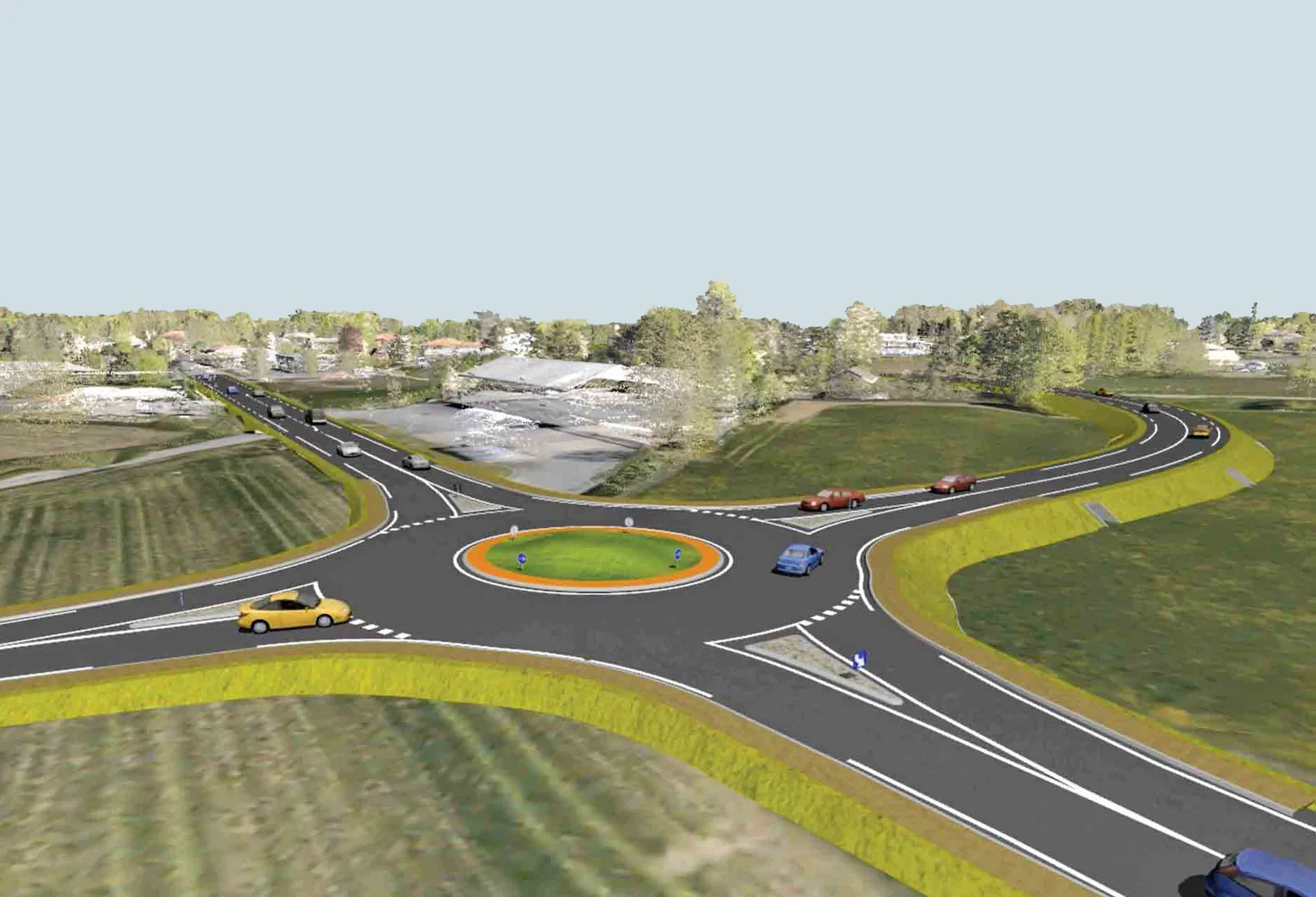
AutoTURN Pro 3D is based on the same calculation engine as the original program, now in version 8, but works with a three-dimensional design view of a road and its junctions based on a digital terrain model. Alternatively a 2D design can be projected onto a DTM says Transoft.

Using a set of special tools the user pulls along a vehicle selected from an extensive library of international vehicle types which the firm says are accurate in detail and dimensions, and the program then calculates the swept-path both horizontally and vertically, alerting the designer to obstacles and terrain conflicts.

It finds ground clearance, distance to objects and height limitations.

A punch-through cross-section can be seen at any point and the program can be used for visualisations for client presentations after the design has been tweaked.




For more information on companies in this article

Related Content

  • Improved laser scanning capabilities
    February 23, 2012
    Leica Geosystems is broadening its software offering with its new Leica Cyclone v7.2 package, which is said to improve office processing capabilities. The package has been developed to address key market needs and trends in the processing and use of rich, as-built point cloud data from high definition laser scanning technology. According to the firm the package can help reduce laser scanning project costs, including office time, allowing projects to use more scans and higher scan densities.
  • Trimble is launching new machine control technology
    November 9, 2016
    Trimble is introducing a range of new technology options for customers that will boost working efficiency across a range of duties. The firm has also scored a major deal with one of China’s largest equipment manufacturers, XCMG.
  • Bentley creates digital production chain for Pont-de-Veyle bypass
    September 14, 2016
    Pont-de-Veyle is a picturesque village of around 1,600 people in France’s eastern Rhones-Alps region. Being in a tourist area and close to major towns and cities meant that traffic – around 9,000 vehicles a day through its small streets – was becoming a concern The village sits about 30km from the larger town of Bourg-en-Bresse, towards the Swiss border. It also lies around 60km from the city of Lyon, all in the Department of Ain. The regional administrative authority Ain created the Conseil Départementa
  • Autodesk introduces new BIM training tool
    August 22, 2013
    Autodesk has launched a specialist training and certification package for civil engineers to bring them up to speed on modem BIM (information modelling) workflows. The Autodesk Official Training Guide, is not just teaching the functionality of the programs says the company, but aims to show how the Autodesk infrastructure software workflows "can help owners and service providers on roads and highways improve productivity, optimise designs, and accelerate project approvals." The course simulates a roadways p