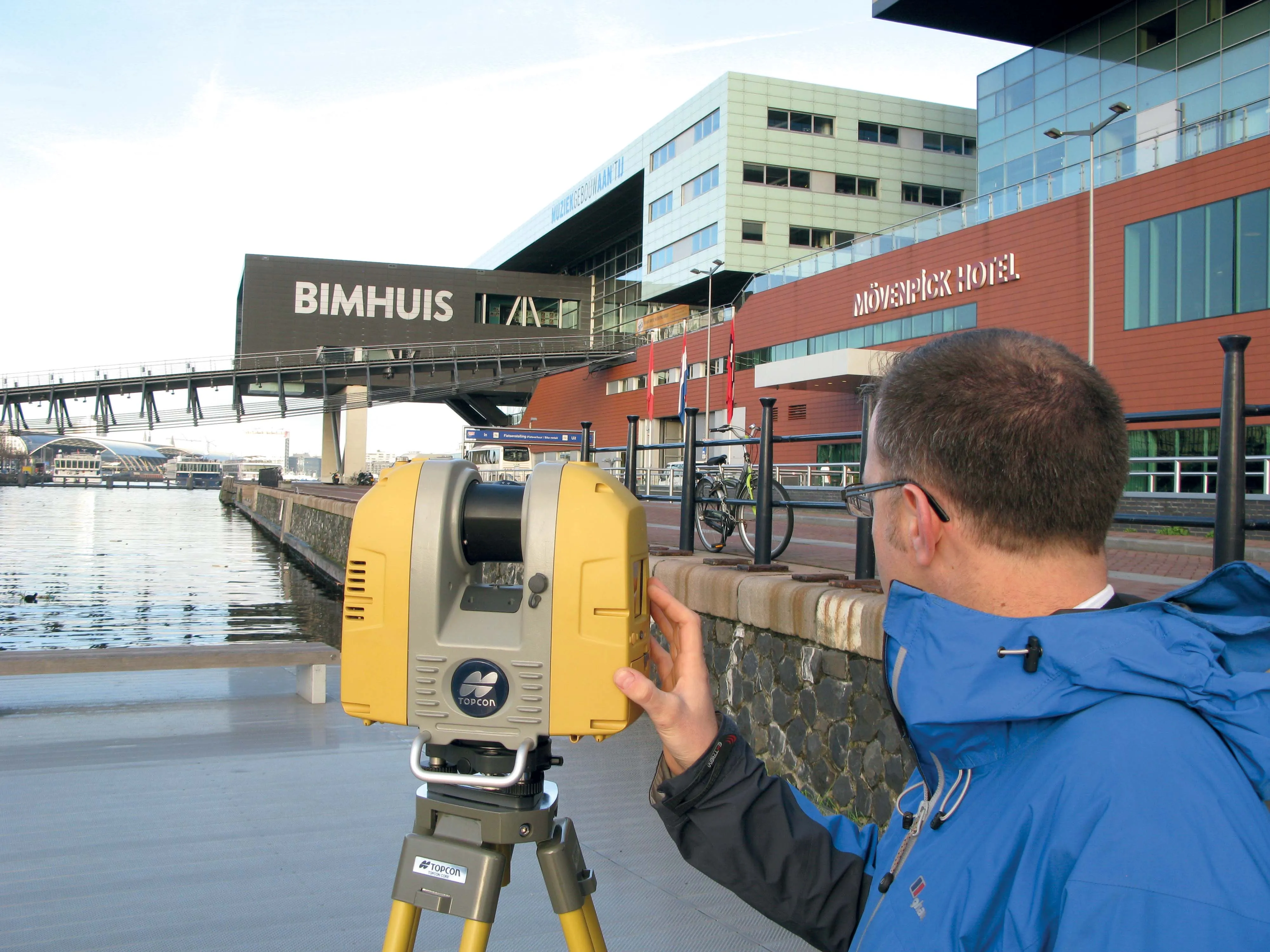
Topcon Positioning Group says it has improved workflow compatibility for the GLS-2000 3D laser scanner and ScanMaster software with Autodesk solutions.
With the latest version of Autodesk ReCap, the GLS-2000 pairs with Topcon ScanMaster software to collect, process, edit and deliver 3D point cloud data from a laser scanner.
ReCap allows users to perform tasks such as scan conversion, editing and viewing point cloud data. It also provides integration with Autodesk’s portfolio of design software.
Aut
Topcon Positioning Group says its new BIM solution - the LN-100 – is the world’s first 3D positioning system designed specifically for construction layout.
Said to offer seamless integration and flow of project data from the design to the field, the LN-100 is simple to operate, removing “the intimidation factor and reducing the learning curve in performing construction layout tasks,” according to Eduardo Falcon, Topcon Positioning Group executive vice president and general manager for the GeoPositioning
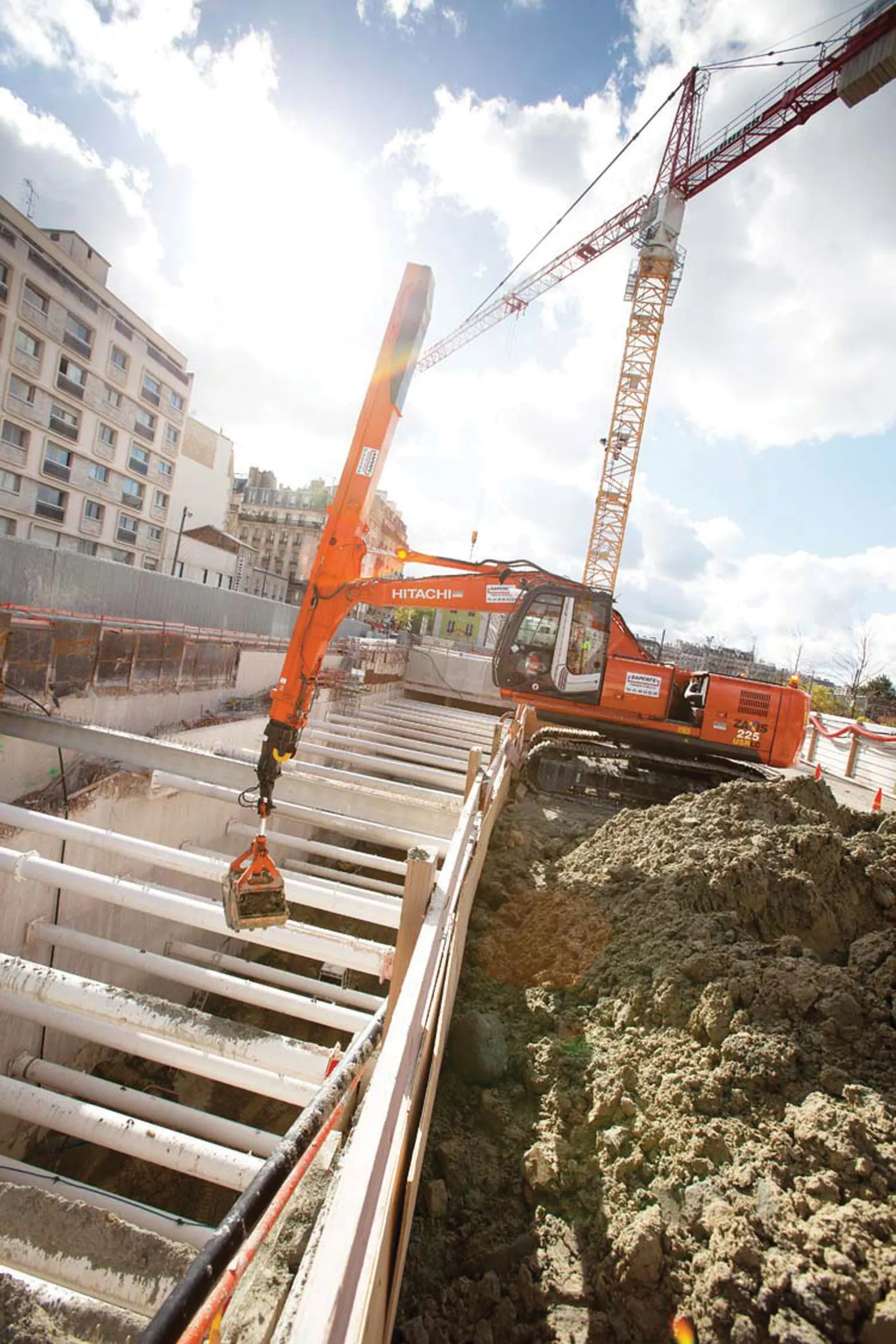
A Hitachi excavator has enabled the creation of a subterranean six-floor car park in the centre of Paris. The ZX225USRLC-3 was used to dig deep below ground in the French capital and remove 65,000m³ of earth before construction of the facility could begin. For Saperfe Travaux Publics, a sub-contractor working on the project, the Hitachi machine was the only specialist equipment required. The clamshell telescopic arm of the ZX225USRLC-3 can reach depths of up to 25m.