Emergency road repair work needn’t create yet another emergency by hitting unknow utility pipes and other systems.
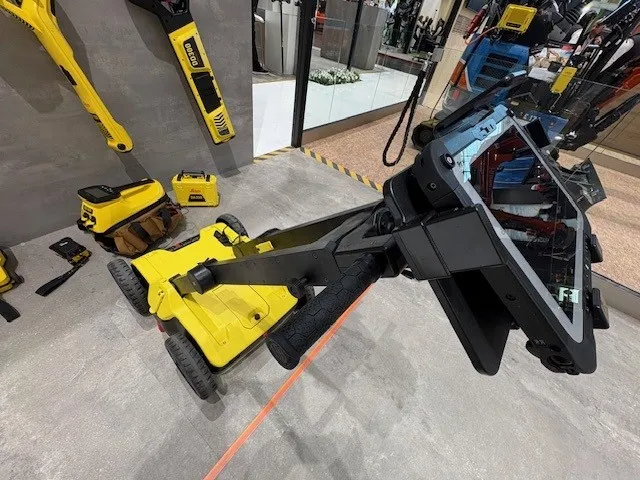
Leica Geosystems says its DSX utility detection solution can quickly be walked over the area where work is about to start and immediately show an excavator operator any dangers that lie below.
It locates, visualises and map utilities. Unlike any other ground penetrating radar system, the Leica DSX maximises productivity with cutting-edge software that automates data analysis and creates a 3D utility map of the field.
Caterpillar plans to open a new manufacturing facility in Xuzhou, Jiangsu Province, China, to produce undercarriage components and track assemblies, which are utilised on Cat hydraulic excavators.
Caterpillar plans to open a new manufacturing facility in Xuzhou, Jiangsu Province, China, to produce undercarriage components and track assemblies, which are utilised on Cat hydraulic excavators.
As World Highways was going to press Autodesk was due to announce the 2014 versions of its entire range of programs including AutoCAD, Civil 3D, NavisWorks and Revit Structural and others programs used by the road industry. As previously, they are packaged in suites; Standard, Premium and Ultimate. Key aspects focus around the inclusion of a completely new and fast point-cloud “engine” developed from the Alice Labs company acquisition made last year. Part of a new Autodesk Recap, standing for reality captur