Know what lies below with Leica’s DSX 3D utility detection system

April 11, 2025 Read time: 1 min
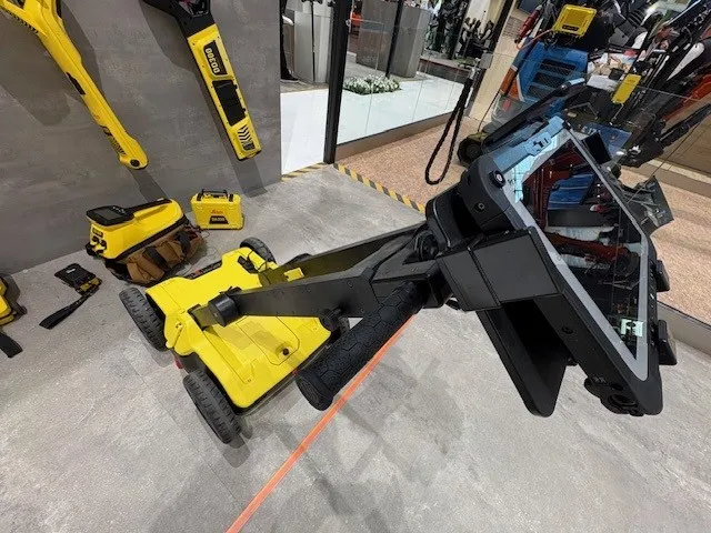
No ordinary lawnmower: utilities can’t hide from Leica Geosystem’s DSX detection solution

Emergency road repair work needn’t create yet another emergency by hitting unknow utility pipes and other systems.  

Leica Geosystems says its DSX utility detection solution can quickly be walked over the area where work is about to start and immediately show an excavator operator any dangers that lie below.

It locates, visualises and map utilities. Unlike any other ground penetrating radar system, the Leica DSX maximises productivity with cutting-edge software that automates data analysis and creates a 3D utility map of the field.

Leica DSX can be used together with Leica GPS/GNSS systems to generate highly accurate georeferenced maps.  

There is also a ‘quick scan’ mode for a quick utility, anomaly and ground condition check before a more detailed grid scan project gets underway.

Operators can add different background layers, such as Google Maps or DXF/DWG.

The solution can export, store, share and access data on major Cloud service providers. It can also maximise troubleshooting efficiency by sharing 
diagnostics data via the Cloud.

For more information on companies in this article

Related Content

  • Sophisticated software solutions offering surveying innovation and construction efficiency
    August 28, 2014
    An array of new software tools will deliver greater efficiencies to construction companies – Mike Woof writes. Sophisticated software systems are delivering advanced solutions to traditional construction tasks. Key developments have been made by major players in the sector, such as Bentley Systems, Fugro Roadware, Leica Geosystems and Topcon Sokkia. From Bentley comes a new package that will help road construction activities in urban areas featuring a heavy concentration of underground utilities. This n
  • Leica Geosystems’ tools for site monitoring and handling GPR data
    October 11, 2017
    Leica Geosystems is offering new tools for construction firms for remote monitoring and for handling data from ground penetrating radar. With the GeoMoS Imaging package, users can stay up-to-date on remote monitoring; the live view allows observation and recording of areas of interest. A joystick provides remote access to the total station so that personnel can increase productivity and reduce time in the field.
  • Latest GIS and software tools improve operations
    February 24, 2012
    Innovative GIS and software solutions are coming to market from the three key market players - Mike Woof reports Competition is strong in the field for GIS and surveying systems as well as the associated software. The three major players in the sector, Leica Geosystems, Topcon and Trimble, all invest heavily in research and development and continue to roll out new solutions for construction customers that will boost the efficiency of surveying as well as overall project implementation.
  • Proper GPR Surveying Techniques
    May 10, 2019
    A sustainably good road surface often depends on how well understood is the ground underneath the road’s route. Brian Jones* offers some best practice and advice for getting the most from ground-penetrating radar investigations Ground-penetrating radar (GPR) is one of the most accurate non-destructive testing (NDT) methods available. To get the most from GPR surveying, it is absolutely essential to understand how GPR tools work and follow best practices when conducting surveys. Key areas to be aware o